|
|
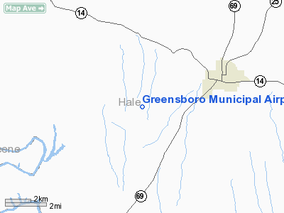
Greensboro Municipal Airport |
| Greensboro Municipal Airport |
 |
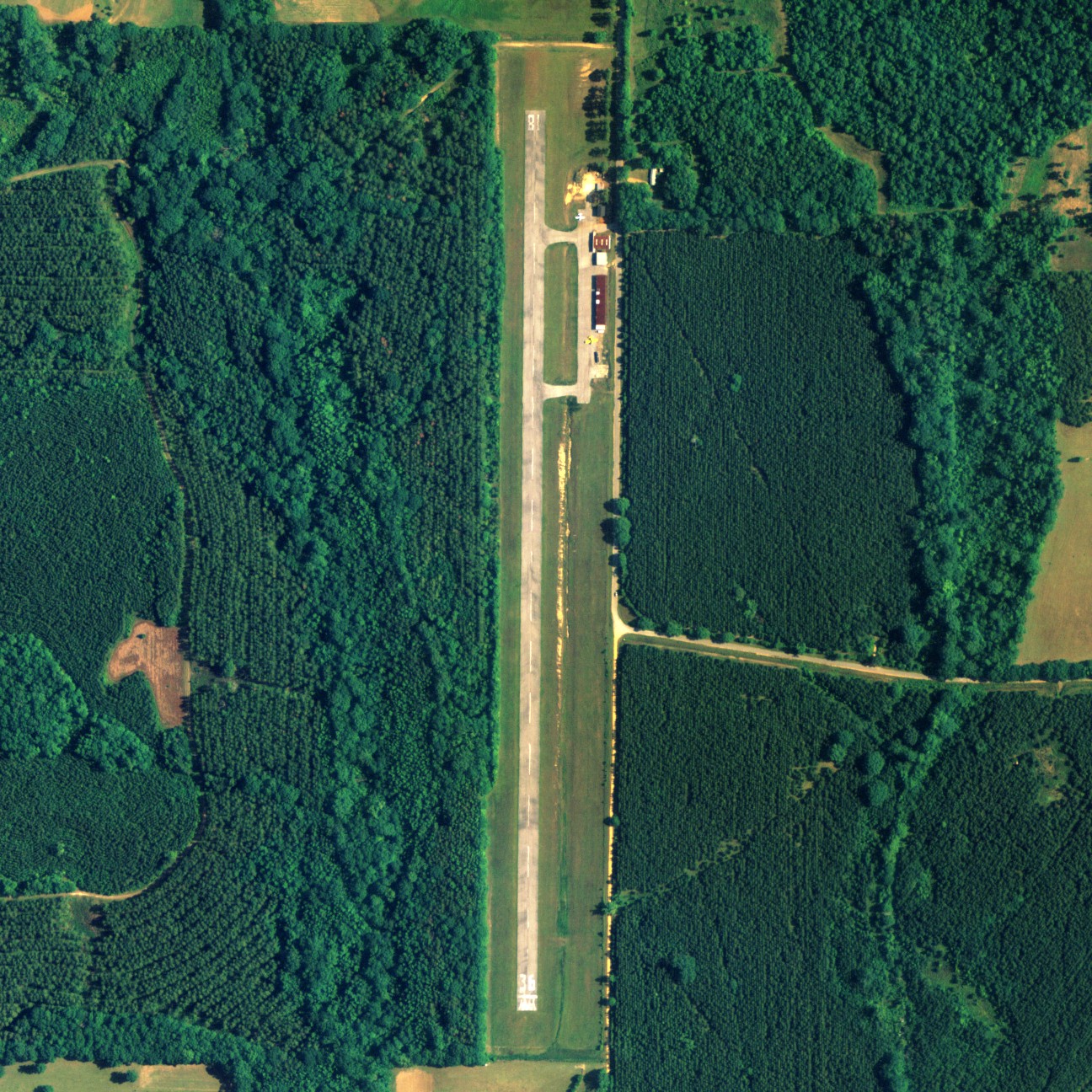
| NAIP aerial image, 30 June 2006 |
| IATA: none – ICAO: none – FAA LID: 7A0 |
| Summary |
| Airport type |
Public |
| Owner |
City of Greensboro |
| Serves |
Greensboro, Alabama |
| Elevation AMSL |
180 ft / 55 m |
| Coordinates |
32°40′53″N 087°39′44″W / 32.68139°N 87.66222°W / 32.68139; -87.66222 |
| Runways |
| Direction |
Length |
Surface |
| ft |
m |
| 18/36 |
3,495 |
1,065 |
Asphalt |
| Statistics (2000) |
| Aircraft operations |
2,088 |
| Source: Federal Aviation Administration |
Greensboro Municipal Airport (FAA LID: 7A0) is a city-owned public-use airport located 3 nautical miles (6 km) southwest of the central business district of Greensboro, a city in Hale County, Alabama, United States. According to the FAA's National Plan of Integrated Airport Systems for 2009–2013, it is categorized as a general aviation facility.
Facilities and aircraft
Greensboro Municipal Airport covers an area of 23 acres (0.04 sq mi; 0.09 km), and contains one runway designated 18/36 that is 3,495 x 78 feet (1,065 x 24 meters) with asphalt pavement. For the 12-month period ending April 4, 2000, the airport had 2,088 general aviation aircraft operations.
The above content comes from Wikipedia and is published under free licenses – click here to read more.
Location
& QuickFacts
|
FAA Information Effective: |
2007-01-18 |
|
Airport
Identifier: |
7A0 |
|
Airport
Status: |
Operational |
|
Longitude/Latitude: |
087-39-43.5000W/32-40-53.3000N
-87.662083/32.681472 (Estimated) |
|
Elevation: |
180 ft / 54.86 m (Estimated) |
|
Land: |
23
acres |
|
From
nearest city: |
3 nautical miles SW of Greensboro, AL |
|
Location: |
Hale County, AL |
|
Magnetic Variation: |
01E (1985) |
Owner
& Manager
|
Ownership: |
Publicly owned |
|
Owner: |
City Of Greensboro |
|
Address: |
Po Drawer 77
Greensboro, AL 36744 |
|
Phone number: |
334-624-8119 |
|
Manager: |
Charles Seale |
|
Address: |
Po Box 437
Greensboro, AL 36744 |
|
Phone number: |
334-624-8392 |
Airport
Operations and Facilities
|
Airport Use: |
Open to public |
|
Wind
indicator: |
Yes |
|
Segmented
Circle: |
No |
|
Control
Tower: |
No |
|
Lighting
Schedule: |
DUSK-DAWN
ACTVT MIRL RY 18/36 - CTAF. |
|
Beacon
Color: |
Clear-Green (lighted land airport)
OTS INDEFLY. |
|
Landing
fee charge: |
No |
|
Sectional
chart: |
Atlanta |
|
Region: |
ASO - Southern |
|
Boundary
ARTCC: |
ZTL - Atlanta |
|
Tie-in
FSS: |
ANB - Anniston |
|
FSS
on Airport: |
No |
|
FSS
Toll Free: |
1-800-WX-BRIEF |
|
NOTAMs
Facility: |
ANB (NOTAM-d service avaliable) |
|
Federal Agreements: |
N |
Airport
Communications
|
CTAF: |
123.000 |
|
Unicom: |
123.000 |
Airport
Services
|
Fuel available: |
100LL |
|
Bottled
Oxygen: |
NONE |
|
Bulk
Oxygen: |
NONE |
|
Runway Information
Runway 18/36
|
Dimension: |
3495 x 78 ft / 1065.3 x 23.8 m |
|
Surface: |
ASPH, Good Condition |
|
Weight
Limit: |
Single wheel: 16000 lbs. |
|
Edge
Lights: |
Medium |
|
|
Runway 18 |
Runway 36 |
|
Longitude: |
087-39-43.5000W |
087-39-43.5000W |
|
Latitude: |
32-41-10.5000N |
32-40-36.0000N |
|
Elevation: |
180.00
ft |
168.00
ft |
|
Traffic
Pattern: |
Left |
Left |
|
Markings: |
Basic, Good Condition |
Basic, Good Condition |
|
Obstruction: |
116 ft trees, 2360.0 ft from runway, 18:1 slope
to clear |
40 ft trees, 2300.0 ft from runway, 50:1 slope
to clear
RY 36 4 FT FENCE 144 FT FROM THLD. |
|
Radio Navigation
Aids
|
ID |
Type |
Name |
Ch |
Freq |
Var |
Dist |
|
EOG |
NDB |
Greensboro |
|
417.00 |
01E |
4.8 nm |
|
RZO |
NDB |
Marengo |
|
391.00 |
01E |
24.0 nm |
|
AIV |
NDB |
Aliceville |
|
254.00 |
|
37.1 nm |
|
BCZ |
NDB |
Choctaw |
|
228.00 |
01E |
41.3 nm |
|
SE |
NDB |
Pollk |
|
344.00 |
01W |
44.7 nm |
|
NMM |
TACAN |
Meridian |
056X |
|
01E |
45.1 nm |
|
JYU |
VOR/DME |
Junior |
083X |
113.60 |
01W |
39.6 nm |
|
LDK |
VORTAC |
Crimson |
125X |
117.80 |
03E |
35.3 nm |
|
OKW |
VORTAC |
Brookwood |
047X |
111.00 |
00E |
39.5 nm |
|
EWA |
VORTAC |
Kewanee |
085X |
113.80 |
04E |
44.6 nm |
Remarks
- VFR
WEATHER CONDITIONS ONLY.
Based Aircraft
|
Aircraft
based on field: |
9 |
|
Single
Engine Airplanes: |
6 |
|
Multi
Engine Airplanes: |
3 |
Operational Statistics
Time Period: 1999-04-06
- 2000-04-04
|
Aircraft
Operations: |
41/Week |
|
General
Aviation Local: |
31.0% |
|
General
Aviation Itinerant: |
69.0% |
Greensboro Municipal Airport
Address:
Hale County, AL
Tel:
334-624-8119, 334-624-8392
Images
and information placed above are from
http://www.airport-data.com/airport/7A0/
We
thank them for the data!
| General
Info |
| Country |
United
States |
| State |
ALABAMA
|
| FAA ID |
7A0
|
| Latitude |
32-40-53.300N
|
| Longitude |
087-39-43.500W
|
| Elevation |
180 feet
|
| Near City |
GREENSBORO
|
We don't guarantee the information is fresh and accurate. The data may
be wrong or outdated.
For more up-to-date information please refer to other sources.
|
|