 |
|
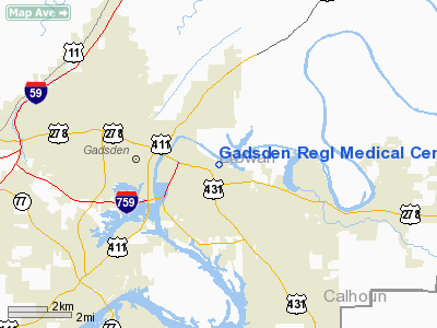
Gadsden Regional Medical Center Heliport |
Location
& QuickFacts
|
FAA Information Effective: |
2007-01-18 |
|
Airport
Identifier: |
0AL7 |
|
Airport
Status: |
Operational |
|
Longitude/Latitude: |
085-57-55.0000W/34-00-30.0000N
-85.965278/34.008333 (Estimated) |
|
Elevation: |
621 ft / 189.28 m (Estimated) |
|
Land: |
0
acres |
|
From
nearest city: |
2 nautical miles E of Gadsden, AL |
|
Location: |
Etowah County, AL |
|
Magnetic Variation: |
01W (1990) |
Owner
& Manager
|
Ownership: |
Privately owned |
|
Owner: |
Gadsden Regl Medical Center |
|
Address: |
1007 Goodyear Avenue
Gadsden, AL 35999 |
|
Phone
number: |
205-543-4189 |
|
Manager: |
Danny W. Hoderfield
DIRECTOR OF ENGINEERING. |
|
Address: |
1007 Goodyear Avenue
Gadsden, AL 35999 |
|
Phone number: |
205-494-4189 |
Airport
Operations and Facilities
|
Airport Use: |
Private
MEDICAL USE. |
|
Segmented
Circle: |
No |
|
Control
Tower: |
No |
|
Sectional
chart: |
Atlanta |
|
Region: |
ASO - Southern |
|
Boundary
ARTCC: |
ZTL - Atlanta |
|
Tie-in
FSS: |
ANB - Anniston |
|
FSS
on Airport: |
No |
|
FSS
Toll Free: |
1-800-WX-BRIEF |
|
Runway Information
Helipad H1
|
Dimension: |
30
x 30 ft / 9.1 x 9.1 m |
|
Surface: |
CONC, |
|
|
Runway H1 |
Runway |
|
Traffic
Pattern: |
Left |
Left |
|
Radio Navigation
Aids
|
ID |
Type |
Name |
Ch |
Freq |
Var |
Dist |
|
ARF |
NDB |
Saratoga |
|
296.00 |
02W |
19.5 nm |
|
PLR |
NDB |
Pell City |
|
257.00 |
01E |
30.5 nm |
|
FTP |
NDB |
Fort Payne |
|
426.00 |
01W |
34.1 nm |
|
OYD |
NDB |
Floyd |
|
388.00 |
02W |
43.5 nm |
|
CPP |
NDB |
Cole Spring |
|
230.00 |
01W |
47.8 nm |
|
GPQ |
NDB |
Carrollton |
|
278.00 |
02W |
49.4 nm |
|
GAD |
VOR/DME |
Gadsden |
070X |
112.30 |
02E |
6.2 nm |
|
TDG |
VOR/DME |
Talladega |
025X |
108.80 |
02E |
26.3 nm |
|
RMG |
VORTAC |
Rome |
101X |
115.40 |
01E |
43.1 nm |
|
BHM |
VOT |
Birmingham Muni |
|
110.00 |
|
47.7 nm |
Remarks
- PRVDD
PR USE; APCH/DEP RTE OPS FROM 270-290 DEG; TKOF/LNDG AREA MKD; WIND
INDICATOR MNTND; & OPS RESTRICTED TO 10 KNOT TAILWIND COMPONENT.
Gadsden Regional Medical Center Heliport
Address:
Etowah County, AL
Tel:
205-543-4189
Images
and information placed above are from
http://www.airport-data.com/airport/0AL7/
We
thank them for the data!
| General
Info |
| Country |
United
States |
| State |
ALABAMA
|
| FAA ID |
0AL7
|
| Latitude |
34-00-30.000N
|
| Longitude |
085-57-55.000W
|
| Elevation |
621 feet
|
| Near City |
GADSDEN
|
We don't guarantee the information is fresh and accurate. The data may
be wrong or outdated.
For more up-to-date information please refer to other sources.
|
|


