 |
|
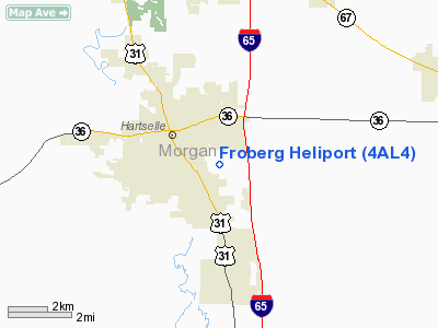
Location
& QuickFacts
|
FAA Information Effective: |
2007-01-18 |
|
Airport
Identifier: |
4AL4 |
|
Airport
Status: |
Operational |
|
Longitude/Latitude: |
086-54-54.0000W/34-25-38.0000N
-86.915000/34.427222 (Estimated) |
|
Elevation: |
630 ft / 192.02 m (Estimated) |
|
Land: |
0
acres |
|
From
nearest city: |
2 nautical miles SE of Hartselle, AL |
|
Location: |
Morgan County, AL |
|
Magnetic Variation: |
01W (1995) |
Owner
& Manager
|
Ownership: |
Privately owned |
|
Owner: |
Ronald D. Froberg |
|
Address: |
1233 Tabernacle Road
Hartselle, AL 35640 |
|
Phone
number: |
256-773-2723 |
|
Manager: |
Ronald Froberg
MANAGER LIVES ON PREMISES. |
|
Address: |
1233 Tabernacle Road
Hartselle, AL 35640 |
|
Phone number: |
256-773-2723 |
Airport
Operations and Facilities
|
Airport Use: |
Private |
|
Segmented
Circle: |
No |
|
Control
Tower: |
No |
|
Lighting
Schedule: |
DUSK-DAWN |
|
Sectional
chart: |
Atlanta |
|
Region: |
ASO - Southern |
|
Boundary
ARTCC: |
ZME - Memphis |
|
Tie-in
FSS: |
ANB - Anniston |
|
FSS
Toll Free: |
1-800-WX-BRIEF |
|
Runway Information
Helipad H1
|
Dimension: |
20
x 20 ft / 6.1 x 6.1 m |
|
Surface: |
CONC, |
|
|
Runway H1 |
Runway |
|
Traffic
Pattern: |
Left |
Left |
|
Radio Navigation
Aids
|
ID |
Type |
Name |
Ch |
Freq |
Var |
Dist |
|
CPP |
NDB |
Cole Spring |
|
230.00 |
01W |
5.8 nm |
|
HUA |
NDB |
Redstone |
|
287.00 |
00W |
19.8 nm |
|
CWH |
NDB |
Capshaw |
|
350.00 |
01W |
21.9 nm |
|
ARF |
NDB |
Saratoga |
|
296.00 |
02W |
35.9 nm |
|
GZS |
NDB |
Giles/dcmsnd |
|
375.00 |
00E |
44.1 nm |
|
TNY |
NDB |
Kelso |
|
358.00 |
01W |
46.3 nm |
|
DCU |
VOR/DME |
Decatur |
075X |
112.80 |
01W |
13.3 nm |
|
GAD |
VOR/DME |
Gadsden |
070X |
112.30 |
02E |
49.4 nm |
|
RQZ |
VORTAC |
Rocket |
059X |
112.20 |
02E |
26.2 nm |
|
MSL |
VORTAC |
Muscle Shoals |
112X |
116.50 |
01E |
33.1 nm |
|
VUZ |
VORTAC |
Vulcan |
091X |
114.40 |
02E |
45.5 nm |
|
HSV |
VOT |
Huntsville |
|
111.00 |
|
34.1 nm |
Remarks
- 265
FT CELL TOWER 0.6 NM SOUTHEAST OF HELIPAD. NUMEROUS ANTENNA TOWERS &
WATER TOWERS UP TO 325 FT WITHIN 1.6 NM OF HELIPAD.
- SEE
AIRSPACE CASE 99-ASO-2013-NRA.
Based
Aircraft
|
Aircraft
based on field: |
1 |
|
Helicopters: |
1 |
Froberg Heliport
Address:
Morgan County, AL
Tel:
256-773-2723
Images
and information placed above are from
http://www.airport-data.com/airport/4AL4/
We
thank them for the data!
| General
Info |
| Country |
United
States |
| State |
ALABAMA
|
| FAA ID |
4AL4
|
| Latitude |
34-25-38.000N
|
| Longitude |
086-54-54.000W
|
| Elevation |
630 feet
|
| Near City |
HARTSELLE
|
We don't guarantee the information is fresh and accurate. The data may
be wrong or outdated.
For more up-to-date information please refer to other sources.
|
|


