 |
|
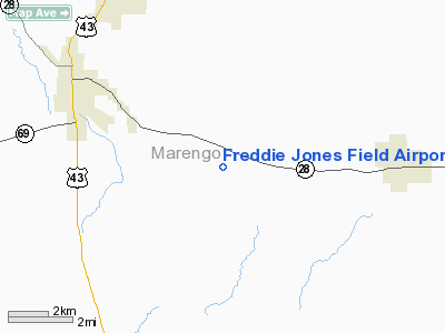
Freddie Jones Field Airport |
|
|
Location
& QuickFacts
|
FAA Information Effective: |
2007-01-18 |
|
Airport
Identifier: |
70A |
|
Airport
Status: |
Operational |
|
Longitude/Latitude: |
087-43-05.0290W/32-16-00.5160N
-87.718064/32.266810 (Estimated) |
|
Elevation: |
161 ft / 49.07 m (Surveyed) |
|
Land: |
51
acres |
|
From
nearest city: |
5 nautical miles SE of Linden, AL |
|
Location: |
Marengo County, AL |
|
Magnetic Variation: |
01E (1985) |
Owner
& Manager
|
Ownership: |
Publicly owned |
|
Owner: |
City Of Linden |
|
Address: |
211 North Main St
Linden, AL 36748 |
|
Phone
number: |
334-295-4121 |
|
Manager: |
City Of Linden |
|
Address: |
211 N Main St
Linden, AL 36748 |
|
Phone number: |
334-295-4121 |
Airport
Operations and Facilities
|
Airport Use: |
Open to public |
|
Wind
indicator: |
Yes |
|
Segmented
Circle: |
No |
|
Control
Tower: |
No |
|
Lighting
Schedule: |
RDO-CTL
ACTVT LIRL RY 18/36 - CTAF OR CALL 334-295-4121. |
|
Landing
fee charge: |
No |
|
Sectional
chart: |
Atlanta |
|
Region: |
ASO - Southern |
|
Boundary
ARTCC: |
ZTL - Atlanta |
|
Tie-in
FSS: |
ANB - Anniston |
|
FSS
on Airport: |
No |
|
FSS
Toll Free: |
1-800-WX-BRIEF |
|
NOTAMs
Facility: |
ANB (NOTAM-d service avaliable) |
Airport
Communications
Airport
Services
|
Airframe Repair: |
NONE |
|
Power Plant Repair: |
NONE |
|
Bottled
Oxygen: |
NONE |
|
Bulk
Oxygen: |
NONE |
|
Runway Information
Runway 18/36
|
Dimension: |
3390 x 80 ft / 1033.3 x 24.4 m |
|
Surface: |
ASPH, Poor Condition
PAVEMENT OXIDIZED & RAVELLING WITH LOOSE AGGREGATE.
GRASS
GROWING IN CRACKS. |
|
Edge
Lights: |
Low
LIRL RY 18/36 OTS INDEFLY. |
|
|
Runway 18 |
Runway 36 |
|
Traffic
Pattern: |
Left |
Left |
|
Markings: |
Nonstandard, Poor Condition
CNTRLN MARKING ONLY; SEVERELY FADED. |
Nonstandard, Poor Condition |
|
Obstruction: |
35 ft trees, 950.0 ft from runway, 200 ft left
of centerline, 21:1 slope to clear |
74 ft trees, 1250.0 ft from runway, 14:1 slope
to clear |
|
Radio Navigation
Aids
|
ID |
Type |
Name |
Ch |
Freq |
Var |
Dist |
|
RZO |
NDB |
Marengo |
|
391.00 |
01E |
17.5 nm |
|
EOG |
NDB |
Greensboro |
|
417.00 |
01E |
20.4 nm |
|
BCZ |
NDB |
Choctaw |
|
228.00 |
01E |
22.5 nm |
|
SE |
NDB |
Pollk |
|
344.00 |
01W |
40.2 nm |
|
NMM |
TACAN |
Meridian |
056X |
|
01E |
46.0 nm |
|
JYU |
VOR/DME |
Junior |
083X |
113.60 |
01W |
37.2 nm |
|
EWA |
VORTAC |
Kewanee |
085X |
113.80 |
04E |
38.1 nm |
Remarks
Based
Aircraft
|
Aircraft
based on field: |
1 |
|
Single
Engine Airplanes: |
1 |
Operational Statistics
Time Period: 1999-03-29
- 2000-03-27
|
Aircraft
Operations: |
25/Week |
|
General
Aviation Local: |
30.8% |
|
General
Aviation Itinerant: |
69.2% |
Freddie Jones Field Airport
Address:
Marengo County, AL
Tel:
334-295-4121
Images
and information placed above are from
http://www.airport-data.com/airport/70A/
We
thank them for the data!
| General
Info |
| Country |
United
States |
| State |
ALABAMA
|
| FAA ID |
70A
|
| Latitude |
32-16-00.516N
|
| Longitude |
087-43-05.029W
|
| Elevation |
161 feet
|
| Near City |
LINDEN
|
We don't guarantee the information is fresh and accurate. The data may
be wrong or outdated.
For more up-to-date information please refer to other sources.
|
|


