 |
|
|
|
|
|
Location
& QuickFacts
|
FAA Information Effective: |
2007-01-18 |
|
Airport
Identifier: |
07A |
|
Airport
Status: |
Operational |
|
Longitude/Latitude: |
085-48-34.8300W/32-10-00.5300N
-85.809675/32.166814 (Estimated) |
|
Elevation: |
300 ft / 91.44 m (Surveyed) |
|
Land: |
50
acres |
|
From
nearest city: |
5 nautical miles W of Union Springs, AL |
|
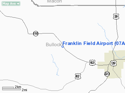
Location: |
Bullock County, AL |
|
Magnetic Variation: |
01W (1985) |
Owner
& Manager
|
Ownership: |
Publicly owned |
|
Owner: |
Bullock County |
|
Address: |
Po Box 352
Union Springs, AL 36089 |
|
Phone
number: |
334-738-3883 |
|
Manager: |
Charles Moon |
|
Address: |
Route 1, Box 73
Union Springs, AL 36089 |
|
Phone number: |
334-738-2100
AG OPER AT ARPT (334) 738/2100 |
Airport
Operations and Facilities
|
Airport Use: |
Open to public |
|
Wind
indicator: |
Yes |
|
Segmented
Circle: |
No |
|
Control
Tower: |
No |
|
Lighting
Schedule: |
DUSK-DAWN
ACTVT MIRL RY 14/32 - CTAF. |
|
Beacon
Color: |
Clear-Green (lighted land airport) |
|
Landing
fee charge: |
No |
|
Sectional
chart: |
Atlanta |
|
Region: |
ASO - Southern |
|
Boundary
ARTCC: |
ZTL - Atlanta |
|
Tie-in
FSS: |
ANB - Anniston |
|
FSS
on Airport: |
No |
|
FSS
Toll Free: |
1-800-WX-BRIEF |
|
NOTAMs
Facility: |
ANB (NOTAM-d service avaliable) |
Airport
Communications
|
CTAF: |
122.800 |
|
Unicom: |
122.800 |
Airport
Services
|
Airframe Repair: |
NONE |
|
Power Plant Repair: |
NONE |
|
Bottled
Oxygen: |
NONE |
|
Bulk
Oxygen: |
NONE |
|
Runway Information
Runway 14/32
|
Dimension: |
3660 x 80 ft / 1115.6 x 24.4 m |
|
Surface: |
ASPH, Poor Condition
RY 14/32 HAS ROUGH & UNEVEN STRETCH OF PAVEMENT FROM 600 FT
TO 1510 FT FROM AER 32. |
|
Weight
Limit: |
Single wheel: 15000 lbs. |
|
Edge
Lights: |
Medium
RY 14/32 MIRL OTS INDEFLY. |
|
|
Runway 14 |
Runway 32 |
|
Longitude: |
085-48-49.1890W |
085-48-21.2030W |
|
Latitude: |
32-10-11.9943N |
32-09-44.6680N |
|
Elevation: |
292.00
ft |
300.00
ft |
|
Traffic
Pattern: |
Left |
Left |
|
Markings: |
Basic, Poor Condition
/32 MARKINGS FADED. |
Basic, Poor Condition |
|
Obstruction: |
56 ft trees, 445.0 ft from runway, 88 ft right
of centerline, 4:1 slope to clear
SHALLOW DITCH LCTD 165 FT FROM THLD RY 14 PERPENDICULAR TO
CNTRLN. |
85 ft trees, 1180.0 ft from runway, 105 ft
right of centerline, 11:1 slope to clear |
|
Radio Navigation
Aids
|
ID |
Type |
Name |
Ch |
Freq |
Var |
Dist |
|
TO |
NDB |
Blood |
|
365.00 |
01W |
25.2 nm |
|
XNE |
NDB |
Spring Hill |
|
281.00 |
00E |
30.2 nm |
|
AWS |
NDB |
Lawson |
|
335.00 |
02W |
40.7 nm |
|
DER |
NDB |
Alexander City |
|
382.00 |
01W |
43.5 nm |
|
XBR |
NDB |
Brantley |
|
410.00 |
00E |
43.9 nm |
|
PRN |
NDB |
Persimmon/dcmsnd |
|
359.00 |
00E |
45.2 nm |
|
LOR |
NDB |
Lowe |
|
269.00 |
03W |
48.6 nm |
|
HYE |
NDB |
Hanchey |
|
221.00 |
00E |
48.8 nm |
|
MXF |
TACAN |
Maxwell |
097X |
|
03E |
31.1 nm |
|
HEY |
VOR |
Hanchey |
|
110.60 |
02E |
48.3 nm |
|
TGE |
VOR/DME |
Tuskegee |
120X |
117.30 |
02E |
20.4 nm |
|
LSF |
VOR/DME |
Lawson |
051X |
111.40 |
02W |
42.7 nm |
|
MGM |
VORTAC |
Montgomery |
058X |
112.10 |
03E |
26.2 nm |
|
EUF |
VORTAC |
Eufaula |
029X |
109.20 |
02E |
37.0 nm |
|
CSG |
VORTAC |
Columbus |
118X |
117.10 |
01E |
48.4 nm |
Remarks
- DEER
ON & INVOF ARPT.
- FOR
EMERG FUEL CALL 334-738-3131 OR 334-738-3883.
- ARPT
CLSD TO NIGHT OPNS.
- VFR
USE ONLY.
Based
Aircraft
|
Aircraft
based on field: |
11 |
|
Single
Engine Airplanes: |
11 |
Operational Statistics
Time Period: 1998-10-19
- 1999-10-18
|
Aircraft
Operations: |
126/Week |
|
General
Aviation Local: |
12.1% |
|
General
Aviation Itinerant: |
87.9% |
Franklin Field Airport
Address:
Bullock County, AL
Tel:
334-738-3883,
334-738-2100
Images
and information placed above are from
http://www.airport-data.com/airport/07A/
We
thank them for the data!
| General
Info |
| Country |
United
States |
| State |
ALABAMA
|
| FAA ID |
07A
|
| Latitude |
32-10-00.531N
|
| Longitude |
085-48-34.826W
|
| Elevation |
301 feet
|
| Near City |
UNION
SPRINGS |
We don't guarantee the information is fresh and accurate. The data may
be wrong or outdated.
For more up-to-date information please refer to other sources.
|
|


