 |
|
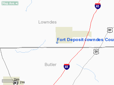
Fort Deposit-lowndes County Airport |
|
|
Location
& QuickFacts
|
FAA Information Effective: |
2007-01-18 |
|
Airport
Identifier: |
67A |
|
Airport
Status: |
Operational |
|
Longitude/Latitude: |
086-35-29.9090W/31-58-20.5350N
-86.591641/31.972371 (Estimated) |
|
Elevation: |
490 ft / 149.35 m (Estimated) |
|
Land: |
55
acres |
|
From
nearest city: |
1 nautical miles SW of Fort Deposit, AL |
|
Location: |
Lowndes County, AL |
|
Magnetic Variation: |
00E (1985) |
Owner
& Manager
|
Ownership: |
Publicly owned |
|
Owner: |
City Of Fort Deposit |
|
Address: |
P.o. Box 260
Fort Deposit, AL 36032 |
|
Phone
number: |
334-227-4331 |
|
Manager: |
Pete Norman |
|
Address: |
P.o. Box 260
Fort Deposit, AL 36032 |
|
Phone number: |
334-227-4331 |
Airport
Operations and Facilities
|
Airport Use: |
Open to public |
|
Wind
indicator: |
Yes |
|
Segmented
Circle: |
No |
|
Control
Tower: |
No |
|
Lighting
Schedule: |
DUSK-DAWN |
|
Beacon
Color: |
Clear-Green (lighted land airport)
ARPT BCN OTS INDEFLY. |
|
Landing
fee charge: |
No |
|
Sectional
chart: |
New Orleans |
|
Region: |
ASO - Southern |
|
Boundary
ARTCC: |
ZTL - Atlanta |
|
Tie-in
FSS: |
ANB - Anniston |
|
FSS
on Airport: |
No |
|
FSS
Toll Free: |
1-800-WX-BRIEF |
|
NOTAMs
Facility: |
ANB (NOTAM-d service avaliable) |
Airport
Communications
Airport
Services
|
Airframe Repair: |
NONE |
|
Power Plant Repair: |
NONE |
|
Runway Information
Runway 15/33
|
Dimension: |
3593 x 78 ft / 1095.1 x 23.8 m |
|
Surface: |
ASPH, Good Condition |
|
Weight
Limit: |
Single wheel: 15000 lbs. |
|
Edge
Lights: |
Medium |
|
|
Runway 15 |
Runway 33 |
|
Longitude: |
086-35-41.6400W |
086-35-20.8200W |
|
Latitude: |
31-58-35.0400N |
31-58-04.1400N |
|
Traffic
Pattern: |
Left |
Left |
|
Markings: |
Basic, Good Condition |
Basic, Good Condition |
|
Obstruction: |
47 ft trees, 1600.0 ft from runway, 29:1 slope
to clear |
40 ft tree, 632.0 ft from runway, 30 ft left
of centerline, 10:1 slope to clear |
|
Radio Navigation
Aids
|
ID |
Type |
Name |
Ch |
Freq |
Var |
Dist |
|
PRN |
NDB |
Persimmon/dcmsnd |
|
359.00 |
00E |
7.4 nm |
|
SE |
NDB |
Pollk |
|
344.00 |
01W |
24.7 nm |
|
TO |
NDB |
Blood |
|
365.00 |
01W |
26.2 nm |
|
XBR |
NDB |
Brantley |
|
410.00 |
00E |
29.0 nm |
|
XNE |
NDB |
Spring Hill |
|
281.00 |
00E |
36.0 nm |
|
JUY |
NDB |
Judd |
|
264.00 |
02W |
41.4 nm |
|
BVG |
NDB |
Boll Weevil |
|
352.00 |
03E |
49.3 nm |
|
MXF |
TACAN |
Maxwell |
097X |
|
03E |
27.0 nm |
|
UIA |
VOR |
Andalusia |
|
110.20 |
00E |
41.1 nm |
|
JYU |
VOR/DME |
Junior |
083X |
113.60 |
01W |
30.2 nm |
|
MGM |
VORTAC |
Montgomery |
058X |
112.10 |
03E |
20.4 nm |
|
MVC |
VORTAC |
Monroeville |
115X |
116.80 |
04E |
49.6 nm |
Operational
Statistics
Time Period: 1999-08-19
- 2000-08-17
|
Aircraft
Operations: |
17/Month |
|
General
Aviation Itinerant: |
100.0% |
Fort Deposit-lowndes County Airport
Address:
Lowndes County, AL
Tel:
334-227-4331
Images
and information placed above are from
http://www.airport-data.com/airport/67A/
We
thank them for the data!
| General
Info |
| Country |
United
States |
| State |
ALABAMA
|
| FAA ID |
67A
|
| Latitude |
31-58-20.535N
|
| Longitude |
086-35-29.909W
|
| Elevation |
490 feet
|
| Near City |
FORT DEPOSIT
|
We don't guarantee the information is fresh and accurate. The data may
be wrong or outdated.
For more up-to-date information please refer to other sources.
|
|


