|
|
| Foley Municipal Airport |
 |
| IATA: none – ICAO: none – FAA LID: 5R4 |
| Summary |
| Airport type |
Public |
| Owner |
Foley, Alabama |
| Serves |
Foley, Alabama |
| Elevation AMSL |
75 ft / 23 m |
| Coordinates |
30°25′40″N 087°42′04″W / 30.42778°N 87.70111°W / 30.42778; -87.70111 |
| Runways |
| Direction |
Length |
Surface |
| ft |
m |
| 18/36 |
3,700 |
1,128 |
Asphalt |
| Statistics (2007) |
| Aircraft operations |
24,700 |
| Source: Federal Aviation Administration |
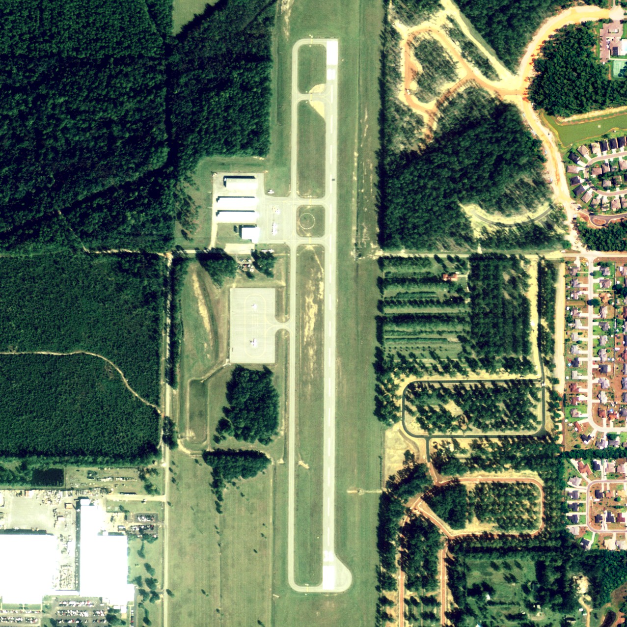
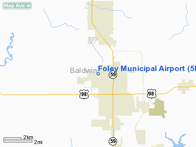
Foley Municipal Airport (FAA LID: 5R4) is a city-owned public-use airport located 3 nautical miles (6 km) northwest of the central business district of Foley, a city in Baldwin County, Alabama, United States.
Facilities and aircraft
Foley Municipal Airport covers an area of 104 acres (0.16 sq mi; 0.42 km), and contains one runway designated 18/36 that is 3,700 x 75 feet (1,128 x 23 meters) with asphalt pavement. For the 12-month period ending March 8, 2007, the airport had 24,700 general aviation aircraft operations.
The above content comes from Wikipedia and is published under free licenses – click here to read more.
Location
& QuickFacts
|
FAA Information Effective: |
2007-01-18 |
|
Airport
Identifier: |
5R4 |
|
Airport
Status: |
Operational |
|
Longitude/Latitude: |
087-42-02.9520W/30-25-39.7100N
-87.700820/30.427697 (Estimated) |
|
Elevation: |
74
ft / 22.56 m (Estimated) |
|
Land: |
104 acres |
|
From
nearest city: |
3 nautical miles NW of Foley, AL |
|
Location: |
Baldwin County, AL |
|
Magnetic Variation: |
01E (1985) |
Owner
& Manager
|
Ownership: |
Publicly owned |
|
Owner: |
City Of Foley |
|
Address: |
Po Drawer 400
Foley, AL 36536 |
|
Phone
number: |
334-943-1545 |
|
Manager: |
Jeff Smith |
|
Address: |
510 North Airport Road
Foley, AL 36535 |
|
Phone number: |
251-947-5688 |
Airport
Operations and Facilities
|
Airport Use: |
Open to public |
|
Wind
indicator: |
Yes |
|
Segmented
Circle: |
Yes |
|
Control
Tower: |
No |
|
Lighting
Schedule: |
DUSK-DAWN
MIRL RY 18/36 PRESET LOW INTST; TO INCR INTST - CTAF. PSIL
RYS 18 & 36 OPER DUSK-DAWN; ACTVT OTHER HRS - CTAF. |
|
Beacon
Color: |
Clear-Green (lighted land airport) |
|
Landing
fee charge: |
No |
|
Sectional
chart: |
New Orleans |
|
Region: |
ASO - Southern |
|
Boundary
ARTCC: |
ZJX - Jacksonville |
|
Tie-in
FSS: |
ANB - Anniston |
|
FSS
on Airport: |
No |
|
FSS
Toll Free: |
1-800-WX-BRIEF |
|
NOTAMs
Facility: |
ANB (NOTAM-d service avaliable) |
|
Federal Agreements: |
NGY |
Airport
Communications
|
CTAF: |
123.050 |
|
Unicom: |
123.050 |
Airport
Services
|
Fuel available: |
100LL |
|
Airframe Repair: |
MAJOR |
|
Power Plant Repair: |
MAJOR |
|
Bottled
Oxygen: |
NONE |
|
Bulk
Oxygen: |
NONE |
|
Runway Information
Runway 18/36
|
Dimension: |
3700 x 75 ft / 1127.8 x 22.9 m |
|
Surface: |
ASPH, Good Condition |
|
Weight
Limit: |
Single wheel: 28000 lbs. |
|
Edge
Lights: |
Medium |
|
|
Runway 18 |
Runway 36 |
|
Longitude: |
087-42-02.9500W |
087-42-02.9500W |
|
Latitude: |
30-25-57.5200N |
30-25-20.9000N |
|
Elevation: |
63.00
ft |
74.00
ft |
|
Alignment: |
127 |
127 |
|
Traffic
Pattern: |
Left |
Left |
|
Markings: |
Basic, Good Condition |
Basic, Good Condition |
|
VASI: |
pulsating/steady burning on left side |
pulsating/steady burning on left side |
|
Obstruction: |
24 ft tree, 1150.0 ft from runway, 190 ft right
of centerline, 39:1 slope to clear |
14 ft road, 451.0 ft from runway, 17:1 slope
to clear |
|
Radio Navigation
Aids
|
ID |
Type |
Name |
Ch |
Freq |
Var |
Dist |
|
ESU |
NDB |
Summerdale |
|
204.00 |
01E |
4.5 nm |
|
PKZ |
NDB |
Pickens |
|
326.00 |
01E |
27.1 nm |
|
MO |
NDB |
Wisle |
|
248.00 |
02E |
37.0 nm |
|
NPA |
TACAN |
Pensacola |
119X |
|
01E |
20.4 nm |
|
NSE |
TACAN |
Whiting |
070X |
|
01E |
39.6 nm |
|
NGS |
TACAN |
Santa Rosa |
063X |
|
01E |
41.1 nm |
|
NUN |
VOR |
Saufley |
|
108.80 |
01E |
19.1 nm |
|
BFM |
VORTAC |
Brookley |
075X |
112.80 |
04E |
21.5 nm |
|
SJI |
VORTAC |
Semmes |
100X |
115.30 |
05E |
38.5 nm |
Remarks
Based
Aircraft
|
Aircraft
based on field: |
35 |
|
Single
Engine Airplanes: |
30 |
|
Multi
Engine Airplanes: |
2 |
|
Helicopters: |
2 |
|
Ultralights: |
1 |
Operational Statistics
Time Period: 1998-10-06
- 1999-10-05
|
Aircraft
Operations: |
68/Day |
|
General
Aviation Local: |
33.2% |
|
General
Aviation Itinerant: |
66.8% |
Foley Municipal Airport
Address:
Baldwin County, AL
Tel:
334-943-1545,
251-947-5688
Images
and information placed above are from
http://www.airport-data.com/airport/5R4/
We
thank them for the data!
| General
Info |
| Country |
United
States |
| State |
ALABAMA
|
| FAA ID |
5R4
|
| Latitude |
30-25-39.710N
|
| Longitude |
087-42-02.952W
|
| Elevation |
74 feet
|
| Near City |
FOLEY
|
We don't guarantee the information is fresh and accurate. The data may
be wrong or outdated.
For more up-to-date information please refer to other sources.
|
|