 |
|
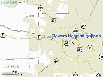
Flowers Hospital Heliport |
|
|
Location
& QuickFacts
|
FAA Information Effective: |
2007-01-18 |
|
Airport
Identifier: |
AL59 |
|
Airport
Status: |
Operational |
|
Longitude/Latitude: |
085-27-22.7610W/31-14-15.6280N
-85.456322/31.237674 (Estimated) |
|
Elevation: |
305 ft / 92.96 m (Estimated) |
|
Land: |
0
acres |
|
From
nearest city: |
3 nautical miles SW of Dothan, AL |
|
Location: |
Houston County, AL |
|
Magnetic Variation: |
01W (1985) |
Owner
& Manager
|
Ownership: |
Privately owned |
|
Owner: |
Flowers Hospital |
|
Address: |
3228 West Main St.
Dothan, AL 36301 |
|
Phone
number: |
205-793-5000 |
|
Manager: |
Jeffrey M. Brannon |
|
Address: |
3228 West Main St.
Dothan, AL 36301 |
|
Phone number: |
205-793-5000 |
Airport
Operations and Facilities
|
Airport Use: |
Private
MEDICAL. |
|
Wind
indicator: |
Yes |
|
Segmented
Circle: |
No |
|
Control
Tower: |
No |
|
Lighting
Schedule: |
PHONE REQ
FOR PERIMETER LIGHTS CALL 205-793-5000. |
|
Landing
fee charge: |
No |
|
Sectional
chart: |
New Orleans |
|
Region: |
ASO - Southern |
|
Boundary
ARTCC: |
ZJX - Jacksonville |
|
Tie-in
FSS: |
ANB - Anniston |
|
FSS
on Airport: |
No |
|
FSS
Toll Free: |
1-800-WX-BRIEF
1-WX-BRIEF |
|
Runway Information
Helipad H1
|
Dimension: |
60 x 60 ft / 18.3 x 18.3 m |
|
Surface: |
CONC, |
|
|
Runway H1 |
Runway |
|
Traffic
Pattern: |
Left |
Left |
|
Radio Navigation
Aids
|
ID |
Type |
Name |
Ch |
Freq |
Var |
Dist |
|
HYE |
NDB |
Hanchey |
|
221.00 |
00E |
12.6 nm |
|
LOR |
NDB |
Lowe |
|
269.00 |
03W |
16.5 nm |
|
OZ |
NDB |
Ruckr |
|
212.00 |
00E |
18.5 nm |
|
BKK |
NDB |
Tri County |
|
275.00 |
02W |
24.4 nm |
|
SMY |
NDB |
Soyya |
|
329.00 |
02W |
25.0 nm |
|
BVG |
NDB |
Boll Weevil |
|
352.00 |
03E |
27.7 nm |
|
IWJ |
NDB |
Blaak |
|
344.00 |
03W |
35.2 nm |
|
XNE |
NDB |
Spring Hill |
|
281.00 |
00E |
37.8 nm |
|
XBR |
NDB |
Brantley |
|
410.00 |
00E |
47.1 nm |
|
JUY |
NDB |
Judd |
|
264.00 |
02W |
48.2 nm |
|
TO |
NDB |
Blood |
|
365.00 |
01W |
48.7 nm |
|
HEY |
VOR |
Hanchey |
|
110.60 |
02E |
13.0 nm |
|
EDN |
VOR |
Enterprise |
|
116.60 |
03W |
23.2 nm |
|
FYL |
VOR |
Tri County |
|
108.40 |
08W |
25.0 nm |
|
UIA |
VOR |
Andalusia |
|
110.20 |
00E |
48.3 nm |
|
OZR |
VOR/DME |
Cairns |
049X |
111.20 |
02E |
14.0 nm |
|
RRS |
VORTAC |
Wiregrass |
053X |
111.60 |
02E |
3.1 nm |
|
MAI |
VORTAC |
Marianna |
087X |
114.00 |
00E |
32.1 nm |
|
EUF |
VORTAC |
Eufaula |
029X |
109.20 |
02E |
46.0 nm |
Remarks
Flowers Hospital Heliport
Address:
Houston County, AL
Tel:
205-793-5000
Images
and information placed above are from
http://www.airport-data.com/airport/AL59/
We
thank them for the data!
| General
Info |
| Country |
United
States |
| State |
ALABAMA
|
| FAA ID |
AL59
|
| Latitude |
31-14-15.628N
|
| Longitude |
085-27-22.761W
|
| Elevation |
305 feet
|
| Near City |
DOTHAN
|
We don't guarantee the information is fresh and accurate. The data may
be wrong or outdated.
For more up-to-date information please refer to other sources.
|
|


