 |
|
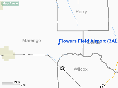
Location
& QuickFacts
|
FAA Information Effective: |
2007-01-18 |
|
Airport
Identifier: |
3AL7 |
|
Airport
Status: |
Operational |
|
Longitude/Latitude: |
087-31-12.0000W/32-17-06.0000N
-87.520000/32.285000 (Estimated) |
|
Elevation: |
280 ft / 85.34 m (Estimated) |
|
Land: |
0
acres |
|
From
nearest city: |
5 nautical miles E of Thomaston, AL |
|
Location: |
Marengo County, AL |
|
Magnetic Variation: |
00W (1995) |
Owner
& Manager
|
Ownership: |
Privately owned |
|
Owner: |
Daniel E. Flowers |
|
Address: |
1525 Marengo County Road 38
Catherine, AL 36728 |
|
Phone
number: |
334-627-3730 |
|
Manager: |
Daniel E. Flowers |
|
Address: |
1525 Marengo County Road 38
Catherine, AL 36728 |
|
Phone number: |
334-627-3730 |
Airport
Operations and Facilities
|
Airport Use: |
Private |
|
Segmented
Circle: |
No |
|
Control
Tower: |
No |
|
Sectional
chart: |
Atlanta |
|
Region: |
ASO - Southern |
|
Boundary
ARTCC: |
ZTL - Atlanta |
|
Tie-in
FSS: |
ANB - Anniston |
|
FSS
Toll Free: |
1-800-WX-BRIEF |
|
Runway Information
Runway 12/30
|
Dimension: |
2000 x 60 ft / 609.6 x 18.3 m |
|
Surface: |
TURF, |
|
|
Runway 12 |
Runway 30 |
|
Traffic
Pattern: |
Left |
Left |
|
Obstruction: |
|
50 ft trees, 150.0 ft from runway |
|
Radio Navigation
Aids
|
ID |
Type |
Name |
Ch |
Freq |
Var |
Dist |
|
EOG |
NDB |
Greensboro |
|
417.00 |
01E |
20.4 nm |
|
RZO |
NDB |
Marengo |
|
391.00 |
01E |
26.3 nm |
|
SE |
NDB |
Pollk |
|
344.00 |
01W |
30.1 nm |
|
BCZ |
NDB |
Choctaw |
|
228.00 |
01E |
32.3 nm |
|
JYU |
VOR/DME |
Junior |
083X |
113.60 |
01W |
27.1 nm |
|
EWA |
VORTAC |
Kewanee |
085X |
113.80 |
04E |
47.9 nm |
Remarks
Flowers Field Airport
Address:
Marengo County, AL
Tel:
334-627-3730
Images
and information placed above are from
http://www.airport-data.com/airport/3AL7/
We
thank them for the data!
| General
Info |
| Country |
United
States |
| State |
ALABAMA
|
| FAA ID |
3AL7
|
| Latitude |
32-17-06.000N
|
| Longitude |
087-31-12.000W
|
| Elevation |
280 feet
|
| Near City |
THOMASTON
|
We don't guarantee the information is fresh and accurate. The data may
be wrong or outdated.
For more up-to-date information please refer to other sources.
|
|


