 |
|
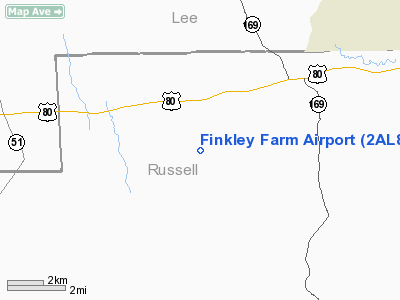
Location
& QuickFacts
|
FAA Information Effective: |
2007-01-18 |
|
Airport
Identifier: |
2AL8 |
|
Airport
Status: |
Operational |
|
Longitude/Latitude: |
085-14-53.0000W/32-25-16.0000N
-85.248056/32.421111 (Estimated) |
|
Elevation: |
413 ft / 125.88 m (Estimated) |
|
Land: |
0
acres |
|
From
nearest city: |
12 nautical miles SW of Phenix City, AL |
|
Location: |
Russell County, AL |
|
Magnetic Variation: |
02W (1995) |
Owner
& Manager
|
Ownership: |
Privately owned |
|
Owner: |
Jimmy Finkley |
|
Address: |
60 Stillwell Road
Opelika, AL 36801 |
|
Phone number: |
334-291-9814 |
|
Manager: |
Jimmy Finkley |
|
Address: |
60 Stillwell Road
Opelika, AL 36801 |
|
Phone number: |
334-291-9814 |
Airport
Operations and Facilities
|
Airport Use: |
Private |
|
Segmented
Circle: |
No |
|
Control
Tower: |
No |
|
Sectional
chart: |
Atlanta |
|
Region: |
ASO - Southern |
|
Boundary
ARTCC: |
ZTL - Atlanta |
|
Tie-in
FSS: |
ANB - Anniston |
|
FSS
on Airport: |
No |
|
FSS
Toll Free: |
1-800-WX-BRIEF |
|
Runway Information
Runway 10/28
|
Dimension: |
2400 x 100 ft / 731.5 x 30.5 m |
|
Surface: |
TURF, |
|
|
Runway 10 |
Runway 28 |
|
Traffic
Pattern: |
Left |
Left |
|
Radio Navigation
Aids
|
ID |
Type |
Name |
Ch |
Freq |
Var |
Dist |
|
AWS |
NDB |
Lawson |
|
335.00 |
02W |
13.8 nm |
|
PIM |
NDB |
Pine Mountain |
|
272.00 |
03W |
31.7 nm |
|
DER |
NDB |
Alexander City |
|
382.00 |
01W |
45.4 nm |
|
LSF |
VOR/DME |
Lawson |
051X |
111.40 |
02W |
14.0 nm |
|
TGE |
VOR/DME |
Tuskegee |
120X |
117.30 |
02E |
21.7 nm |
|
CSG |
VORTAC |
Columbus |
118X |
117.10 |
01E |
16.5 nm |
|
EUF |
VORTAC |
Eufaula |
029X |
109.20 |
02E |
28.9 nm |
|
LGC |
VORTAC |
Lagrange |
103X |
115.60 |
01E |
37.8 nm |
Remarks
Based
Aircraft
|
Aircraft
based on field: |
1 |
|
Single
Engine Airplanes: |
1 |
Finkley Farm Airport
Address:
Russell County, AL
Tel:
334-291-9814
Images
and information placed above are from
http://www.airport-data.com/airport/2AL8/
We
thank them for the data!
| General
Info |
| Country |
United
States |
| State |
ALABAMA
|
| FAA ID |
2AL8
|
| Latitude |
32-25-16.000N
|
| Longitude |
085-14-53.000W
|
| Elevation |
413 feet
|
| Near City |
PHENIX
CITY |
We don't guarantee the information is fresh and accurate. The data may
be wrong or outdated.
For more up-to-date information please refer to other sources.
|
|


