 |
|
|
|
|
|
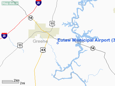
Location
& QuickFacts
|
FAA Information Effective: |
2007-01-18 |
|
Airport
Identifier: |
3A7 |
|
Airport
Status: |
Operational |
|
Longitude/Latitude: |
087-51-45.0490W/32-49-15.4660N
-87.862514/32.820963 (Estimated) |
|
Elevation: |
170 ft / 51.82 m (Surveyed) |
|
Land: |
48
acres |
|
From
nearest city: |
2 nautical miles SE of Eutaw, AL |
|
Location: |
Greene County, AL |
|
Magnetic Variation: |
01E (1985) |
Owner
& Manager
|
Ownership: |
Publicly owned |
|
Owner: |
Town Of Eutaw |
|
Address: |
P O Box 431
Eutaw, AL 35462 |
|
Phone
number: |
205-372-4212 |
|
Manager: |
Town Of Eutaw |
|
Address: |
P.o. Box 431
Eutaw, AL 35462 |
|
Phone number: |
205-372-4212 |
Airport
Operations and Facilities
|
Airport Use: |
Open to public |
|
Wind
indicator: |
Yes |
|
Segmented
Circle: |
No |
|
Control
Tower: |
No |
|
Lighting
Schedule: |
DUSK-DAWN |
|
Beacon
Color: |
Clear-Green (lighted land airport)
ROTG BCN OTS INDEFLY. |
|
Landing
fee charge: |
No |
|
Sectional
chart: |
Atlanta |
|
Region: |
ASO - Southern |
|
Boundary
ARTCC: |
ZTL - Atlanta |
|
Tie-in
FSS: |
ANB - Anniston |
|
FSS
on Airport: |
No |
|
FSS
Toll Free: |
1-800-WX-BRIEF |
|
NOTAMs
Facility: |
ANB (NOTAM-d service avaliable) |
Airport
Communications
Airport
Services
|
Airframe Repair: |
NONE |
|
Power Plant Repair: |
NONE |
|
Runway Information
Runway 16/34
|
Dimension: |
3600 x 80 ft / 1097.3 x 24.4 m |
|
Surface: |
ASPH, Good Condition |
|
Edge
Lights: |
Medium
OTS INDEFLY. |
|
|
Runway 16 |
Runway 34 |
|
Traffic
Pattern: |
Left |
Left |
|
Markings: |
Non-precision instrument, Poor Condition
RY 16/34 MARKINGS FADED. |
Non-precision instrument, Poor Condition |
|
Runway
End Identifier: |
No |
No |
|
Centerline
Lights: |
No |
No |
|
Touchdown
Lights: |
No |
No |
|
Obstruction: |
28 ft trees, 550.0 ft from runway, 65 ft right
of centerline, 12:1 slope to clear |
28 ft pline, 700.0 ft from runway, 175 ft right
of centerline, 17:1 slope to clear
RY 34 +10 FT BRUSH 130 FT FROM THLD 55 FT RIGHT & 110
FT LEFT OF CNTRLN. |
|
Radio Navigation
Aids
|
ID |
Type |
Name |
Ch |
Freq |
Var |
Dist |
|
EOG |
NDB |
Greensboro |
|
417.00 |
01E |
16.6 nm |
|
AIV |
NDB |
Aliceville |
|
254.00 |
|
24.0 nm |
|
RZO |
NDB |
Marengo |
|
391.00 |
01E |
25.6 nm |
|
BCZ |
NDB |
Choctaw |
|
228.00 |
01E |
44.5 nm |
|
NMM |
TACAN |
Meridian |
056X |
|
01E |
37.5 nm |
|
NJW |
TACAN |
Joe Williams |
61Y |
|
01E |
49.2 nm |
|
LDK |
VORTAC |
Crimson |
125X |
117.80 |
03E |
31.0 nm |
|
OKW |
VORTAC |
Brookwood |
047X |
111.00 |
00E |
39.8 nm |
|
EWA |
VORTAC |
Kewanee |
085X |
113.80 |
04E |
40.7 nm |
Remarks
- (PAY
PHONE) PAY PHONE AVAILABLE.
PAYPHONE AVBL AT ARPT 205-372-9901.
- PRIOR
TO FAA ACT.
Based
Aircraft
|
Aircraft
based on field: |
5 |
|
Single
Engine Airplanes: |
4 |
|
Multi
Engine Airplanes: |
1 |
Operational Statistics
Time Period: 1999-04-06
- 2000-04-04
|
Aircraft
Operations: |
124/Week |
|
General
Aviation Local: |
7.2% |
|
General
Aviation Itinerant: |
92.8% |
Eutaw Municipal Airport
Address:
Greene County, AL
Tel:
205-372-4212
Images
and information placed above are from
http://www.airport-data.com/airport/3A7/
We
thank them for the data!
| General
Info |
| Country |
United
States |
| State |
ALABAMA
|
| FAA ID |
3A7
|
| Latitude |
32-49-15.466N
|
| Longitude |
087-51-45.049W
|
| Elevation |
170 feet
|
| Near City |
EUTAW
|
We don't guarantee the information is fresh and accurate. The data may
be wrong or outdated.
For more up-to-date information please refer to other sources.
|
|


