 |
|
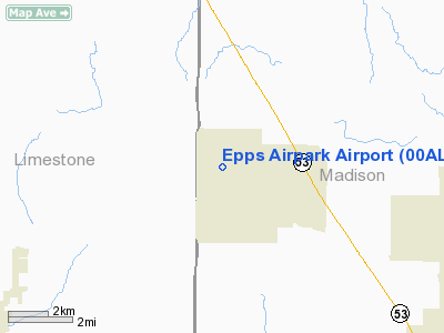
Location
& QuickFacts
|
FAA Information Effective: |
2007-01-18 |
|
Airport
Identifier: |
00AL |
|
Airport
Status: |
Operational |
|
Longitude/Latitude: |
086-46-12.9990W/34-51-53.3170N
-86.770278/34.864810 (Estimated) |
|
Elevation: |
820 ft / 249.94 m (Estimated) |
|
Land: |
15
acres |
|
From
nearest city: |
1 nautical miles NW of Harvest, AL |
|
Location: |
Madison County, AL |
|
Magnetic Variation: |
00W (1985) |
Owner
& Manager
|
Ownership: |
Privately owned |
|
Owner: |
George F. Epps |
|
Address: |
1635 Harvest Rd
Harvest, AL 35749 |
|
Phone number: |
256-837-2224 |
|
Manager: |
George F. Epps |
|
Address: |
1635 Harvest Rd
Harvest, AL 35749 |
|
Phone number: |
256-837-2224 |
Airport
Operations and Facilities
|
Airport Use: |
Private |
|
Wind
indicator: |
Yes |
|
Segmented
Circle: |
No |
|
Control
Tower: |
No |
|
Landing
fee charge: |
No |
|
Sectional
chart: |
Atlanta |
|
Region: |
ASO - Southern |
|
Boundary
ARTCC: |
ZME - Memphis |
|
Tie-in
FSS: |
ANB - Anniston |
|
FSS
on Airport: |
No |
|
FSS Toll Free: |
1-800-WX-BRIEF |
Airport
Services
|
Airframe Repair: |
NONE |
|
Power Plant Repair: |
NONE |
|
Runway Information
Runway 01/19
|
Dimension: |
2300 x 200 ft / 701.0 x 61.0 m |
|
Surface: |
TURF, |
|
|
Runway 01 |
Runway 19 |
|
Traffic
Pattern: |
Left |
Left |
|
Radio Navigation
Aids
|
ID |
Type |
Name |
Ch |
Freq |
Var |
Dist |
|
SYI |
FAN MARKER |
Bomar |
|
|
01W |
40.1 nm |
|
CWH |
NDB |
Capshaw |
|
350.00 |
01W |
5.5 nm |
|
HUA |
NDB |
Redstone |
|
287.00 |
00W |
10.8 nm |
|
TNY |
NDB |
Kelso |
|
358.00 |
01W |
19.7 nm |
|
GZS |
NDB |
Giles/dcmsnd |
|
375.00 |
00E |
22.3 nm |
|
CPP |
NDB |
Cole Spring |
|
230.00 |
01W |
30.0 nm |
|
LRT |
NDB |
Lawrenceburg |
|
269.00 |
00E |
32.8 nm |
|
LUG |
NDB |
Verona |
|
251.00 |
00W |
38.3 nm |
|
BGF |
NDB |
Boiling Fork |
|
263.00 |
02W |
39.4 nm |
|
ULH |
NDB |
Burwi |
|
332.00 |
03W |
44.3 nm |
|
ARF |
NDB |
Saratoga |
|
296.00 |
02W |
45.7 nm |
|
PBC |
NDB |
Maury County |
|
365.00 |
01W |
47.4 nm |
|
UOS |
NDB |
Sewanee |
|
275.00 |
02E |
47.6 nm |
|
UXM |
VOR |
Tullahoma Regional |
|
109.65 |
03W |
40.3 nm |
|
DCU |
VOR/DME |
Decatur |
075X |
112.80 |
01W |
15.5 nm |
|
SYI |
VOR/DME |
Shelbyville |
027X |
109.00 |
01W |
45.0 nm |
|
RQZ |
VORTAC |
Rocket |
059X |
112.20 |
02E |
7.9 nm |
|
MSL |
VORTAC |
Muscle Shoals |
112X |
116.50 |
01E |
36.8 nm |
|
HSV |
VOT |
Huntsville |
|
111.00 |
|
7.0 nm |
Remarks
Based
Aircraft
|
Aircraft
based on field: |
4 |
|
Single
Engine Airplanes: |
4 |
Epps Airpark Airport
Address:
Madison County, AL
Tel:
256-837-2224
Images
and information placed above are from
http://www.airport-data.com/airport/00AL/
We
thank them for the data!
| General
Info |
| Country |
United
States |
| State |
ALABAMA
|
| FAA ID |
00AL
|
| Latitude |
34-51-53.317N
|
| Longitude |
086-46-12.999W
|
| Elevation |
820 feet
|
| Near City |
HARVEST
|
We don't guarantee the information is fresh and accurate. The data may
be wrong or outdated.
For more up-to-date information please refer to other sources.
|
|


