 |
|
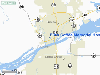
Eliza Coffee Memorial Hospital Heliport |
Location
& QuickFacts
|
FAA Information Effective: |
2007-01-18 |
|
Airport
Identifier: |
AL22 |
|
Airport
Status: |
Operational |
|
Longitude/Latitude: |
087-41-00.1040W/34-47-38.3160N
-87.683362/34.793977 (Estimated) |
|
Elevation: |
581 ft / 177.09 m (Estimated) |
|
Land: |
0
acres |
|
From
nearest city: |
1 nautical miles W of Florence, AL |
|
Location: |
Lauderdale County, AL |
|
Magnetic Variation: |
01E (1985) |
Owner
& Manager
|
Ownership: |
Privately owned |
|
Owner: |
Eliza Coffee Mem Hospital |
|
Address: |
205 Marengo St
Florence, AL 35631 |
|
Phone
number: |
205-767-9191 |
|
Manager: |
Richard H Peck |
|
Address: |
P.o. Box 818
Florence, AL 35631 |
|
Phone number: |
205-767-9191 |
Airport
Operations and Facilities
|
Airport Use: |
Private
MEDICAL. |
|
Wind
indicator: |
Yes |
|
Segmented
Circle: |
No |
|
Control
Tower: |
No |
|
Sectional
chart: |
Atlanta |
|
Region: |
ASO - Southern |
|
Boundary
ARTCC: |
ZME - Memphis |
|
Tie-in
FSS: |
ANB - Anniston |
|
FSS
Toll Free: |
1-800-WX-BRIEF |
|
Runway Information
Helipad H1
|
Dimension: |
50 x 50 ft / 15.2 x 15.2 m |
|
Surface: |
CONC, |
|
|
Runway H1 |
Runway |
|
Traffic
Pattern: |
Left |
Left |
|
Radio Navigation
Aids
|
ID |
Type |
Name |
Ch |
Freq |
Var |
Dist |
|
LRT |
NDB |
Lawrenceburg |
|
269.00 |
00E |
33.7 nm |
|
GZS |
NDB |
Giles/dcmsnd |
|
375.00 |
00E |
37.6 nm |
|
HHY |
NDB |
Pinhook |
|
346.00 |
01W |
37.7 nm |
|
JHG |
NDB |
Hohenwald |
|
257.00 |
01W |
40.3 nm |
|
CWH |
NDB |
Capshaw |
|
350.00 |
01W |
44.7 nm |
|
SZY |
NDB |
Sibley |
|
386.00 |
01E |
48.9 nm |
|
HUA |
NDB |
Redstone |
|
287.00 |
00W |
49.5 nm |
|
CPP |
NDB |
Cole Spring |
|
230.00 |
01W |
49.6 nm |
|
DCU |
VOR/DME |
Decatur |
075X |
112.80 |
01W |
37.8 nm |
|
MSL |
VORTAC |
Muscle Shoals |
112X |
116.50 |
01E |
10.8 nm |
|
HAB |
VORTAC |
Hamilton |
041X |
110.40 |
02E |
39.5 nm |
|
HSV |
VOT |
Huntsville |
|
111.00 |
|
46.3 nm |
Remarks
- ALL
APCHS ARE MADE FM THE NORTH AND ALL LANDINGS ARE MADE TO THE SOUTH.
ALL TAKE-OFFS AND DEPARTURES ARE MADE TO THE NORTH.
- ALL
OPS VFR, LDG AREA PVT USE, APCH FM N; LAND TO S; TAKEOFFS & DEPARTURES
MADE TO THE NORTH, REMOVE 2 SYCAMORE TREES NORTH.
Eliza Coffee Memorial Hospital Heliport
Address:
Lauderdale County, AL
Tel:
205-767-9191
Images
and information placed above are from
http://www.airport-data.com/airport/AL22/
We
thank them for the data!
| General
Info |
| Country |
United
States |
| State |
ALABAMA
|
| FAA ID |
AL22
|
| Latitude |
34-47-38.316N
|
| Longitude |
087-41-00.104W
|
| Elevation |
581 feet
|
| Near City |
FLORENCE
|
We don't guarantee the information is fresh and accurate. The data may
be wrong or outdated.
For more up-to-date information please refer to other sources.
|
|


