 |
|
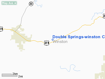
Double Springs - Winston County Airport |
|
|
Location
& QuickFacts
|
FAA Information Effective: |
2007-01-18 |
|
Airport
Identifier: |
3M2 |
|
Airport
Status: |
Operational |
|
Longitude/Latitude: |
087-19-40.0520W/34-08-40.3710N
-87.327792/34.144548 (Estimated) |
|
Elevation: |
753 ft / 229.51 m (Surveyed) |
|
Land: |
65
acres |
|
From
nearest city: |
4 nautical miles E of Double Springs, AL |
|
Location: |
Winston County, AL |
|
Magnetic Variation: |
00E (1985) |
Owner
& Manager
|
Ownership: |
Publicly owned |
|
Owner: |
City And County |
|
Address: |
P.o. Box 279
Double Springs, AL 35553 |
|
Phone
number: |
205-489-5447 |
|
Manager: |
Rusty Banks |
|
Address: |
Econoline Trailers
Double Springs, AL 35553 |
|
Phone number: |
205-489-5318
ALSO 489-2723. |
Airport
Operations and Facilities
|
Airport Use: |
Open to public |
|
Wind
indicator: |
Yes |
|
Segmented
Circle: |
No |
|
Control
Tower: |
No |
|
Lighting
Schedule: |
DUSK-DAWN |
|
Beacon
Color: |
Clear-Green (lighted land airport) |
|
Landing
fee charge: |
No |
|
Sectional
chart: |
Atlanta |
|
Region: |
ASO - Southern |
|
Boundary
ARTCC: |
ZME - Memphis |
|
Tie-in
FSS: |
ANB - Anniston |
|
FSS
on Airport: |
No |
|
FSS
Toll Free: |
1-800-WX-BRIEF |
|
NOTAMs
Facility: |
ANB (NOTAM-d service avaliable) |
Airport
Communications
Airport
Services
|
Airframe Repair: |
MAJOR |
|
Power Plant Repair: |
MAJOR |
|
Bottled
Oxygen: |
NONE |
|
Bulk
Oxygen: |
NONE |
|
Runway Information
Runway 03/21
|
Dimension: |
3403 x 79 ft / 1037.2 x 24.1 m |
|
Surface: |
ASPH, Good Condition |
|
Weight
Limit: |
Single wheel: 15000 lbs. |
|
Edge
Lights: |
Medium |
|
|
Runway 03 |
Runway 21 |
|
Traffic
Pattern: |
Left |
Left |
|
Markings: |
Non-precision instrument, Good Condition |
Non-precision instrument, Good Condition |
|
Obstruction: |
20 ft trees, 900.0 ft from runway, 75 ft left
of centerline, 35:1 slope to clear |
, 50:1 slope to clear
RY 21 +10 FT BRUSH 115 FT FROM THLD & 85-125 FT RIGHT. |
|
Radio Navigation
Aids
|
ID |
Type |
Name |
Ch |
Freq |
Var |
Dist |
|
CPP |
NDB |
Cole Spring |
|
230.00 |
01W |
28.4 nm |
|
FDF |
NDB |
Fayette |
|
204.00 |
00E |
35.4 nm |
|
BH |
NDB |
Mcden |
|
224.00 |
01W |
45.0 nm |
|
HUA |
NDB |
Redstone |
|
287.00 |
00W |
46.0 nm |
|
CWH |
NDB |
Capshaw |
|
350.00 |
01W |
46.6 nm |
|
DCU |
VOR/DME |
Decatur |
075X |
112.80 |
01W |
35.9 nm |
|
HAB |
VORTAC |
Hamilton |
041X |
110.40 |
02E |
34.2 nm |
|
MSL |
VORTAC |
Muscle Shoals |
112X |
116.50 |
01E |
34.8 nm |
|
VUZ |
VORTAC |
Vulcan |
091X |
114.40 |
02E |
35.6 nm |
|
BHM |
VOT |
Birmingham Muni |
|
110.00 |
|
45.1 nm |
Remarks
Based
Aircraft
|
Aircraft
based on field: |
6 |
|
Single
Engine Airplanes: |
4 |
|
Jet Engine
Airplanes: |
1 |
|
Helicopters: |
1 |
Operational Statistics
Time Period: 1999-04-07
- 2000-04-05
|
Aircraft
Operations: |
73/Week |
|
General
Aviation Local: |
11.1% |
|
General
Aviation Itinerant: |
88.9% |
Double Springs-winston County Airport
Address:
Winston County, AL
Tel:
205-489-5447,
205-489-5318
Images
and information placed above are from
http://www.airport-data.com/airport/3M2/
We
thank them for the data!
| General
Info |
| Country |
United
States |
| State |
ALABAMA
|
| FAA ID |
3M2
|
| Latitude |
34-08-40.371N
|
| Longitude |
087-19-40.052W
|
| Elevation |
753 feet
|
| Near City |
DOUBLE
SPRINGS |
We don't guarantee the information is fresh and accurate. The data may
be wrong or outdated.
For more up-to-date information please refer to other sources.
|
|


