Dch Regional Medical Center Heliport |
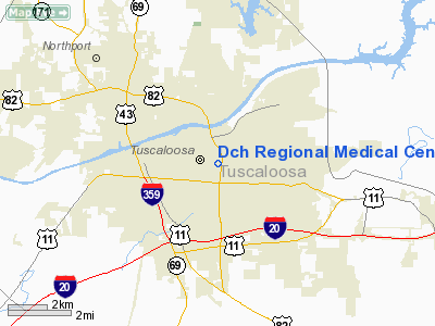
Location
& QuickFacts
|
FAA Information Effective: |
2007-01-18 |
|
Airport
Identifier: |
AL98 |
|
Airport
Status: |
Operational |
|
Longitude/Latitude: |
087-31-35.0000W/33-12-22.0000N
-87.526389/33.206111 (Estimated) |
|
Elevation: |
284 ft / 86.56 m (Estimated) |
|
Land: |
0
acres |
|
From
nearest city: |
0 nautical miles N of Tuscaloosa, AL |
|
Location: |
Tuscaloosa County, AL |
|
Magnetic Variation: |
00E (1990) |
Owner
& Manager
|
Ownership: |
Publicly owned |
|
Owner: |
Dch Regional Medical Center |
|
Address: |
809 University Blvd
Tuscaloosa, AL 35401 |
|
Phone number: |
205-750-5636 |
|
Address: |
|
Airport
Operations and Facilities
|
Airport Use: |
Private
MEDICAL USE. |
|
Segmented
Circle: |
No |
|
Control
Tower: |
No |
|
Lighting
Schedule: |
PHONE REQ
FOR PERIMETER LGTS CALL 205-759-7325. |
|
Sectional
chart: |
Atlanta |
|
Region: |
ASO - Southern |
|
Boundary
ARTCC: |
ZTL - Atlanta |
|
Tie-in
FSS: |
ANB - Anniston |
|
FSS
on Airport: |
No |
|
FSS
Toll Free: |
1-800-WX-BRIEF |
|
Runway Information
Helipad H1
|
Dimension: |
50 x 50 ft / 15.2 x 15.2 m |
|
Surface: |
CONC, |
|
|
Runway H1 |
Runway |
|
Traffic
Pattern: |
Left |
Left |
|
Radio Navigation
Aids
|
ID |
Type |
Name |
Ch |
Freq |
Var |
Dist |
|
BEQ |
NDB |
Bessemer |
|
368.00 |
00E |
31.0 nm |
|
AIV |
NDB |
Aliceville |
|
254.00 |
|
33.6 nm |
|
FDF |
NDB |
Fayette |
|
204.00 |
00E |
33.8 nm |
|
EOG |
NDB |
Greensboro |
|
417.00 |
01E |
36.9 nm |
|
BH |
NDB |
Mcden |
|
224.00 |
01W |
38.8 nm |
|
LDK |
VORTAC |
Crimson |
125X |
117.80 |
03E |
3.2 nm |
|
OKW |
VORTAC |
Brookwood |
047X |
111.00 |
00E |
14.0 nm |
|
VUZ |
VORTAC |
Vulcan |
091X |
114.40 |
02E |
42.0 nm |
|
BHM |
VOT |
Birmingham Muni |
|
110.00 |
|
44.2 nm |
Remarks
- PRVDD
PR USE; APCH/DEP RTE OPS FROM 293-303 DEG; TKOF/LNDG AREA MKD; WIND
INDICATOR MNTND ON TOP OF BLDG; OPS RSTRD TO A MAX 10 KNOT TAILWIND
COMPONENT; 2 POLES & A TREE TO NW REMOVED; CHANGES MADE IN ACCORDANCE
WITH YOUR LTR OF 11/14/89.
Dch Regional Medical Center Heliport
Address:
Tuscaloosa County, AL
Tel:
205-750-5636
Images
and information placed above are from
http://www.airport-data.com/airport/AL98/
We
thank them for the data!
| General
Info |
| Country |
United
States |
| State |
ALABAMA
|
| FAA ID |
AL98
|
| Latitude |
33-12-22.000N
|
| Longitude |
087-31-35.000W
|
| Elevation |
284 feet
|
| Near City |
TUSCALOOSA
|
We don't guarantee the information is fresh and accurate. The data may
be wrong or outdated.
For more up-to-date information please refer to other sources.
|


