 |
|
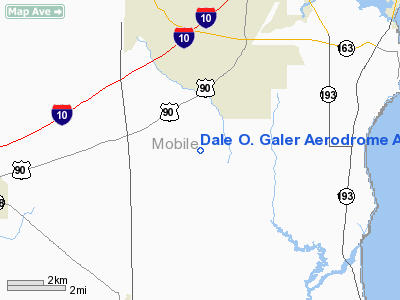
Dale O Galer Aerodrome Airport |
Location
& QuickFacts
|
FAA Information Effective: |
2007-01-18 |
|
Airport
Identifier: |
2AL6 |
|
Airport
Status: |
Operational |
|
Longitude/Latitude: |
088-11-53.4000W/30-29-57.5000N
-88.198167/30.499306 (Estimated) |
|
Elevation: |
40
ft / 12.19 m (Estimated) |
|
Land: |
17
acres |
|
From
nearest city: |
4 nautical miles SW of Theodore, AL |
|
Location: |
Mobile County, AL |
|
Magnetic Variation: |
00E (1995) |
Owner
& Manager
|
Ownership: |
Privately owned |
|
Owner: |
Charles J. Galea |
|
Address: |
4978 Bayou Jonas Drive
Coden, AL 36523 |
|
Phone
number: |
334-873-4544 |
|
Manager: |
Charles J. Galea |
|
Address: |
4978 Bayou Jonas Drive
Coden, AL 36523 |
|
Phone number: |
334-873-4544 |
Airport
Operations and Facilities
|
Airport Use: |
Private |
|
Wind
indicator: |
Yes |
|
Segmented
Circle: |
No |
|
Control
Tower: |
No |
|
Sectional
chart: |
New Orleans |
|
Region: |
ASO - Southern |
|
Boundary
ARTCC: |
ZHU - Houston |
|
Tie-in
FSS: |
ANB - Anniston |
|
FSS
Toll Free: |
1-800-WX-BRIEF |
|
Runway Information
Runway 18/36
|
Dimension: |
2100 x 150 ft / 640.1 x 45.7 m |
|
Surface: |
TURF, Good Condition |
|
|
Runway 18 |
Runway 36 |
|
Traffic
Pattern: |
Right |
Right |
|
Displaced
threshold: |
209.00
ft |
0.00 ft |
|
Obstruction: |
50 ft trees, 500.0 ft from runway |
69 ft trees, 450.0 ft from runway |
|
Radio Navigation
Aids
|
ID |
Type |
Name |
Ch |
Freq |
Var |
Dist |
|
MO |
NDB |
Wisle |
|
248.00 |
02E |
16.6 nm |
|
ESU |
NDB |
Summerdale |
|
204.00 |
01E |
24.5 nm |
|
BIX |
TACAN |
Keesler |
055X |
|
01E |
38.3 nm |
|
NPA |
TACAN |
Pensacola |
119X |
|
01E |
46.5 nm |
|
NUN |
VOR |
Saufley |
|
108.80 |
01E |
44.7 nm |
|
GPT |
VOR/DME |
Gulfport |
27X |
109.00 |
02E |
45.8 nm |
|
BFM |
VORTAC |
Brookley |
075X |
112.80 |
04E |
10.1 nm |
|
SJI |
VORTAC |
Semmes |
100X |
115.30 |
05E |
16.0 nm |
|
GCV |
VORTAC |
Greene County |
104X |
115.70 |
05E |
38.9 nm |
Remarks
Based
Aircraft
|
Aircraft
based on field: |
5 |
|
Single
Engine Airplanes: |
2 |
|
Ultralights: |
3 |
Dale O. Galer Aerodrome Airport
Address:
Mobile County, AL
Tel:
334-873-4544
Images
and information placed above are from
http://www.airport-data.com/airport/2AL6/
We
thank them for the data!
| General
Info |
| Country |
United
States |
| State |
ALABAMA
|
| FAA ID |
2AL6
|
| Latitude |
30-29-57.500N
|
| Longitude |
088-11-53.400W
|
| Elevation |
40 feet
|
| Near City |
THEODORE
|
We don't guarantee the information is fresh and accurate. The data may
be wrong or outdated.
For more up-to-date information please refer to other sources.
|
|


