 |
|
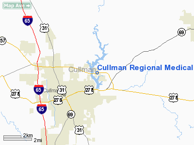
Cullman Regional Medical Center Heliport |
Location
& QuickFacts
|
FAA Information Effective: |
2007-01-18 |
|
Airport
Identifier: |
3AL9 |
|
Airport
Status: |
Operational |
|
Longitude/Latitude: |
086-48-17.0000W/34-12-02.0000N
-86.804722/34.200556 (Estimated) |
|
Elevation: |
826
ft / 251.76 m (Estimated) |
|
Land: |
0
acres |
|
From
nearest city: |
0 nautical miles N of Cullman, AL |
|
Location: |
Cullman County, AL |
|
Magnetic Variation: |
01W (1995) |
Owner
& Manager
|
Ownership: |
Privately owned |
|
Owner: |
Cullman Rgnl Medical Center |
|
Address: |
1912 Al Hwy 157
Cullman, AL 35055 |
|
Phone number: |
205-737-2000 |
|
Manager: |
Carlton Brown |
|
Address: |
1912 Al Hwy 157
Cullman, AL 35055 |
|
Phone number: |
205-737-2566 |
Airport
Operations and Facilities
|
Airport Use: |
Private |
|
Wind
indicator: |
Yes |
|
Segmented
Circle: |
Yes |
|
Control
Tower: |
No |
|
Sectional
chart: |
Atlanta |
|
Region: |
ASO - Southern |
|
Boundary
ARTCC: |
ZTL - Atlanta |
|
Tie-in
FSS: |
ANB - Anniston |
|
FSS
Toll Free: |
1-800-WX-BRIEF |
|
Runway Information
Helipad H1
|
Dimension: |
50 x 50 ft / 15.2 x 15.2 m |
|
Surface: |
CONC, |
|
|
Runway H1 |
Runway |
|
Traffic
Pattern: |
Left |
Left |
|
Radio Navigation
Aids
|
ID |
Type |
Name |
Ch |
Freq |
Var |
Dist |
|
CPP |
NDB |
Cole Spring |
|
230.00 |
01W |
10.1 nm |
|
ARF |
NDB |
Saratoga |
|
296.00 |
02W |
29.1 nm |
|
HUA |
NDB |
Redstone |
|
287.00 |
00W |
30.5 nm |
|
CWH |
NDB |
Capshaw |
|
350.00 |
01W |
34.5 nm |
|
BH |
NDB |
Mcden |
|
224.00 |
01W |
41.5 nm |
|
PLR |
NDB |
Pell City |
|
257.00 |
01E |
47.5 nm |
|
DCU |
VOR/DME |
Decatur |
075X |
112.80 |
01W |
27.7 nm |
|
GAD |
VOR/DME |
Gadsden |
070X |
112.30 |
02E |
38.3 nm |
|
VUZ |
VORTAC |
Vulcan |
091X |
114.40 |
02E |
32.2 nm |
|
RQZ |
VORTAC |
Rocket |
059X |
112.20 |
02E |
36.9 nm |
|
MSL |
VORTAC |
Muscle Shoals |
112X |
116.50 |
01E |
45.7 nm |
|
BHM |
VOT |
Birmingham Muni |
|
110.00 |
|
38.4 nm |
|
HSV |
VOT |
Huntsville |
|
111.00 |
|
47.0 nm |
Remarks
- PRVDD
PVT USE, AREA IS MKD, APCH/DEP FROM 060 CLKWS TO 080, WIND INDICATOR
IS MAINTAINED, TKOF/LNDG RESTRICTED TO MAX 20 KNOT HEADWIND.
Cullman Regional Medical Center Heliport
Address:
Cullman County, AL
Tel:
205-737-2000, 205-737-2566
Images
and information placed above are from
http://www.airport-data.com/airport/3AL9/
We
thank them for the data!
| General
Info |
| Country |
United
States |
| State |
ALABAMA
|
| FAA ID |
3AL9
|
| Latitude |
34-12-02.000N
|
| Longitude |
086-48-17.000W
|
| Elevation |
826 feet
|
| Near City |
CULLMAN
|
We don't guarantee the information is fresh and accurate. The data may
be wrong or outdated.
For more up-to-date information please refer to other sources.
|
|


