 |
|
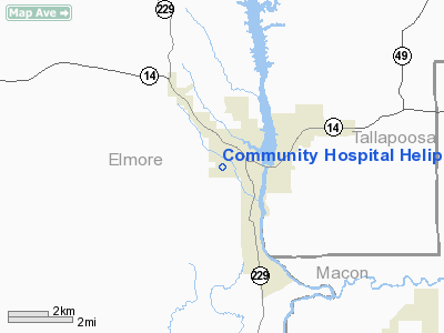
Community Hospital Heliport |
Location
& QuickFacts
| FAA Information Effective: |
2005-10-27 |
| Airport Identifier: |
AL83 |
| Longitude/Latitude: |
085-54-40.8530W/32-32-02.4850N
-85.911348/32.534024 (Estimated) |
| Elevation: |
400
ft / 121.92 m (Estimated) |
| Land: |
1
acres |
| From nearest city: |
1
nautical miles W of Tallassee, AL |
| Location: |
Elmore
County, AL |
| Magnetic Variation: |
01W
(1985) |
Owner
& Manager
| Ownership: |
Privately
owned |
| Owner: |
Community
Hospital |
| Address: |
Friendship
Road Po Box 707
Tallassee, AL 36078 |
| Phone number: |
205-283-6541 |
| Manager: |
Marlon
Johnson |
| Address: |
Friendship
Road Po Box 707
Tallassee, AL 36078 |
| Phone number: |
205-283-6541 |
Airport
Operations and Facilities
| Airport Use: |
Private
MEDICAL |
| Wind indicator: |
Yes |
| Segmented Circle: |
No |
| Control Tower: |
No |
| Attendance Schedule: |
ALL/ALL/ALL |
| Lighting Schedule: |
DUSK-DAWN |
| Sectional chart: |
Atlanta |
| Region: |
ASO
- Southern |
| Boundary ARTCC: |
ZTL
- Atlanta |
| Tie-in FSS: |
ANB
- Anniston |
| FSS Phone: |
256-832-2100 |
| FSS Toll Free: |
1-800-WX-BRIEF |
Runway
Information
Helipad H1
| Dimension: |
20
x 20 ft / 6.1 x 6.1 m |
| Surface: |
CONC,
|
| |
Runway
H1 |
Runway
|
| Traffic Pattern: |
Left |
Left |
|
Radio
Navigation Aids
| ID |
Type |
Name |
Ch |
Freq |
Var |
Dist |
| DER |
NDB |
Alexander
City |
|
382.00 |
01W |
20.9
nm |
| GGY |
NDB |
Gragg-wade |
|
338.00 |
01E |
40.3
nm |
| TO |
NDB |
Blood |
|
365.00 |
01W |
43.4
nm |
| SCD |
NDB |
Sylacauga |
|
284.00 |
03W |
43.6
nm |
| AWS |
NDB |
Lawson |
|
335.00 |
02W |
47.3
nm |
| MXF |
TACAN |
Maxwell |
097X |
|
03E |
25.0
nm |
| TGE |
VOR/DME |
Tuskegee |
120X |
117.30 |
02E |
12.6
nm |
| LSF |
VOR/DME |
Lawson |
051X |
111.40 |
02W |
48.1
nm |
| MGM |
VORTAC |
Montgomery |
058X |
112.10 |
03E |
27.9
nm |
| CSG |
VORTAC |
Columbus |
118X |
117.10 |
01E |
45.5
nm |
| LGC |
VORTAC |
Lagrange |
103X |
115.60 |
01E |
47.2
nm |
Remarks
- PRVD
VFR/PVT USE; & THE SOUTH EAST AND WEST INGRESS/EGRESS ROUTES ARE
SUITABLE PROVIDING ALL TREES & OTHER OBSTN ARE CLEARED TO A MINIMUM
OF 100' TO THE CENTER OF THE LANDING PAD.
Community Hospital Heliport
Localion: Elmore County,
AL
Tel:
205-283-6541
Images and information placed above are from
http://www.airport-data.com/airport/AL83/
We thank them for the data!
| General Info
|
| Country |
United States
|
| State |
ALABAMA
|
| FAA ID |
AL83
|
| Latitude |
32-32-02.485N
|
| Longitude |
085-54-40.853W
|
| Elevation |
400 feet
|
| Near City |
TALLASSEE
|
We don't guarantee the information is fresh and accurate. The data may be wrong or outdated.
For more up-to-date information please refer to other sources.
|
|


