 |
|
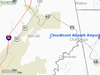
Cloudmont Airpark Airport |
Location
& QuickFacts
|
FAA Information Effective: |
2005-10-27 |
|
Airport Identifier: |
AL09 |
|
Longitude/Latitude: |
085-35-24.8710W/34-32-00.3050N
-85.590242/34.533418 (Estimated) |
|
Elevation: |
1692
ft / 515.72 m (Surveyed) |
|
Land: |
10
acres |
|
From nearest city: |
3
nautical miles S of Mentone, AL |
|
Location: |
De
Kalb County, AL |
|
Magnetic Variation: |
01W
(1985) |
Owner
& Manager
|
Ownership: |
Privately
owned |
|
Owner: |
Jack
E. Jones |
|
Address: |
Cloudmont
Airpark, Po Box 435
Mentone, AL 35984 |
|
Phone number: |
205-634-4344 |
|
Address: |
|
Airport
Operations and Facilities
|
Airport Use: |
Private |
|
Wind indicator: |
Yes |
|
Segmented Circle: |
No |
|
Control Tower: |
No |
|
Attendance Schedule: |
UNATNDD |
|
Landing fee charge: |
No |
|
Sectional chart: |
Atlanta |
|
Region: |
ASO
- Southern |
|
Boundary ARTCC: |
ZTL
- Atlanta |
|
Tie-in FSS: |
ANB
- Anniston |
|
FSS on Airport: |
No |
|
FSS Phone: |
256-832-2100 |
|
FSS Toll Free: |
1-800-WX-BRIEF |
Airport
Services
|
Airframe Repair: |
NONE |
|
Power Plant Repair: |
NONE |
Runway
Information
Runway
18/36
|
Dimension: |
2450
x 80 ft / 746.8 x 24.4 m |
|
Surface: |
TURF,
|
| |
Runway
18 |
Runway
36 |
|
Traffic Pattern: |
Left |
Left |
|
Obstruction: |
6
ft trees, 200.0 ft from runway |
20
ft trees, 300.0 ft from runway |
|
Radio
Navigation Aids
|
ID |
Type |
Name |
Ch |
Freq |
Var |
Dist |
|
FTP |
NDB |
Fort
Payne |
|
426.00 |
01W |
4.2
nm |
|
OYD |
NDB |
Floyd |
|
388.00 |
02W |
25.4
nm |
|
APT |
NDB |
Jasper |
|
382.00 |
02W |
31.6
nm |
|
OUK |
NDB |
Calhoun |
|
323.00 |
02W |
33.8
nm |
|
UWI |
NDB |
Whitfield |
|
400.00 |
03W |
35.4
nm |
|
ARF |
NDB |
Saratoga |
|
296.00 |
02W |
35.7
nm |
|
EVZ |
NDB |
Cartersville |
|
308.00 |
02W |
42.1
nm |
|
UOS |
NDB |
Sewanee |
|
275.00 |
02E |
43.0
nm |
|
CQN |
NDB |
Daisy |
|
341.00 |
02W |
43.6
nm |
|
BGF |
NDB |
Boiling
Fork |
|
263.00 |
02W |
45.4
nm |
|
GAD |
VOR/DME |
Gadsden |
070X |
112.30 |
02E |
41.5
nm |
|
RMG |
VORTAC |
Rome |
101X |
115.40 |
01E |
32.3
nm |
|
GQO |
VORTAC |
Choo
Choo |
105X |
115.80 |
01E |
33.6
nm |
Remarks
- < 100? OVER APCH N FIRETOWER. OF EAST &
WATERFALL S LCTD>
- VFR
USE ONLY.
Cloudmont Airpark Airport
Localion: De Kalb
County, AL
Tel:
205-634-4344
Images and information placed above are from
http://www.airport-data.com/airport/AL09/
We thank them for the data!
| General Info
|
| Country |
United States
|
| State |
ALABAMA
|
| FAA ID |
AL09
|
| Latitude |
34-32-00.305N
|
| Longitude |
085-35-24.871W
|
| Elevation |
1692 feet
|
| Near City |
MENTONE
|
We don't guarantee the information is fresh and accurate. The data may be wrong or outdated.
For more up-to-date information please refer to other sources.
|
|


