 |
|
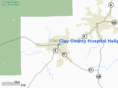
Clay County Hospital Heliport |
Location
& QuickFacts
|
FAA Information Effective: |
2005-10-27 |
|
Airport Identifier: |
0AL2 |
|
Longitude/Latitude: |
085-50-00.0000W/33-16-30.0000N
-85.833333/33.275000 (Estimated) |
|
Elevation: |
1040
ft / 316.99 m (Estimated) |
|
Land: |
0
acres |
|
From nearest city: |
1
nautical miles E of Ashland, AL |
|
Location: |
Clay
County, AL |
|
Magnetic Variation: |
01W
(1990) |
Owner
& Manager
|
Ownership: |
Publicly
owned |
|
Owner: |
Clay
County Hospital |
|
Address: |
544
East 1st Avenue
Ashland, AL 36251 |
|
Phone number: |
205-354-2131
EXTENSION 168. |
|
Manager: |
Linda
Barnes |
|
Address: |
544
East 1st Avenue
Ashland, AL 36251 |
|
Phone number: |
205-354-2131 |
Airport
Operations and Facilities
|
Airport Use: |
Open
to public
MEDICAL USE. |
|
Wind indicator: |
Yes |
|
Segmented Circle: |
No |
|
Control Tower: |
No |
|
Attendance Schedule: |
ALL/ALL/ALL |
|
Sectional chart: |
Atlanta |
|
Region: |
ASO
- Southern |
|
Boundary ARTCC: |
ZTL
- Atlanta |
|
Tie-in FSS: |
ANB
- Anniston |
|
FSS on Airport: |
No |
|
FSS Phone: |
256-832-2100 |
|
FSS Toll Free: |
1-800-WX-BRIEF |
Runway
Information
Helipad H1
|
Dimension: |
24
x 21 ft / 7.3 x 6.4 m |
|
Surface: |
CONC,
|
| |
Runway
H1 |
Runway
|
|
Traffic Pattern: |
Left |
Left |
|
Radio
Navigation Aids
|
ID |
Type |
Name |
Ch |
Freq |
Var |
Dist |
|
DER |
NDB |
Alexander
City |
|
382.00 |
01W |
24.6
nm |
|
SCD |
NDB |
Sylacauga |
|
284.00 |
03W |
25.1
nm |
|
PLR |
NDB |
Pell
City |
|
257.00 |
01E |
27.0
nm |
|
GPQ |
NDB |
Carrollton |
|
278.00 |
02W |
39.3
nm |
|
GGY |
NDB |
Gragg-wade |
|
338.00 |
01E |
46.7
nm |
|
TDG |
VOR/DME |
Talladega |
025X |
108.80 |
02E |
20.9
nm |
|
GAD |
VOR/DME |
Gadsden |
070X |
112.30 |
02E |
44.0
nm |
|
TGE |
VOR/DME |
Tuskegee |
120X |
117.30 |
02E |
48.2
nm |
|
LGC |
VORTAC |
Lagrange |
103X |
115.60 |
01E |
34.4
nm |
|
BHM |
VOT |
Birmingham
Muni |
|
110.00 |
|
49.4
nm |
Remarks
- PRVDD
APCH/DEP RTE OPS FROM 300-330 DEGS; TKOF/LNDG
AREA MKD; WIND INDICATOR MNTND; AND NO OPS
CONDUCTED WITH A TAILWIND COMPONENT IN EXCESS
OF 10 KNOTS.
Clay County Hospital Heliport
Localion: Clay County,
AL
Tel:
205-354-2131
Images and information placed above are from
http://www.airport-data.com/airport/0AL2/
We thank them for the data!
| General Info
|
| Country |
United States
|
| State |
ALABAMA
|
| FAA ID |
0AL2
|
| Latitude |
33-16-30.000N
|
| Longitude |
085-50-00.000W
|
| Elevation |
1040 feet
|
| Near City |
ASHLAND
|
We don't guarantee the information is fresh and accurate. The data may be wrong or outdated.
For more up-to-date information please refer to other sources.
|
|


