 |
|
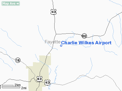
Location
& QuickFacts
|
FAA Information Effective: |
2005-10-27 |
|
Airport Identifier: |
AL00 |
|
Longitude/Latitude: |
087-47-11.0000W/33-44-40.0000N
-87.786389/33.744444 (Estimated) |
|
Elevation: |
340
ft / 103.63 m (Estimated) |
|
Land: |
0
acres |
|
From nearest city: |
5
nautical miles NE of Fayette, AL |
|
Location: |
Fayette
County, AL |
|
Magnetic Variation: |
00W
(1995) |
Owner
& Manager
|
Ownership: |
Privately
owned |
|
Owner: |
William
Musgrave |
|
Address: |
Route
3, Box 182
Fayette, AL 35555 |
|
Phone number: |
205-932-6273 |
|
Manager: |
William
Musgrave |
|
Address: |
Route
3, Box 182
Fayette, AL 35555 |
|
Phone number: |
205-932-6273 |
Airport
Operations and Facilities
|
Airport Use: |
Private |
|
Segmented Circle: |
No |
|
Control Tower: |
No |
|
Attendance Schedule: |
UNATNDD |
|
Sectional chart: |
Atlanta |
|
Region: |
ASO
- Southern |
|
Boundary ARTCC: |
ZME
- Memphis |
|
Tie-in FSS: |
ANB
- Anniston |
|
FSS Phone: |
256-832-2100 |
|
FSS Toll Free: |
1-800-WX-BRIEF |
Runway
Information
Runway 02/20
|
Dimension: |
1800
x 200 ft / 548.6 x 61.0 m |
|
Surface: |
TURF,
|
| |
Runway
02 |
Runway
20 |
|
Traffic Pattern: |
Right |
Left |
|
Radio
Navigation Aids
|
ID |
Type |
Name |
Ch |
Freq |
Var |
Dist |
|
FDF |
NDB |
Fayette |
|
204.00 |
00E |
2.3
nm |
|
AIV |
NDB |
Aliceville |
|
254.00 |
|
42.9
nm |
|
BH |
NDB |
Mcden |
|
224.00 |
01W |
49.1
nm |
|
HAB |
VORTAC |
Hamilton |
041X |
110.40 |
02E |
29.3
nm |
|
LDK |
VORTAC |
Crimson |
125X |
117.80 |
03E |
31.8
nm |
|
CBM |
VORTAC |
Caledonia |
099X |
115.20 |
00E |
33.2
nm |
|
IGB |
VORTAC |
Bigbee |
109X |
116.20 |
04E |
39.6
nm |
|
OKW |
VORTAC |
Brookwood |
047X |
111.00 |
00E |
40.5
nm |
|
VUZ |
VORTAC |
Vulcan |
091X |
114.40 |
02E |
44.6
nm |
Remarks
- PRVDD
VFR, PVT USE, ADHERENCE WITH LETTER OF AGREEMENT
WITH RICHARD ARTHUR FIELD.
Charlie Wilkes Airport
Localion: Fayette
County, AL
Tel:
205-932-6273
Images and information placed above are from
http://www.airport-data.com/airport/AL00/
We thank them for the data!
| General Info
|
| Country |
United States
|
| State |
ALABAMA
|
| FAA ID |
AL00
|
| Latitude |
33-44-40.000N
|
| Longitude |
087-47-11.000W
|
| Elevation |
340 feet
|
| Near City |
FAYETTE
|
We don't guarantee the information is fresh and accurate. The data may be wrong or outdated.
For more up-to-date information please refer to other sources.
|
|


