 |
|
Carraway Medical Center Heliport |
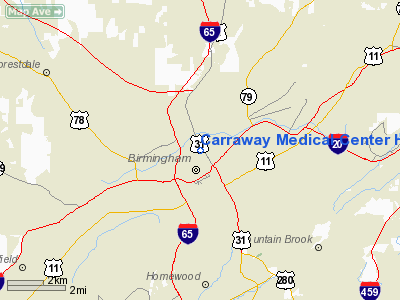
Location
& QuickFacts
|
FAA Information Effective: |
2005-10-27 |
|
Airport Identifier: |
AL49 |
| Longitude/Latitude: |
086-48-40.9650W/33-32-09.3780N
-86.811379/33.535938 (Estimated) |
|
Elevation: |
672
ft / 204.83 m (Estimated) |
| Land: |
0
acres |
|
From nearest city: |
0
nautical miles N of Birmingham, AL |
| Location: |
Jefferson
County, AL |
|
Magnetic Variation: |
00E
(1985) |
Owner
& Manager
|
Ownership: |
Privately
owned |
|
Owner: |
Carraway
Methodist Med Center |
| Address: |
1600
North 26th St
Birmingham, AL 35234 |
|
Phone number: |
205-226-6000 |
| Manager: |
Brooks
Wall |
|
Address: |
1600
North 26th St
Birmingham, AL 35234 |
| Phone number: |
205-226-6914 |
Airport
Operations and Facilities
|
Airport Use: |
Private
MEDICAL. |
| Wind indicator: |
Yes |
|
Segmented Circle: |
No |
| Control Tower: |
No |
|
Attendance Schedule: |
ALL/ALL/ALL |
| Lighting Schedule: |
DUSK-DAWN |
|
Landing fee charge: |
No |
| Sectional chart: |
Atlanta |
|
Region: |
ASO
- Southern |
| Boundary ARTCC: |
ZTL
- Atlanta |
|
Tie-in FSS: |
ANB
- Anniston |
| FSS on Airport: |
No |
|
FSS Phone: |
256-832-2100 |
| FSS Toll Free: |
1-800-WX-BRIEF |
Runway
Information
Helipad H1
|
Dimension: |
70
x 70 ft / 21.3 x 21.3 m
CIRCULAR LANDING AREA.
CIRCULAR LNDG AREA. |
| Surface: |
CONC,
|
| |
Runway
H1 |
Runway
|
|
Traffic Pattern: |
Left |
Left |
|
Helipad H2
|
Dimension: |
70
x 70 ft / 21.3 x 21.3 m
CIRCULAR LANDING AREA.
CIRCULAR LNDG AREA. |
|
Surface: |
CONC,
|
| |
Runway
H2 |
Runway
|
|
Traffic Pattern: |
Left |
Left |
|
Radio
Navigation Aids
| ID |
Type |
Name |
Ch |
Freq |
Var |
Dist |
| BH |
NDB |
Mcden |
|
224.00 |
01W |
2.3
nm |
|
BEQ |
NDB |
Bessemer |
|
368.00 |
00E |
14.6
nm |
| PLR |
NDB |
Pell
City |
|
257.00 |
01E |
28.2
nm |
|
SCD |
NDB |
Sylacauga |
|
284.00 |
03W |
33.0
nm |
| GGY |
NDB |
Gragg-wade |
|
338.00 |
01E |
42.3
nm |
|
TDG |
VOR/DME |
Talladega |
025X |
108.80 |
02E |
38.6
nm |
| GAD |
VOR/DME |
Gadsden |
070X |
112.30 |
02E |
45.0
nm |
|
VUZ |
VORTAC |
Vulcan |
091X |
114.40 |
02E |
9.2
nm |
| OKW |
VORTAC |
Brookwood |
047X |
111.00 |
00E |
28.3
nm |
|
LDK |
VORTAC |
Crimson |
125X |
117.80 |
03E |
40.0
nm |
| BHM |
VOT |
Birmingham
Muni |
|
110.00 |
|
3.2
nm |
Remarks
- VFR,
PVT USE, COORD USE OF HELIPORT WITH BIRMINGHAM GADO
Carraway Medical Center Heliport
Localion: Jefferson
County, AL
Tel:
205-226-6914
Images and information placed above are from
http://www.airport-data.com/airport/AL49/
We thank them for the data!
| General Info
|
| Country |
United States
|
| State |
ALABAMA
|
| FAA ID |
AL49
|
| Latitude |
33-32-09.378N
|
| Longitude |
086-48-40.965W
|
| Elevation |
672 feet
|
| Near City |
BIRMINGHAM
|
We don't guarantee the information is fresh and accurate. The data may be wrong or outdated.
For more up-to-date information please refer to other sources.
|
|


