 |
|
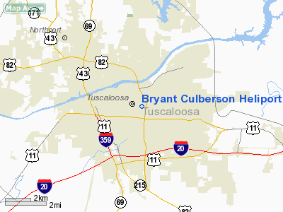
Bryant Culberson Heliport |
|
|
Location
& QuickFacts
| FAA Information Effective: |
2005-10-27 |
| Airport Identifier: |
AL26 |
| Longitude/Latitude: |
087-31-40.0200W/33-12-21.4260N
-87.527783/33.205952 (Estimated) |
| Elevation: |
283
ft / 86.26 m (Estimated) |
| Land: |
0
acres |
| From nearest city: |
3
nautical miles E of Tuscaloosa, AL |
| Location: |
Tuscaloosa
County, AL |
| Magnetic Variation: |
01E
(1985) |
Owner
& Manager
| Ownership: |
Publicly
owned |
| Owner: |
Dch
Regional Medical Center |
| Address: |
809
University Blvd East
Tuscaloosa, AL 35401 |
| Phone number: |
205-759-7189 |
| Manager: |
Bill
Cassels, Vp Of Operations |
| Address: |
Druid
City Hospital, 809 University Blvd East
Tuscaloosa, AL 35403 |
| Phone number: |
205-759-7189 |
Airport
Operations and Facilities
| Airport Use: |
Open
to public
MEDICAL. |
| Wind indicator: |
Yes |
| Segmented Circle: |
No |
| Control Tower: |
No |
| Attendance Schedule: |
IREG |
| Landing fee charge: |
No |
| Sectional chart: |
Atlanta |
| Region: |
ASO
- Southern |
| Boundary ARTCC: |
ZTL
- Atlanta |
| Tie-in FSS: |
ANB
- Anniston |
| FSS on Airport: |
No |
| FSS Phone: |
256-832-2100 |
| FSS Toll Free: |
1-800-WX-BRIEF
LONG DISTANCE CALL TO FSS205-758-3628. |
Runway
Information
Helipad
H1
| Dimension: |
50
x 50 ft / 15.2 x 15.2 m |
| Surface: |
CONC,
|
| |
Runway
H1 |
Runway
|
| Traffic Pattern: |
Left |
Left |
|
Radio
Navigation Aids
| ID |
Type |
Name |
Ch |
Freq |
Var |
Dist |
| BEQ |
NDB |
Bessemer |
|
368.00 |
00E |
31.1
nm |
| AIV |
NDB |
Aliceville |
|
254.00 |
|
33.6
nm |
| FDF |
NDB |
Fayette |
|
204.00 |
00E |
33.8
nm |
| EOG |
NDB |
Greensboro |
|
417.00 |
01E |
36.9
nm |
| BH |
NDB |
Mcden |
|
224.00 |
01W |
38.9
nm |
| LDK |
VORTAC |
Crimson |
125X |
117.80 |
03E |
3.2
nm |
| OKW |
VORTAC |
Brookwood |
047X |
111.00 |
00E |
14.1
nm |
| VUZ |
VORTAC |
Vulcan |
091X |
114.40 |
02E |
42.1
nm |
| BHM |
VOT |
Birmingham
Muni |
|
110.00 |
|
44.3
nm |
Remarks
- VFR
PVT USE; COORD USE OF HELI WITH BHM GADO; 2-WAY RADIO COMS ESTABD
WITH TCL ATCT PRIOR TO ENTERING/DEPARTING CTL ZONE/ARPT TFC
AREA.
Bryant Culberson Heliport
Localion: Tuscaloosa
County, AL
Tel:
205-759-7189
Images and information placed above are from
http://www.airport-data.com/airport/AL26/
We thank them for the data!
| General Info
|
| Country |
United States
|
| State |
ALABAMA
|
| FAA ID |
AL26
|
| Latitude |
33-12-21.426N
|
| Longitude |
087-31-40.020W
|
| Elevation |
283 feet
|
| Near City |
TUSCALOOSA
|
We don't guarantee the information is fresh and accurate. The data may be wrong or outdated.
For more up-to-date information please refer to other sources.
|
|


