|
 |
|
||||
|
|
|||||||||||||||||||||||||||||||||||||||||||||||||||||||||||||||||||||||||||||||||||||||||||||||||||||||||||||||||||||||||||||||||||||||||||||||||||||||||||||||||||||||||||||||||||||||||||||||||||||||||||
| FAA Information Effective: |
2005-10-27 |
| Airport Identifier: |
AL14 |
| Longitude/Latitude: |
087-51-48.0490W/32-30-12.4910N |
| Elevation: |
150 ft / 45.72 m (Estimated) |
| Land: |
3 acres |
| From nearest city: |
0 nautical miles N of Demopolis, AL |
| Location: |
Marengo County, AL |
| Magnetic Variation: |
01E (1985) |
| Ownership: |
Publicly owned |
| Owner: |
Bryon Whitfield Meml Hosp |
| Address: |
Po
Box 890 |
| Phone number: |
205-289-4000 |
| Manager: |
Charles E. Nabors, Hosp Admin |
| Address: |
Po
Box 890 |
| Phone number: |
205-289-4000 |
| Airport Use: |
Open
to public |
| Wind indicator: |
Yes |
| Segmented Circle: |
No |
| Control Tower: |
No |
| Attendance Schedule: |
ALL/ALL/ALL |
| Lighting Schedule: |
PHONE
REQ |
| Beacon Color: |
Clear-Green-Yellow (heliport) |
| Sectional chart: |
Atlanta |
| Region: |
ASO - Southern |
| Boundary ARTCC: |
ZTL - Atlanta |
| Tie-in FSS: |
ANB - Anniston |
| FSS Phone: |
256-832-2100 |
| FSS Toll Free: |
1-800-WX-BRIEF |
| Dimension: |
50 x 50 ft / 15.2 x 15.2 m |
||||||
| Surface: |
CONC, |
||||||
|
|||||||
| ID |
Type |
Name |
Ch |
Freq |
Var |
Dist |
| RZO |
NDB |
Marengo |
391.00 |
01E |
9.4 nm |
|
| EOG |
NDB |
Greensboro |
417.00 |
01E |
11.8 nm |
|
| BCZ |
NDB |
Choctaw |
228.00 |
01E |
26.8 nm |
|
| AIV |
NDB |
Aliceville |
254.00 |
40.1 nm |
||
| ME |
NDB |
Savoy |
356.00 |
01E |
48.6 nm |
|
| SE |
NDB |
Pollk |
344.00 |
01W |
49.5 nm |
|
| NMM |
TACAN |
Meridian |
056X |
01E |
34.9 nm |
|
| JYU |
VOR/DME |
Junior |
083X |
113.60 |
01W |
45.3 nm |
| EWA |
VORTAC |
Kewanee |
085X |
113.80 |
04E |
31.3 nm |
| LDK |
VORTAC |
Crimson |
125X |
117.80 |
03E |
48.3 nm |
| MEI |
VORTAC |
Meridian |
117X |
117.00 |
05E |
48.3 nm |
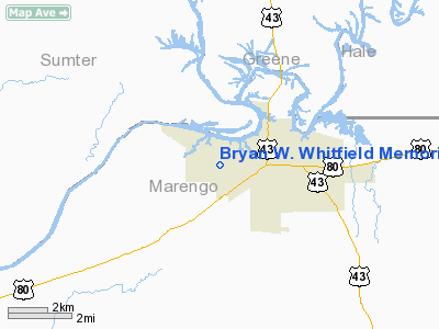
Bryan W. Whitfield Memorial Hospital Heliport
Localion: Marengo County, AL
Tel: 205-289-4000
Images and information placed above are from
http://www.airport-data.com/airport/AL14/
We thank them for the data!
| General Info | |
|---|---|
| Country | United States |
| State | ALABAMA |
| FAA ID | AL14 |
| Latitude | 32-30-12.491N |
| Longitude | 087-51-48.049W |
| Elevation | 150 feet |
| Near City | DEMOPOLIS |

 |
|
Copyright 2004-2026 © by Airports-Worldwide.com, Vyshenskoho st. 36, Lviv 79010, Ukraine Legal Disclaimer |