|
 |
|
||||
|
|
|||||||||||||||||||||||||||||||||||||||||||||||||||||||||||||||||||||||||||||||||||||||||||||||||||||||||||||||||||||||||||||||||||||||||||||||||||||||||||||||||||||||||||||||||||||||||||||||||||||||||||||||||||||||||||||||||||||||||||||||||||||||||||||||||||||||||||||||||
| FAA Information Effective: |
2005-10-27 |
| Airport Identifier: |
60A |
| Longitude/Latitude: |
085-48-16.8030W/31-44-00.5800N |
| Elevation: |
476 ft / 145.08 m (Estimated) |
| Land: |
40 acres |
| From nearest city: |
1 nautical miles NE of Brundidge, AL |
| Location: |
Pike County, AL |
| Magnetic Variation: |
00W (1985) |
| Ownership: |
Publicly owned |
| Owner: |
Town Of Brundidge |
| Address: |
P.o.
Box 638 |
| Phone number: |
334-735-2385 |
| Manager: |
Fred Matney |
| Address: |
Po
Box 245 |
| Phone number: |
334-735-2008 |
| Airport Use: |
Open to public |
| Wind indicator: |
Yes |
| Segmented Circle: |
No |
| Control Tower: |
No |
| Attendance Schedule: |
UNATNDD |
| Lighting Schedule: |
DUSK-DAWN |
| Landing fee charge: |
No |
| Sectional chart: |
New Orleans |
| Region: |
ASO - Southern |
| Boundary ARTCC: |
ZTL - Atlanta |
| Tie-in FSS: |
ANB - Anniston |
| FSS on Airport: |
No |
| FSS Phone: |
256-832-2100 |
| FSS Toll Free: |
1-800-WX-BRIEF |
| NOTAMs Facility: |
ANB (NOTAM-d service avaliable) |
| CTAF: |
122.900 |
| Airframe Repair: |
NONE |
| Power Plant Repair: |
NONE |
| Bottled Oxygen: |
NONE |
| Bulk Oxygen: |
NONE |
| Dimension: |
3000 x 80 ft / 914.4 x 24.4 m |
|||||||||
| Surface: |
ASPH,
Poor Condition |
|||||||||
| Weight Limit: |
Single wheel: 15000 lbs. |
|||||||||
| Edge Lights: |
Medium |
|||||||||
|
||||||||||
| ID |
Type |
Name |
Ch |
Freq |
Var |
Dist |
| XNE |
NDB |
Spring Hill |
281.00 |
00E |
9.2 nm |
|
| TO |
NDB |
Blood |
365.00 |
01W |
16.4 nm |
|
| LOR |
NDB |
Lowe |
269.00 |
03W |
22.6 nm |
|
| HYE |
NDB |
Hanchey |
221.00 |
00E |
23.4 nm |
|
| BVG |
NDB |
Boll Weevil |
352.00 |
03E |
25.5 nm |
|
| XBR |
NDB |
Brantley |
410.00 |
00E |
27.0 nm |
|
| OZ |
NDB |
Ruckr |
212.00 |
00E |
30.5 nm |
|
| JUY |
NDB |
Judd |
264.00 |
02W |
39.6 nm |
|
| PRN |
NDB |
Persimmon/dcmsnd |
359.00 |
00E |
42.0 nm |
|
| MXF |
TACAN |
Maxwell |
097X |
03E |
48.3 nm |
|
| HEY |
VOR |
Hanchey |
110.60 |
02E |
23.0 nm |
|
| EDN |
VOR |
Enterprise |
116.60 |
03W |
26.8 nm |
|
| UIA |
VOR |
Andalusia |
110.20 |
00E |
39.4 nm |
|
| OZR |
VOR/DME |
Cairns |
049X |
111.20 |
02E |
28.2 nm |
| TGE |
VOR/DME |
Tuskegee |
120X |
117.30 |
02E |
45.7 nm |
| RRS |
VORTAC |
Wiregrass |
053X |
111.60 |
02E |
33.1 nm |
| EUF |
VORTAC |
Eufaula |
029X |
109.20 |
02E |
36.8 nm |
| MGM |
VORTAC |
Montgomery |
058X |
112.10 |
03E |
39.4 nm |
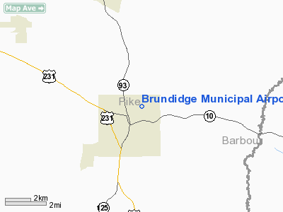
Brundidge Municipal Airport
Localion: Pike County, AL
Tel: 334-735-2008
Images and information placed above are from
http://www.airport-data.com/airport/60A/
We thank them for the data!
| General Info | |
|---|---|
| Country | United States |
| State | ALABAMA |
| FAA ID | 60A |
| Latitude | 31-44-00.580N |
| Longitude | 085-48-16.803W |
| Elevation | 476 feet |
| Near City | BRUNDIDGE |

 |
|
Copyright 2004-2026 © by Airports-Worldwide.com, Vyshenskoho st. 36, Lviv 79010, Ukraine Legal Disclaimer |