 |
|
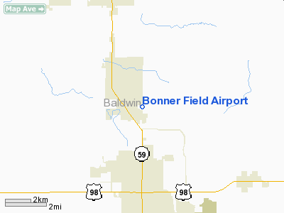
Location
& QuickFacts
| FAA Information Effective: |
2005-10-27 |
| Airport Identifier: |
4AL6 |
| Longitude/Latitude: |
087-40-59.9510W/30-28-00.7050N
-87.683320/30.466863 (Estimated) |
| Elevation: |
105
ft / 32.00 m (Estimated) |
| Land: |
7
acres |
| From nearest city: |
1
nautical miles SE of Summerdale, AL |
| Location: |
Baldwin
County, AL |
| Magnetic Variation: |
01E
(1985) |
Owner
& Manager
| Ownership: |
Privately
owned |
| Owner: |
Charles
Bonner |
| Address: |
308
East Sanborn Ave
Summerdale, AL 36580 |
| Phone number: |
334-989-6624 |
| Manager: |
Charles
Bonner |
| Address: |
308
East Sanborn Ave
Summerdale, AL 36580 |
| Phone number: |
334-989-6624 |
Airport
Operations and Facilities
| Airport Use: |
Private |
| Segmented Circle: |
No |
| Control Tower: |
No |
| Attendance Schedule: |
ALL/MON-SAT/DAWN-DUSK |
| Landing fee charge: |
No |
| Sectional chart: |
New
Orleans |
| Region: |
ASO
- Southern |
| Boundary ARTCC: |
ZJX
- Jacksonville |
| Tie-in FSS: |
ANB
- Anniston |
| FSS on Airport: |
No |
| FSS Phone: |
256-832-2100 |
| FSS Toll Free: |
1-800-WX-BRIEF |
Airport
Services
| Airframe Repair: |
NONE |
| Power Plant Repair: |
NONE |
Runway
Information
Runway 18/36
| Dimension: |
1600
x 160 ft / 487.7 x 48.8 m |
| Surface: |
TURF,
|
| |
Runway
18 |
Runway
36 |
| Traffic Pattern: |
Left |
Left |
|
Radio
Navigation Aids
| ID |
Type |
Name |
Ch |
Freq |
Var |
Dist |
| ESU |
NDB |
Summerdale |
|
204.00 |
01E |
2.9
nm |
| PKZ |
NDB |
Pickens |
|
326.00 |
01E |
26.2
nm |
| MO |
NDB |
Wisle |
|
248.00 |
02E |
36.6
nm |
| NPA |
TACAN |
Pensacola |
119X |
|
01E |
20.1
nm |
| NSE |
TACAN |
Whiting |
070X |
|
01E |
37.7
nm |
| NGS |
TACAN |
Santa
Rosa |
063X |
|
01E |
39.6
nm |
| NUN |
VOR |
Saufley |
|
108.80 |
01E |
18.0
nm |
| BFM |
VORTAC |
Brookley |
075X |
112.80 |
04E |
21.2
nm |
| SJI |
VORTAC |
Semmes |
100X |
115.30 |
05E |
38.3
nm |
Remarks
Bonner Field Airport Baldwin County, AL
Tel:
334-989-6624
Images and information placed above are from
http://www.airport-data.com/airport/4AL6/
We thank them for the data!
| General Info
|
| Country |
United States
|
| State |
ALABAMA
|
| FAA ID |
4AL6
|
| Latitude |
30-28-00.705N
|
| Longitude |
087-40-59.951W
|
| Elevation |
105 feet
|
| Near City |
SUMMERDALE
|
We don't guarantee the information is fresh and accurate. The data may be wrong or outdated.
For more up-to-date information please refer to other sources.
|
|


