 |
|
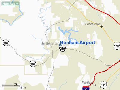
Location
& QuickFacts
| FAA Information Effective: |
2005-10-27 |
| Airport Identifier: |
AL40 |
| Longitude/Latitude: |
086-59-08.9800W/33-32-35.3830N
-86.985828/33.543162 (Estimated) |
| Elevation: |
600
ft / 182.88 m (Estimated) |
| Land: |
0
acres |
| From nearest city: |
6
nautical miles W of Birmingham, AL |
| Location: |
Jefferson
County, AL |
| Magnetic Variation: |
00E
(1985) |
Owner
& Manager
| Ownership: |
Privately
owned |
| Owner: |
Gary
H. Bonham |
| Address: |
Po
Box 352
Mulga, AL 35118 |
| Phone number: |
205-787-9021 |
| Manager: |
Gary
H. Bonham |
| Address: |
Po
Box 352
Mulga, AL 35118 |
| Phone number: |
205-787-9021 |
Airport
Operations and Facilities
| Airport Use: |
Private |
| Segmented Circle: |
No |
| Control Tower: |
No |
| Attendance Schedule: |
UNATNDD |
| Sectional chart: |
Atlanta |
| Region: |
ASO
- Southern |
| Boundary ARTCC: |
ZTL
- Atlanta |
| Tie-in FSS: |
ANB
- Anniston |
| FSS on Airport: |
No |
| FSS Phone: |
256-832-2100 |
| FSS Toll Free: |
1-800-WX-BRIEF |
Runway
Information
Runway
01/19
| Dimension: |
1500
x 15 ft / 457.2 x 4.6 m |
| Surface: |
TURF-GRVL,
|
| |
Runway
01 |
Runway
19 |
| Traffic Pattern: |
Left |
Left |
| Obstruction: |
50
ft pline, 25.0 ft from runway |
50
ft pline, 300.0 ft from runway |
|
Radio
Navigation Aids
| ID |
Type |
Name |
Ch |
Freq |
Var |
Dist |
| BH |
NDB |
Mcden |
|
224.00 |
01W |
7.3
nm |
| BEQ |
NDB |
Bessemer |
|
368.00 |
00E |
14.2
nm |
| PLR |
NDB |
Pell
City |
|
257.00 |
01E |
36.9
nm |
| SCD |
NDB |
Sylacauga |
|
284.00 |
03W |
40.2
nm |
| FDF |
NDB |
Fayette |
|
204.00 |
00E |
42.7
nm |
| GGY |
NDB |
Gragg-wade |
|
338.00 |
01E |
45.6
nm |
| TDG |
VOR/DME |
Talladega |
025X |
108.80 |
02E |
47.3
nm |
| VUZ |
VORTAC |
Vulcan |
091X |
114.40 |
02E |
8.8
nm |
| OKW |
VORTAC |
Brookwood |
047X |
111.00 |
00E |
22.6
nm |
| LDK |
VORTAC |
Crimson |
125X |
117.80 |
03E |
32.5
nm |
| BHM |
VOT |
Birmingham
Muni |
|
110.00 |
|
11.6
nm |
Remarks
Bonham Airport Jefferson County, AL
Tel:
205-787-9021
Images and information placed above are from
http://www.airport-data.com/airport/AL40/
We thank them for the data!
| General Info
|
| Country |
United States
|
| State |
ALABAMA
|
| FAA ID |
AL40
|
| Latitude |
33-32-35.383N
|
| Longitude |
086-59-08.980W
|
| Elevation |
600 feet
|
| Near City |
BIRMINGHAM
|
We don't guarantee the information is fresh and accurate. The data may be wrong or outdated.
For more up-to-date information please refer to other sources.
|
|


