Location
& QuickFacts
| FAA Information Effective: |
2005-10-27 |
| Airport Identifier: |
AL99 |
| Longitude/Latitude: |
087-46-22.0000W/30-50-23.0000N
-87.772778/30.839722 (Estimated) |
| Elevation: |
241
ft / 73.46 m (Estimated) |
| Land: |
0
acres |
| From nearest city: |
1
nautical miles S of Bay Minette, AL |
| Location: |
Baldwin
County, AL |
| Magnetic Variation: |
01E
(1990) |
Owner
& Manager
| Ownership: |
Privately
owned |
| Owner: |
Blast
Off, Inc. |
| Address: |
2423
Highway 31 South
Bay Minette, AL 26507 |
| Phone number: |
205-937-5555 |
| Manager: |
Thomas
Meacham |
| Address: |
2423
Highway 31 South
Bay Minette, AL 26507 |
| Phone number: |
205-937-5555 |
Airport
Operations and Facilities
| Airport Use: |
Private |
| Segmented Circle: |
No |
| Control Tower: |
No |
| Attendance Schedule: |
UNATNDD |
| Sectional chart: |
New
Orleans |
| Region: |
ASO
- Southern |
| Boundary ARTCC: |
ZHU
- Houston |
| Tie-in FSS: |
ANB
- Anniston |
| FSS on Airport: |
No |
| FSS Phone: |
256-832-2100 |
| FSS Toll Free: |
1-800-WX-BRIEF |
Runway
Information
Helipad
H1
| Dimension: |
40
x 40 ft / 12.2 x 12.2 m |
| Surface: |
CONC,
|
| |
Runway
H1 |
Runway
|
| Traffic Pattern: |
Left |
Left |
|
Radio
Navigation Aids
| ID |
Type |
Name |
Ch |
Freq |
Var |
Dist |
| ESU |
NDB |
Summerdale |
|
204.00 |
01E |
20.6
nm |
| MO |
NDB |
Wisle |
|
248.00 |
02E |
27.8
nm |
| PKZ |
NDB |
Pickens |
|
326.00 |
01E |
39.1
nm |
| NPA |
TACAN |
Pensacola |
119X |
|
01E |
37.4
nm |
| NSE |
TACAN |
Whiting |
070X |
|
01E |
39.6
nm |
| NGS |
TACAN |
Santa
Rosa |
063X |
|
01E |
45.2
nm |
| NUN |
VOR |
Saufley |
|
108.80 |
01E |
31.6
nm |
| BFM |
VORTAC |
Brookley |
075X |
112.80 |
04E |
20.0
nm |
| SJI |
VORTAC |
Semmes |
100X |
115.30 |
05E |
31.0
nm |
| GCV |
VORTAC |
Greene
County |
104X |
115.70 |
05E |
39.9
nm |
| MVC |
VORTAC |
Monroeville |
115X |
116.80 |
04E |
43.1
nm |
Remarks
- PRVDD
PR USE; APCH/DEP RTE OPS FROM 020-160 DEG; TKOF/LNDG AREA MKD; &
WIND INDICATOR MNTND.
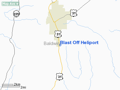
Blast Off Heliport Baldwin County, AL
Tel:
205-937-5555
Images and information placed above are from
http://www.airport-data.com/airport/AL99/
We thank them for the data!
| General Info
|
| Country |
United States
|
| State |
ALABAMA
|
| FAA ID |
AL99
|
| Latitude |
30-50-23.000N
|
| Longitude |
087-46-22.000W
|
| Elevation |
241 feet
|
| Near City |
BAY MINETTE
|
We don't guarantee the information is fresh and accurate. The data may be wrong or outdated.
For more up-to-date information please refer to other sources.