 |
|
|
|
|
|
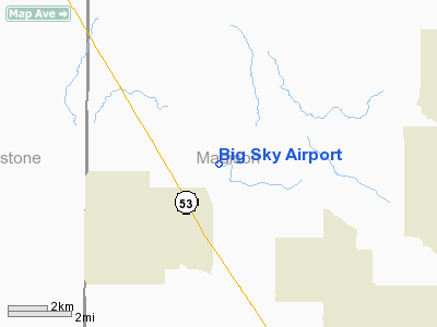
Location
& QuickFacts
| FAA Information Effective: |
2005-10-27 |
| Airport Identifier: |
AL93 |
| Longitude/Latitude: |
086-42-35.9920W/34-53-08.3160N
-86.709998/34.885643 (Estimated) |
| Elevation: |
830
ft / 252.98 m (Estimated) |
| Land: |
19
acres |
| From nearest city: |
12
nautical miles NW of Huntsville, AL |
| Location: |
Madison
County, AL |
| Magnetic Variation: |
01W
(1990) |
Owner
& Manager
| Ownership: |
Privately
owned |
| Owner: |
Christopher
A Barber |
| Address: |
437
Will Raby Rd
Toney, AL 35773 |
| Phone number: |
256-858-9558 |
| Manager: |
Christopher
A Barber |
| Address: |
437
Will Raby Rd
Toney, AL 35773 |
| Phone number: |
256-858-9558 |
Airport
Operations and Facilities
| Airport Use: |
Private |
| Segmented Circle: |
No |
| Control Tower: |
No |
| Attendance Schedule: |
IREG |
| Sectional chart: |
Atlanta |
| Region: |
ASO
- Southern |
| Boundary ARTCC: |
ZME
- Memphis |
| Tie-in FSS: |
ANB
- Anniston |
| FSS Phone: |
256-832-2100 |
| FSS Toll Free: |
1-800-WX-BRIEF |
Runway
Information
Runway
18/36
| Dimension: |
2450
x 80 ft / 746.8 x 24.4 m |
| Surface: |
TURF,
Good Condition |
| |
Runway
18 |
Runway
36 |
| Traffic Pattern: |
Left |
Right |
| Displaced threshold: |
0.00
ft |
400.00
ft
RY 36 DSPLCD THLD MKD WITH CONES. |
| Obstruction: |
|
60
ft trees, 200.0 ft from runway |
|
Radio
Navigation Aids
| ID |
Type |
Name |
Ch |
Freq |
Var |
Dist |
| SYI |
FAN
MARKER |
Bomar |
|
|
01W |
37.9
nm |
| CWH |
NDB |
Capshaw |
|
350.00 |
01W |
7.5
nm |
| HUA |
NDB |
Redstone |
|
287.00 |
00W |
11.3
nm |
| TNY |
NDB |
Kelso |
|
358.00 |
01W |
17.1
nm |
| GZS |
NDB |
Giles/dcmsnd |
|
375.00 |
00E |
23.4
nm |
| CPP |
NDB |
Cole
Spring |
|
230.00 |
01W |
31.6
nm |
| LRT |
NDB |
Lawrenceburg |
|
269.00 |
00E |
34.3
nm |
| BGF |
NDB |
Boiling
Fork |
|
263.00 |
02W |
36.1
nm |
| LUG |
NDB |
Verona |
|
251.00 |
00W |
37.3
nm |
| ULH |
NDB |
Burwi |
|
332.00 |
03W |
41.6
nm |
| UOS |
NDB |
Sewanee |
|
275.00 |
02E |
44.4
nm |
| ARF |
NDB |
Saratoga |
|
296.00 |
02W |
45.0
nm |
| PBC |
NDB |
Maury
County |
|
365.00 |
01W |
47.3
nm |
| UXM |
VOR |
Tullahoma
Regional |
|
109.65 |
03W |
37.5
nm |
| DCU |
VOR/DME |
Decatur |
075X |
112.80 |
01W |
18.2
nm |
| SYI |
VOR/DME |
Shelbyville |
027X |
109.00 |
01W |
42.8
nm |
| RQZ |
VORTAC |
Rocket |
059X |
112.20 |
02E |
6.5
nm |
| MSL |
VORTAC |
Muscle
Shoals |
112X |
116.50 |
01E |
40.0
nm |
| HSV |
VOT |
Huntsville |
|
111.00 |
|
6.6
nm |
Remarks
- PRVDD
ALL OPNS IN VFR WX CONDITIONS, LIMITED TO PVT USE.
Big Sky Airport
Madison County, AL
Tel:
256-858-9558
Images and information placed above are from
http://www.airport-data.com/airport/AL93/
We thank them for the data!
| General Info
|
| Country |
United States
|
| State |
ALABAMA
|
| FAA ID |
AL93
|
| Latitude |
34-53-08.316N
|
| Longitude |
086-42-35.992W
|
| Elevation |
830 feet
|
| Near City |
HUNTSVILLE
|
We don't guarantee the information is fresh and accurate. The data may be wrong or outdated.
For more up-to-date information please refer to other sources.
|
|


