 |
|
|
|
|
|
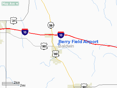
Location
& QuickFacts
| FAA Information Effective: |
2005-10-27 |
| Airport Identifier: |
1AL5 |
| Longitude/Latitude: |
087-44-52.0000W/30-38-11.0000N
-87.747778/30.636389 (Estimated) |
| Elevation: |
170
ft / 51.82 m (Estimated) |
| Land: |
0
acres |
| From nearest city: |
1
nautical miles N of Loxley, AL |
| Location: |
Baldwin
County, AL |
| Magnetic Variation: |
01E
(1990) |
Owner
& Manager
| Ownership: |
Privately
owned |
| Owner: |
Roger
Barnhill, Jr. |
| Address: |
3243
N. Holly Street
Loxley, AL 36551 |
| Phone number: |
205-964-5169 |
| Manager: |
Roger
Barnhill, Jr. |
| Address: |
3243
N. Holly Street
Loxley, AL 36551 |
| Phone number: |
205-964-5169 |
Airport
Operations and Facilities
| Airport Use: |
Private |
| Segmented Circle: |
No |
| Control Tower: |
No |
| Attendance Schedule: |
UNATNDD |
| Sectional chart: |
New
Orleans |
| Region: |
ASO
- Southern |
| Boundary ARTCC: |
ZJX
- Jacksonville |
| Tie-in FSS: |
ANB
- Anniston |
| FSS on Airport: |
No |
| FSS Phone: |
256-832-2100 |
| FSS Toll Free: |
1-800-WX-BRIEF |
Runway
Information
Runway
09/27
| Dimension: |
1300
x 75 ft / 396.2 x 22.9 m |
| Surface: |
TURF,
|
| |
Runway
09 |
Runway
27 |
| Traffic Pattern: |
Left |
Left |
| Obstruction: |
65
ft pline, 2000.0 ft from runway |
5
ft fence, 200.0 ft from runway |
|
Radio
Navigation Aids
| ID |
Type |
Name |
Ch |
Freq |
Var |
Dist |
| ESU |
NDB |
Summerdale |
|
204.00 |
01E |
8.3
nm |
| MO |
NDB |
Wisle |
|
248.00 |
02E |
29.7
nm |
| PKZ |
NDB |
Pickens |
|
326.00 |
01E |
31.8
nm |
| NPA |
TACAN |
Pensacola |
119X |
|
01E |
27.9
nm |
| NSE |
TACAN |
Whiting |
070X |
|
01E |
38.1
nm |
| NGS |
TACAN |
Santa
Rosa |
063X |
|
01E |
41.9
nm |
| NUN |
VOR |
Saufley |
|
108.80 |
01E |
23.5
nm |
| BFM |
VORTAC |
Brookley |
075X |
112.80 |
04E |
16.0
nm |
| SJI |
VORTAC |
Semmes |
100X |
115.30 |
05E |
32.1
nm |
| GCV |
VORTAC |
Greene
County |
104X |
115.70 |
05E |
47.1
nm |
Remarks
Berry Field Airport
Baldwin County, AL
Tel:
205-964-5169
Images and information placed above are from
http://www.airport-data.com/airport/1AL5/
We thank them for the data!
| General Info
|
| Country |
United States
|
| State |
ALABAMA
|
| FAA ID |
1AL5
|
| Latitude |
30-38-11.000N
|
| Longitude |
087-44-52.000W
|
| Elevation |
170 feet
|
| Near City |
LOXLEY
|
We don't guarantee the information is fresh and accurate. The data may be wrong or outdated.
For more up-to-date information please refer to other sources.
|
|


