 |
|
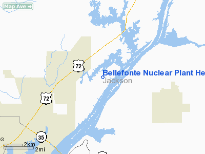
Bellefonte Nuclear Plant Heliport |
Location
& QuickFacts
| FAA Information Effective: |
2005-10-27 |
| Airport Identifier: |
AL80 |
| Longitude/Latitude: |
085-55-25.9170W/34-42-43.2990N
-85.923866/34.712027 (Estimated) |
| Elevation: |
623
ft / 189.89 m (Estimated) |
| Land: |
1
acres |
| From nearest city: |
6
nautical miles NE of Scottsboro, AL |
| Location: |
Jackson
County, AL |
| Magnetic Variation: |
01W
(1985) |
Owner
& Manager
| Ownership: |
Publicly
owned |
| Owner: |
Tennessee
Valley Authority |
| Address: |
400
W Summit Hill Dr
Knoxville, TN 37902 |
| Phone number: |
615-751-2186 |
| Manager: |
Fred
Mc Cluskey |
| Address: |
P
O Box 2000
Hollywood, AL 35752-0200 |
| Phone number: |
205-574-8700 |
Airport
Operations and Facilities
| Airport Use: |
Open
to public
PERSONAL USE. |
| Wind indicator: |
Yes |
| Segmented Circle: |
Yes |
| Control Tower: |
No |
| Attendance Schedule: |
UNATNDD |
| Lighting Schedule: |
PHONE
REQ
FOR PERIMETER LGTS CALL 205-574-8700. |
| Sectional chart: |
Atlanta |
| Region: |
ASO
- Southern |
| Boundary ARTCC: |
ZTL
- Atlanta |
| Tie-in FSS: |
ANB
- Anniston |
| FSS Phone: |
256-832-2100 |
| FSS Toll Free: |
1-800-WX-BRIEF |
Runway
Information
Helipad
H1
| Dimension: |
41
x 41 ft / 12.5 x 12.5 m |
| Surface: |
CONC,
|
| |
Runway
H1 |
Runway
|
| Traffic Pattern: |
Left |
Left |
|
Radio
Navigation Aids
| ID |
Type |
Name |
Ch |
Freq |
Var |
Dist |
| FTP |
NDB |
Fort
Payne |
|
426.00 |
01W |
16.9
nm |
| APT |
NDB |
Jasper |
|
382.00 |
02W |
26.8
nm |
| BGF |
NDB |
Boiling
Fork |
|
263.00 |
02W |
28.9
nm |
| UOS |
NDB |
Sewanee |
|
275.00 |
02E |
29.6
nm |
| ARF |
NDB |
Saratoga |
|
296.00 |
02W |
31.3
nm |
| HUA |
NDB |
Redstone |
|
287.00 |
00W |
37.8
nm |
| TNY |
NDB |
Kelso |
|
358.00 |
01W |
39.6
nm |
| CWH |
NDB |
Capshaw |
|
350.00 |
01W |
42.4
nm |
| OYD |
NDB |
Floyd |
|
388.00 |
02W |
45.1
nm |
| CQN |
NDB |
Daisy |
|
341.00 |
02W |
46.6
nm |
| ULH |
NDB |
Burwi |
|
332.00 |
03W |
47.7
nm |
| UWI |
NDB |
Whitfield |
|
400.00 |
03W |
48.5
nm |
| CPP |
NDB |
Cole
Spring |
|
230.00 |
01W |
49.1
nm |
| UXM |
VOR |
Tullahoma
Regional |
|
109.65 |
03W |
43.2
nm |
| GAD |
VOR/DME |
Gadsden |
070X |
112.30 |
02E |
44.9
nm |
| RQZ |
VORTAC |
Rocket |
059X |
112.20 |
02E |
35.4
nm |
| GQO |
VORTAC |
Choo
Choo |
105X |
115.80 |
01E |
40.9
nm |
| HSV |
VOT |
Huntsville |
|
111.00 |
|
44.9
nm |
Remarks
Bellefonte Nuclear Plant Heliport
Jackson
County, AL
Tel:
205-574-8700
Images and information placed above are from
http://www.airport-data.com/airport/AL80/
We thank them for the data!
| General Info
|
| Country |
United States
|
| State |
ALABAMA
|
| FAA ID |
AL80
|
| Latitude |
34-42-43.299N
|
| Longitude |
085-55-25.917W
|
| Elevation |
623 feet
|
| Near City |
SCOTTSBORO
|
We don't guarantee the information is fresh and accurate. The data may be wrong or outdated.
For more up-to-date information please refer to other sources.
|
|


