|
|
Bay Minette Municipal Airport |
| Bay Minette Municipal Airport |
 |
| IATA: none – ICAO: none – FAA LID: 1R8 |
| Summary |
| Airport type |
Public |
| Owner |
Bay Minette, Alabama |
| Serves |
Bay Minette, Alabama |
| Elevation AMSL |
248 ft / 76 m |
| Coordinates |
30°52′13″N 087°49′10″W / 30.87028°N 87.81944°W / 30.87028; -87.81944 |
| Runways |
| Direction |
Length |
Surface |
| ft |
m |
| 8/26 |
5,497 |
1,675 |
Asphalt |
| Statistics (2006) |
| Aircraft operations |
8,416 |
| Source: Federal Aviation Administration |
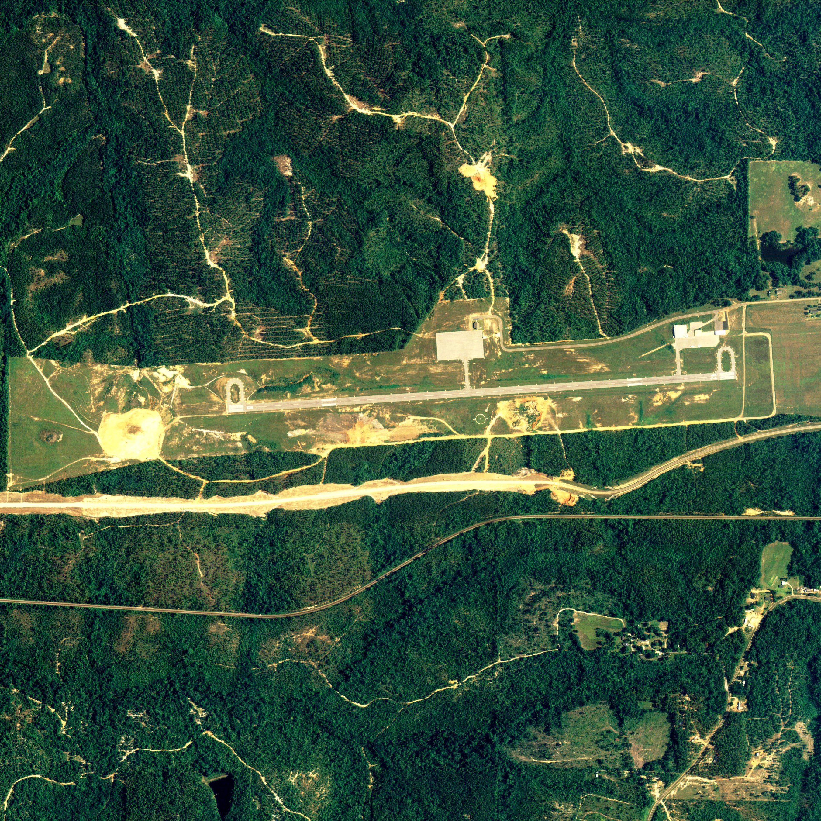
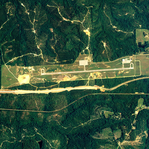
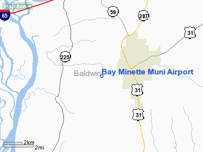
Bay Minette Municipal Airport (FAA LID: 1R8) is a city-owned public-use airport located 3 nautical miles (6 km) southwest of the central business district of Bay Minette, a city in Baldwin County, Alabama, United States.
Facilities and aircraft
Bay Minette Municipal Airport covers an area of 184 acres (0.29 sq mi; 0.74 km) which contains one runway designated 8/26 is 5,497 x 80 feet (1,675 x 24 meters) asphalt pavement. For the 12-month period ending March 2, 2006, the airport had 8,416 general aviation aircraft operations.
The above content comes from Wikipedia and is published under free licenses – click here to read more.
Location
& QuickFacts
| FAA Information Effective: |
2005-10-27 |
| Airport Identifier: |
1R8 |
| Longitude/Latitude: |
087-49-02.5550W/30-52-13.6200N
-87.817376/30.870450 (Estimated) |
| Elevation: |
248
ft / 75.59 m (Surveyed) |
| Land: |
184
acres |
| From nearest city: |
3
nautical miles SW of Bay Minette, AL |
| Location: |
Baldwin
County, AL |
| Magnetic Variation: |
00E
(2000) |
Owner
& Manager
| Ownership: |
Publicly
owned |
| Owner: |
City
Of Bay Minette |
| Address: |
Po
Box 1208
Bay Minette, AL 36507 |
| Phone number: |
334-937-5502 |
| Manager: |
Joel
Clark |
| Address: |
12301
Airport Rd
Bay Minette, AL 36507 |
| Phone number: |
251-937-8227 |
Airport
Operations and Facilities
| Airport Use: |
Open
to public |
| Wind indicator: |
Yes |
| Segmented Circle: |
Yes |
| Control Tower: |
No |
| Attendance Schedule: |
ALL/MON-FRI/0700-1600
ARPT UNATNDD 4TH OF JULY, THANKSGIVING, CHRISTMAS & NEW YEARS
DAY - FOR SVC CALL 334-937-8777. |
| Lighting Schedule: |
DUSK-DAWN |
| Beacon Color: |
Clear-Green
(lighted land airport) |
| Landing fee charge: |
No |
| Sectional chart: |
New
Orleans |
| Region: |
ASO
- Southern |
| Boundary ARTCC: |
ZHU
- Houston |
| Tie-in FSS: |
ANB
- Anniston |
| FSS on Airport: |
No |
| FSS Phone: |
256-832-2100 |
| FSS Toll Free: |
1-800-WX-BRIEF |
| NOTAMs Facility: |
ANB
(NOTAM-d service avaliable) |
| Federal Agreements: |
NGY |
Airport
Communications
| CTAF: |
122.800 |
|
Unicom: |
122.800
UNICOM NOT ATTENDED BY GROUND PERSONNEL; CTAF ONLY. |
Airport
Services
| Fuel available: |
100LL |
|
Airframe Repair: |
MAJOR |
| Power Plant Repair: |
MAJOR |
| Bottled Oxygen: |
NONE |
| Bulk Oxygen: |
NONE |
|
Runway Information
Runway
08/26
| Dimension: |
4276
x 80 ft / 1303.3 x 24.4 m |
| Surface: |
ASPH,
Good Condition |
| Weight Limit: |
Single
wheel: 28000 lbs. |
| Edge Lights: |
Non-standard
lighting system
NSTD MIRL; RY 08 FIRST 87 FT UNLGTD. |
| |
Runway
08 |
Runway
26 |
| Longitude: |
087-49-27.0200W |
087-48-38.0900W |
| Latitude: |
30-52-12.0600N |
30-52-15.1800N |
| Elevation: |
215.00
ft |
248.00
ft |
| Alignment: |
86 |
127 |
| Traffic Pattern: |
Left |
Left |
| Markings: |
Non-precision
instrument, Good Condition |
Non-precision
instrument, Good Condition |
| VASI: |
2-light
PAPI on left side |
|
| Runway End Identifier: |
Yes |
|
| Obstruction: |
35
ft trees, 1190.0 ft from runway, 28:1 slope to clear
RY 08 +5 FT BRUSH 135 FT FROM THLD & 90 FT RIGHT. |
,
50:1 slope to clear
RY 28 +5 FT DIRT ROAD 70 FT FROM THLD & PERPENDICULAR
TO RY +5 FT BRUSH 115 FT FROM THLD & 80 FT RIGHT. |
|
Radio
Navigation Aids
| ID |
Type |
Name |
Ch |
Freq |
Var |
Dist |
| ESU |
NDB |
Summerdale |
|
204.00 |
01E |
22.8
nm |
| MO |
NDB |
Wisle |
|
248.00 |
02E |
25.9
nm |
| PKZ |
NDB |
Pickens |
|
326.00 |
01E |
42.1
nm |
| NPA |
TACAN |
Pensacola |
119X |
|
01E |
40.3
nm |
| NSE |
TACAN |
Whiting |
070X |
|
01E |
42.2
nm |
| NGS |
TACAN |
Santa
Rosa |
063X |
|
01E |
48.0
nm |
| NUN |
VOR |
Saufley |
|
108.80 |
01E |
34.5
nm |
| BFM |
VORTAC |
Brookley |
075X |
112.80 |
04E |
19.8
nm |
| SJI |
VORTAC |
Semmes |
100X |
115.30 |
05E |
29.3
nm |
| GCV |
VORTAC |
Greene
County |
104X |
115.70 |
05E |
37.1
nm |
| MVC |
VORTAC |
Monroeville |
115X |
116.80 |
04E |
42.8
nm |
Remarks
Bay Minette Municipal Airport
Baldwin County, AL
Tel:
251-937-8227
Images and information placed above are from
http://www.airport-data.com/airport/1R8/
We thank them for the data!
| General Info
|
| Country |
United States
|
| State |
ALABAMA
|
| FAA ID |
1R8
|
| Latitude |
30-52-13.620N
|
| Longitude |
087-49-02.555W
|
| Elevation |
248 feet
|
| Near City |
BAY MINETTE
|
We don't guarantee the information is fresh and accurate. The data may be wrong or outdated.
For more up-to-date information please refer to other sources.
|
|