Location
& QuickFacts
| FAA Information Effective: |
2005-10-27 |
| Airport Identifier: |
02AL |
| Longitude/Latitude: |
087-45-52.0000W/30-22-17.2700N
-87.764444/30.371464 (Estimated) |
| Elevation: |
61
ft / 18.59 m () |
| Land: |
10
acres |
| From nearest city: |
5
nautical miles NE of Foley, AL |
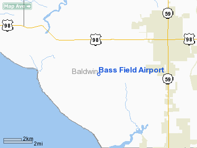
| Location: |
Baldwin
County, AL |
| Magnetic Variation: |
00W
(2000) |
Owner
& Manager
| Ownership: |
Privately
owned |
| Owner: |
Phillip
W. Bass |
| Address: |
Po
Box 2305
Gulf Shores, AL 36547 |
| Phone number: |
334-968-4252 |
| Manager: |
Phillip
W. Bass |
| Address: |
Po
Box 2305
Gulf Shores, AL 36547 |
| Phone number: |
334-965-3431 |
Airport
Operations and Facilities
| Airport Use: |
Private |
| Wind indicator: |
Yes |
| Segmented Circle: |
No |
| Control Tower: |
No |
| Attendance Schedule: |
UNATNDD |
| Sectional chart: |
New
Orleans |
| Region: |
ASO
- Southern |
| Boundary ARTCC: |
ZJX
- Jacksonville |
| Tie-in FSS: |
ANB
- Anniston |
| FSS Phone: |
256-832-2100 |
| FSS Toll Free: |
1-800-WX-BRIEF |
Runway
Information
Runway
18/36
| Dimension: |
2000
x 150 ft / 609.6 x 45.7 m |
| Surface: |
TURF,
|
| |
Runway
18 |
Runway
36 |
| Traffic Pattern: |
Right |
Left |
|
Radio
Navigation Aids
| ID |
Type |
Name |
Ch |
Freq |
Var |
Dist |
| ESU |
NDB |
Summerdale |
|
204.00 |
01E |
7.9
nm |
| PKZ |
NDB |
Pickens |
|
326.00 |
01E |
30.6
nm |
| MO |
NDB |
Wisle |
|
248.00 |
02E |
36.4
nm |
| NPA |
TACAN |
Pensacola |
119X |
|
01E |
23.2
nm |
| NSE |
TACAN |
Whiting |
070X |
|
01E |
44.1
nm |
| NGS |
TACAN |
Santa
Rosa |
063X |
|
01E |
45.3
nm |
| NUN |
VOR |
Saufley |
|
108.80 |
01E |
23.0
nm |
| BFM |
VORTAC |
Brookley |
075X |
112.80 |
04E |
20.9
nm |
| SJI |
VORTAC |
Semmes |
100X |
115.30 |
05E |
37.4
nm |
Remarks
- PROVIDED
VFR OPNS, PRIVATE USE, AND TRAFFIC PATTERN IS RESTRICTED TO THE
WEST OF THE AIRPORT SO AS TO AVOID CONFLICT WITH STRYON LANDING
FIELD.
Bass Field Airport
Baldwin County, AL
Tel:
334-965-3431
Images and information placed above are from
http://www.airport-data.com/airport/02AL/
We thank them for the data!
| General Info
|
| Country |
United States
|
| State |
ALABAMA
|
| FAA ID |
02AL
|
| Latitude |
30-22-17.270N
|
| Longitude |
087-45-52.000W
|
| Elevation |
61 feet
|
| Near City |
FOLEY
|
We don't guarantee the information is fresh and accurate. The data may be wrong or outdated.
For more up-to-date information please refer to other sources.