Location
& QuickFacts
| FAA Information Effective: |
2005-10-27 |
| Airport Identifier: |
AL45 |
| Longitude/Latitude: |
086-44-59.0000W/33-31-03.0000N
-86.749722/33.517500 (Estimated) |
| Elevation: |
966
ft / 294.44 m (Surveyed) |
| Land: |
0
acres |
| From nearest city: |
0
nautical miles N of Birmingham, AL |
| Location: |
Jefferson
County, AL |
| Magnetic Variation: |
00W
(1985) |
Owner
& Manager
| Ownership: |
Privately
owned |
| Owner: |
Baptist
Medical Center |
| Address: |
800
Montclair Road
Birmingham, AL 35213 |
| Phone number: |
205-592-1330 |
| Manager: |
Glenn
Griffin |
| Address: |
800
Montclair Road
Birmingham, AL 35213 |
| Phone number: |
205-592-1330 |
Airport
Operations and Facilities
| Airport Use: |
Private
MEDICAL. |
| Wind indicator: |
Yes |
| Segmented Circle: |
No |
| Control Tower: |
No |
| Attendance Schedule: |
ALL/ALL/ALL |
| Landing fee charge: |
No |
| Sectional chart: |
Atlanta |
| Region: |
ASO
- Southern |
| Boundary ARTCC: |
ZTL
- Atlanta |
| Tie-in FSS: |
ANB
- Anniston |
| FSS on Airport: |
No |
| FSS Phone: |
256-832-2100 |
| FSS Toll Free: |
1-800-WX-BRIEF |
Runway
Information
Helipad
H1
| Dimension: |
19
x 19 ft / 5.8 x 5.8 m |
| Surface: |
CONC,
|
| |
Runway
H1 |
Runway
|
| Traffic Pattern: |
Left |
Left |
|
Radio
Navigation Aids
| ID |
Type |
Name |
Ch |
Freq |
Var |
Dist |
| BH |
NDB |
Mcden |
|
224.00 |
01W |
4.8
nm |
| BEQ |
NDB |
Bessemer |
|
368.00 |
00E |
15.1
nm |
| PLR |
NDB |
Pell
City |
|
257.00 |
01E |
25.2
nm |
| SCD |
NDB |
Sylacauga |
|
284.00 |
03W |
29.9
nm |
| GGY |
NDB |
Gragg-wade |
|
338.00 |
01E |
40.5
nm |
| TDG |
VOR/DME |
Talladega |
025X |
108.80 |
02E |
35.6
nm |
| GAD |
VOR/DME |
Gadsden |
070X |
112.30 |
02E |
43.2
nm |
| VUZ |
VORTAC |
Vulcan |
091X |
114.40 |
02E |
11.9
nm |
| OKW |
VORTAC |
Brookwood |
047X |
111.00 |
00E |
30.2
nm |
| LDK |
VORTAC |
Crimson |
125X |
117.80 |
03E |
42.5
nm |
| BHM |
VOT |
Birmingham
Muni |
|
110.00 |
|
2.8
nm |
Remarks
- EMERGENCY
ONLY
- VFR,
PVT USE ONLY.
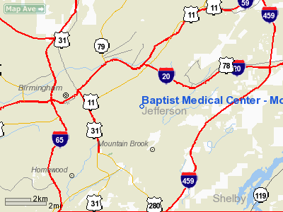
Baptist Medical Center - Montclair Heliport
Jefferson County, AL
Tel:
205-592-1330
Images and information placed above are from
http://www.airport-data.com/airport/AL45/
We thank them for the data!
| General Info
|
| Country |
United States
|
| State |
ALABAMA
|
| FAA ID |
AL45
|
| Latitude |
33-31-03.000N
|
| Longitude |
086-44-59.000W
|
| Elevation |
966 feet
|
| Near City |
BIRMINGHAM
|
We don't guarantee the information is fresh and accurate. The data may be wrong or outdated.
For more up-to-date information please refer to other sources.