Location
& QuickFacts
| FAA Information Effective: |
2005-10-27 |
| Airport Identifier: |
AL88 |
| Longitude/Latitude: |
087-28-14.9260W/30-25-35.7120N
-87.470813/30.426587 (Estimated) |
| Elevation: |
80
ft / 24.38 m (Estimated) |
| Land: |
40
acres |
| From nearest city: |
3
nautical miles NW of Lillian, AL |
| Location: |
Baldwin
County, AL |
| Magnetic Variation: |
01E
(1985) |
Owner
& Manager
| Ownership: |
Privately
owned |
| Owner: |
William
T. Miles |
| Address: |
P.o.
Box 329
Lillian, AL 36549 |
| Phone number: |
205-962-4417 |
| Manager: |
William
T. Miles |
| Address: |
P.o.
Box 329
Lillian, AL 36549 |
| Phone number: |
205-962-4417 |
Airport
Operations and Facilities
| Airport Use: |
Private |
| Wind indicator: |
Yes |
| Segmented Circle: |
No |
| Control Tower: |
No |
| Attendance Schedule: |
ALL/ALL/ALL |
| Sectional chart: |
New
Orleans |
| Region: |
ASO
- Southern |
| Boundary ARTCC: |
ZJX
- Jacksonville |
| Tie-in FSS: |
ANB
- Anniston |
| FSS on Airport: |
No |
| FSS Phone: |
256-832-2100 |
| FSS Toll Free: |
1-800-WX-BRIEF |
Runway
Information
Runway
09/27
| Dimension: |
1320
x 95 ft / 402.3 x 29.0 m |
| Surface: |
TURF,
|
| |
Runway
09 |
Runway
27 |
| Traffic Pattern: |
Right |
Left |
|
Radio
Navigation Aids
| ID |
Type |
Name |
Ch |
Freq |
Var |
Dist |
| ESU |
NDB |
Summerdale |
|
204.00 |
01E |
13.9
nm |
| PKZ |
NDB |
Pickens |
|
326.00 |
01E |
15.2
nm |
| MO |
NDB |
Wisle |
|
248.00 |
02E |
47.5
nm |
| NPA |
TACAN |
Pensacola |
119X |
|
01E |
9.0
nm |
| NSE |
TACAN |
Whiting |
070X |
|
01E |
29.5
nm |
| NGS |
TACAN |
Santa
Rosa |
063X |
|
01E |
29.8
nm |
| HRT |
TACAN |
Hurlburt |
045X |
|
00E |
40.5
nm |
| DWG |
TACAN |
Warrington |
002X |
|
00E |
49.3
nm |
| NUN |
VOR |
Saufley |
|
108.80 |
01E |
7.5
nm |
| BFM |
VORTAC |
Brookley |
075X |
112.80 |
04E |
32.3
nm |
| CEW |
VORTAC |
Crestview |
106X |
115.90 |
03E |
47.5
nm |
| SJI |
VORTAC |
Semmes |
100X |
115.30 |
05E |
49.4
nm |
Remarks
- OWNER
DESIRES ARPT NOT BE CHARTED.
- PRVDD
VFR/PVT USE; OPERATIONAL LETTER OF AGREEMENT MAINTAINED BETWEEN
OWNERS/OPERATORS OF THE BAN FARM ARPT AND SHIELDS ARPT.
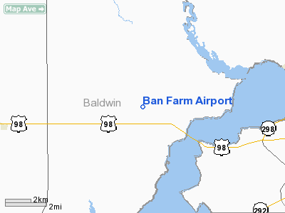
Ban Farm Airport
Baldwin County, AL
Tel:
205-962-4417
Images and information placed above are from
http://www.airport-data.com/airport/AL88/
We thank them for the data!
| General Info
|
| Country |
United States
|
| State |
ALABAMA
|
| FAA ID |
AL88
|
| Latitude |
30-25-35.712N
|
| Longitude |
087-28-14.926W
|
| Elevation |
80 feet
|
| Near City |
LILLIAN
|
We don't guarantee the information is fresh and accurate. The data may be wrong or outdated.
For more up-to-date information please refer to other sources.