|
|
Ashland/lineville Airport |
| Ashland/Lineville Airport |
 |
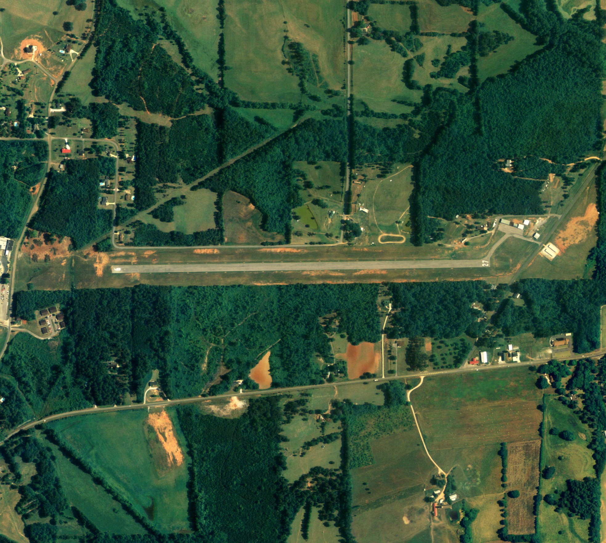
| NAIP aerial image, 15 June 2006 |
| IATA: none – ICAO: none – FAA LID: 26A |
| Summary |
| Airport type |
Public |
| Owner |
Clay County, Alabama |
| Serves |
Ashland-Lineville, Alabama |
| Elevation AMSL |
1,065 ft / 324.6 m |
| Coordinates |
33°17′03″N 085°48′33″W / 33.28417°N 85.80917°W / 33.28417; -85.80917 |
| Runways |
| Direction |
Length |
Surface |
| ft |
m |
| 9/27 |
3,997 |
1,218 |
Asphalt |
| Statistics (2007) |
| Aircraft operations |
2,863 |
| Source: Federal Aviation Administration |
Ashland/Lineville Airport (FAA LID: 26A) is a county-owned public-use airport located 2 nautical miles (4 km) northeast of the central business district of Ashland, a town in Clay County, Alabama, United States. According to the FAA's National Plan of Integrated Airport Systems for 2009–2013, it is categorized as a general aviation facility.
Facilities and aircraft
Ashland/Lineville Airport covers an area of 35 acres (0.05 sq mi; 0.14 km) which contains one runway designated 9/27 is 3,997 x 80 feet (1,218 x 24 meters) asphalt pavement. For the 12-month period ending February 12, 2007, the airport had 2,863 general aviation aircraft operations.
The above content comes from Wikipedia and is published under free licenses – click here to read more.
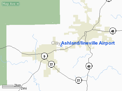
Location
& QuickFacts
|
FAA Information Effective: |
2005-10-27 |
| Airport Identifier: |
26A |
| Longitude/Latitude: |
085-48-14.8630W/33-17-15.4110N
-85.804129/33.287614 (Estimated) |
| Elevation: |
1065
ft / 324.61 m (Surveyed) |
| Land: |
35
acres |
| From nearest city: |
2
nautical miles NE of Ashland/lineville, AL |
| Location: |
Clay
County, AL |
| Magnetic Variation: |
01W
(1985) |
Owner
& Manager
|
Ownership: |
Publicly
owned |
| Owner: |
Clay
County |
| Address: |
Po
Box 187
Ashland, AL 36251 |
| Phone number: |
256-354-2197 |
| Manager: |
Bob
Mc Clellan
CHAIRMAN, CLAY COUNTY ARPT BD. |
| Address: |
Po
Box 33
Ashland, AL 36251 |
| Phone number: |
256-354-2859
ALTERNATE PHONE NO. 256-354-2895. |
Airport
Operations and Facilities
|
Airport Use: |
Open
to public |
| Wind indicator: |
Yes |
| Segmented Circle: |
No |
| Control Tower: |
No |
| Attendance Schedule: |
ALL/ALL/ALL
ATTENDANT LIVES IN TRAILER AT ARPT. |
| Lighting Schedule: |
RDO-CTL
ACTVT MIRL RY 09/27 - 123.0. |
| Landing fee charge: |
No |
| Sectional chart: |
Atlanta |
| Region: |
ASO
- Southern |
| Boundary ARTCC: |
ZTL
- Atlanta |
| Tie-in FSS: |
ANB
- Anniston |
| FSS on Airport: |
No |
| FSS Phone: |
256-832-2100 |
| FSS Toll Free: |
1-800-WX-BRIEF |
| NOTAMs Facility: |
ANB
(NOTAM-d service avaliable) |
| Federal Agreements: |
N |
Airport
Communications
Airport
Services
| Bottled Oxygen: |
NONE |
| Bulk Oxygen: |
NONE |
Runway
Information
Runway
09/27
|
Dimension: |
3997
x 80 ft / 1218.3 x 24.4 m |
| Surface: |
ASPH,
Good Condition |
| Weight Limit: |
Single
wheel: 20000 lbs. |
| Edge Lights: |
Medium
LIGHTED THLD WEST END RELOCATED 200 FT; 3797 FT OF
RY LGTD AT NIGHT. |
| |
Runway
09 |
Runway
27 |
| Traffic Pattern: |
Left |
Left |
|
Markings: |
Basic,
Good Condition |
Basic,
Good Condition |
| Displaced threshold: |
318.00
ft |
50.00
ft |
|
Obstruction: |
20
ft trees, 201.0 ft from runway, 100 ft left
of centerline
APCH RATIO 24:1 TO DSPLCD THLD.
+4 FT RISING GND 100 FT FROM THLD. |
|
|
Radio
Navigation Aids
| ID |
Type |
Name |
Ch |
Freq |
Var |
Dist |
| DER |
NDB |
Alexander
City |
|
382.00 |
01W |
25.8
nm |
| SCD |
NDB |
Sylacauga |
|
284.00 |
03W |
26.7
nm |
| PLR |
NDB |
Pell
City |
|
257.00 |
01E |
27.7
nm |
| GPQ |
NDB |
Carrollton |
|
278.00 |
02W |
37.7
nm |
| GGY |
NDB |
Gragg-wade |
|
338.00 |
01E |
48.3
nm |
| TDG |
VOR/DME |
Talladega |
025X |
108.80 |
02E |
21.0
nm |
| GAD |
VOR/DME |
Gadsden |
070X |
112.30 |
02E |
43.7
nm |
| TGE |
VOR/DME |
Tuskegee |
120X |
117.30 |
02E |
48.7
nm |
| LGC |
VORTAC |
Lagrange |
103X |
115.60 |
01E |
33.3
nm |
Remarks
Ashland/lineville Airport
Clay County, AL
Tel:
256-354-2859
Images and information placed above are from
http://www.airport-data.com/airport/26A/
We thank them for the data!
| General Info
|
| Country |
United States
|
| State |
ALABAMA
|
| FAA ID |
26A
|
| Latitude |
33-17-15.411N
|
| Longitude |
085-48-14.863W
|
| Elevation |
1065 feet
|
| Near City |
ASHLAND/LINEVILLE
|
We don't guarantee the information is fresh and accurate. The data may be wrong or outdated.
For more up-to-date information please refer to other sources.
|
|