 |
|
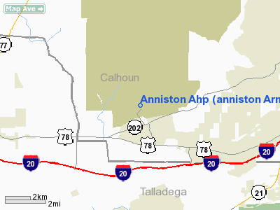
Anniston Ahp (anniston Army Depot) Heliport |
|
|
Location
& QuickFacts
| FAA Information Effective: |
2005-10-27 |
| Airport Identifier: |
04AL |
| Longitude/Latitude: |
085-58-02.0000W/33-37-35.0000N
-85.967222/33.626389 (Estimated) |
| Elevation: |
686
ft / 209.09 m (Estimated) |
| Land: |
0
acres |
| From nearest city: |
5
nautical miles SW of Anniston, AL |
| Location: |
Calhoun
County, AL |
| Magnetic Variation: |
02W
(2000) |
Owner
& Manager
| Ownership: |
Army
owned |
| Owner: |
U.s.
Army |
| Address: |
9325
Guston Rd
Ft. Belvoir, VA 22060 |
Airport
Operations and Facilities
| Wind indicator: |
Yes |
| Segmented Circle: |
No |
| Control Tower: |
No |
| Attendance Schedule: |
ALL/MON-FRI/0800-1630 |
| Sectional chart: |
Atlanta |
| Region: |
ASO
- Southern |
| Boundary ARTCC: |
ZTL
- Atlanta |
| Tie-in FSS: |
ANB
- Anniston |
| FSS Phone: |
256-832-2100 |
| FSS Toll Free: |
1-800-WX-BRIEF |
Airport
Communications
Runway
Information
Helipad H1
| Dimension: |
100
x 100 ft / 30.5 x 30.5 m |
| Surface: |
ASPH,
|
| |
Runway
H1 |
Runway
|
| Traffic Pattern: |
Left |
Left |
|
Radio
Navigation Aids
| ID |
Type |
Name |
Ch |
Freq |
Var |
Dist |
| PLR |
NDB |
Pell
City |
|
257.00 |
01E |
14.7
nm |
| SCD |
NDB |
Sylacauga |
|
284.00 |
03W |
32.4
nm |
| ARF |
NDB |
Saratoga |
|
296.00 |
02W |
39.8
nm |
| GPQ |
NDB |
Carrollton |
|
278.00 |
02W |
42.0
nm |
| BH |
NDB |
Mcden |
|
224.00 |
01W |
44.5
nm |
| DER |
NDB |
Alexander
City |
|
382.00 |
01W |
44.9
nm |
| TDG |
VOR/DME |
Talladega |
025X |
108.80 |
02E |
4.9
nm |
| GAD |
VOR/DME |
Gadsden |
070X |
112.30 |
02E |
21.8
nm |
| VUZ |
VORTAC |
Vulcan |
091X |
114.40 |
02E |
46.7
nm |
| BHM |
VOT |
Birmingham
Muni |
|
110.00 |
|
39.6
nm |
Anniston Ahp (anniston Army Depot) Heliport
Calhoun
County, AL
Images and information placed above are from
http://www.airport-data.com/airport/04AL/
We thank them for the data!
| General Info
|
| Country |
United States
|
| State |
ALABAMA
|
| FAA ID |
04AL
|
| Latitude |
33-37-35.000N
|
| Longitude |
085-58-02.000W
|
| Elevation |
686 feet
|
| Near City |
ANNISTON
|
We don't guarantee the information is fresh and accurate. The data may be wrong or outdated.
For more up-to-date information please refer to other sources.
|
|


