|
 |
|
||||
|
|
|||||||||||||||||||||||||||||||||||||||||||||||||||||||||||||||||||||||||||||||||||||||||||||||||||||||||||||||||||||||||||||||||||||||||||||||||||||||||||||||||||||||||||||||||||||||||||||||||||||||||||
| FAA Information Effective: |
2005-10-27 |
| Airport Identifier: |
AL66 |
| Longitude/Latitude: |
086-48-48.9640W/33-31-10.3790N |
| Elevation: |
676 ft / 206.04 m (Estimated) |
| Land: |
0 acres |
| From nearest city: |
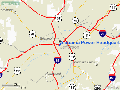
0 nautical miles N of Birmingham, AL |
| Location: |
Jefferson County, AL |
| Magnetic Variation: |
00E (1980) |
| Ownership: |
Privately owned |
| Owner: |
Alabama Power Company |
| Address: |
600
North 18th St |
| Phone number: |
205-250-2282 |
| Manager: |
Ron Hasenfuss |
| Address: |
|
| Phone number: |
205-250-2128 |
| Airport Use: |
Private |
| Wind indicator: |
Yes |
| Segmented Circle: |
No |
| Control Tower: |
No |
| Attendance Schedule: |
UNATNDD |
| Lighting Schedule: |
PHONE
REQ |
| Beacon Color: |
Clear-Green-Yellow (heliport) |
| Sectional chart: |
Atlanta |
| Region: |
ASO - Southern |
| Boundary ARTCC: |
ZTL - Atlanta |
| Tie-in FSS: |
ANB - Anniston |
| FSS Phone: |
256-832-2100 |
| FSS Toll Free: |
1-800-WX-BRIEF |
| Dimension: |
64 x 64 ft / 19.5 x 19.5 m |
||||||
| Surface: |
CONC, |
||||||
|
|||||||
| ID |
Type |
Name |
Ch |
Freq |
Var |
Dist |
| BH |
NDB |
Mcden |
224.00 |
01W |
1.7 nm |
|
| BEQ |
NDB |
Bessemer |
368.00 |
00E |
13.6 nm |
|
| PLR |
NDB |
Pell City |
257.00 |
01E |
28.4 nm |
|
| SCD |
NDB |
Sylacauga |
284.00 |
03W |
32.4 nm |
|
| GGY |
NDB |
Gragg-wade |
338.00 |
01E |
41.3 nm |
|
| TDG |
VOR/DME |
Talladega |
025X |
108.80 |
02E |
38.8 nm |
| GAD |
VOR/DME |
Gadsden |
070X |
112.30 |
02E |
45.7 nm |
| VUZ |
VORTAC |
Vulcan |
091X |
114.40 |
02E |
10.0 nm |
| OKW |
VORTAC |
Brookwood |
047X |
111.00 |
00E |
27.6 nm |
| LDK |
VORTAC |
Crimson |
125X |
117.80 |
03E |
39.5 nm |
| BHM |
VOT |
Birmingham Muni |
110.00 |
3.9 nm |
Jefferson County, AL
Tel: 205-250-2128
Images and information placed above are from
http://www.airport-data.com/airport/AL66/
We thank them for the data!
| General Info | |
|---|---|
| Country | United States |
| State | ALABAMA |
| FAA ID | AL66 |
| Latitude | 33-31-10.379N |
| Longitude | 086-48-48.964W |
| Elevation | 676 feet |
| Near City | BIRMINGHAM |

 |
|
Copyright 2004-2026 © by Airports-Worldwide.com, Vyshenskoho st. 36, Lviv 79010, Ukraine Legal Disclaimer |