|
|
Kerch Airport (Ukrainian: Аеропорт «Керч», Russian: Аэропорт «Керчь») (IATA: KHC, ICAO: URFK) is an airport in Kerch, Disputed between Russia and Ukraine. The airport is located 1.5 km northwest of the city (sometimes it is confused with Baherove Air Base located nearby). The airport is currently bankrupt, and was put on sale for 27M Hryvn (3.3M USD) by the city authorities.
Though the airport is bankrupt, it is still in service, and is used by general aviation today. The airport itself is not in good condition. Runway needs repair, airport facilities are bad, there is working ATC tower which is also needs improvements. There is no airline services to this airport.
Airline flights to/from airport ceased operation approximately in 2008, there were approximately 8-10 flights a day both Domestic and International. In 2005-2006 airport tried to resume flights to Kiev and Moscow using Motor Sich Airlines, but expenses were high and profit was too low, which made flying unprofitable.
|
Kerch Airport
Аеропорт «Керч»
|
|
|
| Summary |
| Airport type |
Public |
| Owner |
Local Government |
| Location |
Kerch, Disputed between Russia and Ukraine[1] |
| Elevation AMSL |
171 ft / 52 m |
| Coordinates |
45°22′21″N
036°24′05″E |
| Map |
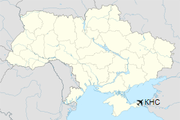
Location of Kerch Airport in Ukraine
|
| Runways |
| Direction |
Length |
Surface |
| ft |
m |
| 07/25 |
5,420 |
1,652 |
Asphalt |
| 07/25 |
6,561 |
2,000 |
Soil |
|
Accidents and incidents
On November 13, 1971, Aeroflot Antonov 24B (CCCP-46378) struck a cable and crashed on approach. There were total of 5 passenger and crew on aboard who all died on impact. The aircraft was written off (damaged beyond repair).
The above content comes from Wikipedia and is published under free licenses – click here to read more.
| General Info
|
| Country |
Ukraine
|
| ICAO ID |
UKFK
|
| Time |
UTC+2(+3DT)
|
| Latitude |
45.372869
45° 22' 22.33" N
|
| Longitude |
36.402761
036° 24' 09.94" E
|
| Elevation |
152 feet
46 meters
|
| Type |
Civil
|
| Magnetic Variation |
006° E (01/06)
|
| Operating Agency |
UNKNOWN
|
| Operating Hours |
SEE REMARKS FOR OPERATING HOURS OR COMMUNICATIONS FOR POSSIBLE HOURS
|
| Daylight Saving Time |
Last Sunday in March to last Sunday in October
|
| Runways
|
| ID |
Dimensions |
Surface |
PCN |
ILS
|
| 07/25 |
5420 x 115 feet
1652 x 35 meters |
ASPHALT |
028FCYT |
NO
|
| Navaids
|
| Type |
ID |
Name |
Channel |
Freq |
Distance From Field |
Bearing From Navaid
|
| DME |
KER |
KERCH |
110X |
- |
At Field |
-
|
| Supplies/Equipment
|
| Oil |
Available (Types unknown)
|
| Remarks
|
| CSTMS/AG/IMG |
Cstms and img avbl O/R, health and sanitation opr 0500Z++ to SS.
|
| FUEL |
(NC-A1)
|
| MISC |
Fone C(06561) 2 12 65.
|
| OIL |
O-SM4.5
|
| OPR HOURS |
Opr 0600Z++ to SS
|
The content above was published at Airports-Worldwide.com in 2020.
We don't guarantee the information is fresh and accurate. The data may be wrong or outdated.
For more up-to-date information please refer to other sources.
|
|