 |
|
Aberdeen International Airport |
 |
|
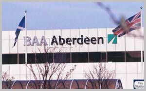
 Aberdeen airport is under the control of The British Airports Authority, it is their furthermost Scottish airport and provides many links to the Northern Isles and Scandinavia. It is also an important helicopter base with services to all the North Sea Oil fields. Aberdeen airport also provides direct services to Central Scotland and most of the major English cities. Sumburgh in Shetland is perhaps the most important link with scheduled fixed wing flights to the Scottish mainland. Although the BAA are competent operators, Aberdeen airport would benefit from a change of ownership to a more locally orientated management.
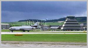
Aberdeen Airport is situated seven miles north west of Aberdeen city centre. Because the city is Europe's largest oil-related centre, the airport is the world's largest commercial heliport and the majority of the traffic through it are helicopter flights to and from the North Sea oil rigs.
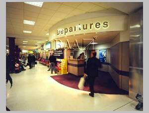
The airport is open between 0500 and 2230. Check-in is located at the front of the concourse with domestic arrivals and all departure lounges located towards the rear.
The airport is equipped with shops, bureaux de change, left luggage and baby care facilities. For travellers with special needs, you can contact the airport call centre on +44 (0)1224 722331 or minicom +44 (0)1224 725082 to pre-arrange assistance or check available facilities.
 HOW TO GET THERE BY ROAD.
The access road to the airport is sign posted from the A96 Aberdeen to Inverness road. The airport is 7 miles North West of the Aberdeen city centre on the A947 at Dyce. There is a large car park in front of the terminal building for short and long stay parking. You can drop off passengers outside the terminal building , but if you want to visit the terminal building you should use the car park.
HELICOPTER PASSENGERS
Helicopter passengers for Bristows and British International Helicopters should travel to the airport via the A96 and follow the signposts for their specific terminal. There is a long term car park for helicopter passengers opposite Bristows Helicopters. Bond Helicopters passengers use the East terminal, and road access is via the A947 from Bucksburn.
CAR PARKING
There are two car parks at the airport. The main car park which is situated in front of the terminal building is available for for both long and short term parking. The other car park is situated adjacent to the Bristow heliport and is primarily for use by heliport passengers.
 Aberdeen International Airport
Telephone: (01224) 722331
Telex: 739567 ABZLTD G
Fax: (01224) 725724
Enquiry Desk: 01224 722 331
IATA CODE: ABZ
Postal Address : Aberdeen Airport, Farburn Terrace, Dyce, Aberdeen, AB21 7DU
Managing Director: Miss Lesley Bale.
www.baa.com/main/airports/aberdeen/
Images and information placed above are from http://www.users.zetnet.co.uk/jcurry/abz.html, http://www.baa.com/main/airports/aberdeen/
We thank them for the data!
| General Info
|
| Country |
United Kingdom
|
| ICAO ID |
EGPD
|
| Time |
UTC 0(+1DT)
|
| Latitude |
57.201944
57° 12' 07.00" N
|
| Longitude |
-2.197778
002° 11' 52.00" W
|
| Elevation |
215 feet
66 meters
|
| Type |
Civil
|
| Magnetic Variation |
004° W (01/04)
|
| Operating Agency |
CIVIL GOVERNMENT, (LANDING FEES AND DIPLOMATIC CLEARANCE MAY BE REQUIRED)
|
| Alternate Name |
ABERDEEN
|
| Near City |
Aberdeen
|
| Operating Hours |
SEE REMARKS FOR OPERATING HOURS OR COMMUNICATIONS FOR POSSIBLE HOURS
|
| International Clearance Status |
Airport of Entry
|
| Daylight Savings Time |
Last Sunday in March to last Sunday in October
|
| Communications
|
ABERDEEN TWR
Opr 0545-2230Z++ Mon-Sun.
|
118.1
|
ABERDEEN INFO
Opr 0700-2200Z++ Mon-Sun.
|
135.175
|
ABERDEEN GND
Opr 0630-1930Z++ Mon-Fri, OT HO.
|
121.7
|
ABERDEEN ATIS
Opr 0610-2150Z++ Mon-Sun.
|
114.3
121.85
|
ABERDEEN APP
Opr 0605-2230Z++ Mon-Sun.
|
119.05
|
| Communications Remarks |
|
| ATIS |
Airborne-ADN VOR 114.3; gnd use only 121.85
|
| Runways
|
| ID |
Dimensions |
Surface |
PCN |
ILS
|
| 05/23 |
1893 x 151 feet
577 x 46 meters |
CONCRETE. |
- |
NO
|
| 14/32 |
2165 x 75 feet
660 x 23 meters |
ASPHALT |
- |
NO
|
| 16/34 |
6001 x 151 feet
1829 x 46 meters |
ASPHALT |
056FBXT |
YES
|
| 18/36 |
853 x 75 feet
260 x 23 meters |
ASPHALT |
- |
NO
|
| Navaids
|
| Type |
ID |
Name |
Channel |
Freq |
Distance From Field |
Bearing From Navaid
|
| VOR-DME |
ADN |
ABERDEEN |
090X |
114.3 |
6.9 NM |
165.7
|
| NDB |
ATF |
ABERDEEN/DYCE |
- |
348 |
8.1 NM |
342.8
|
| Supplies/Equipment
|
| Oil |
O-123, 1065,(Dispersant)Reciprocating Engine Oil(MIL L 22851 Type III)
|
| Remarks
|
| CAUTION |
Both ends of Rwy 16-34 wid are twice that of associated edge lgt due to extra pavement on one side, pilots should ensure they are lined up correctly especially if tkof is at ngt or in low vis. Ints copter act.
|
| FUEL |
(NC-100LL avbl 0800-2000Z++ Mon-Fri, 0900-1600Z++ Sat and Sun, OT by arng.
|
| LGT |
CHAPI Rwy 23 GS 6
|
| OPR HOURS |
Opr 0615-2230Z++.
|
| RSTD |
Rwy 18 not used. Rwy 5-23, 14-32 and 36 for copter use only.
|
Runway 05/23
1893 x 151 feet
577 x 46 meters
| Runway 05
|
| Surface |
CONCRETE.
|
| True Heading |
046.0
|
| Latitude |
57.203611
57° 12' 13.00" N
|
| Longitude |
-2.202778
002° 12' 10.00" W
|
| Elevation |
203.0 feet
62 meters
|
| Slope |
-0.7°
|
| Landing Distance |
1893 feet
577 meters
|
| Takeoff Distance |
1893 feet
577 meters
|
| Lighting System |
LIRL
|
| Runway 23
|
| Surface |
CONCRETE.
|
| True Heading |
226.0
|
| Latitude |
57.207222
57° 12' 26.00" N
|
| Longitude |
-2.195833
002° 11' 45.00" W
|
| Elevation |
190.0 feet
58 meters
|
| Slope |
0.7°
|
| Landing Distance |
1893 feet
577 meters
|
| Takeoff Distance |
1893 feet
577 meters
|
| Lighting System |
LIRL
|
Runway 14/32
2165 x 75 feet
660 x 23 meters
| Runway 14
|
| Surface |
ASPHALT
|
| True Heading |
139.0
|
| Latitude |
57.203889
57° 12' 14.00" N
|
| Longitude |
-2.201944
002° 12' 07.00" W
|
| Elevation |
200.0 feet
61 meters
|
| Slope |
-0.1°
|
| Landing Distance |
2165 feet
660 meters
|
| Takeoff Distance |
2165 feet
660 meters
|
| Runway 32
|
| Surface |
ASPHALT
|
| True Heading |
319.0
|
| Latitude |
57.199383
57° 11' 57.78" N
|
| Longitude |
-2.194856
002° 11' 41.48" W
|
| Elevation |
197.0 feet
60 meters
|
| Slope |
0.1°
|
| Landing Distance |
2165 feet
660 meters
|
| Takeoff Distance |
2165 feet
660 meters
|
Runway 16/34
6001 x 151 feet
1829 x 46 meters
| Runway 16
|
| Surface |
ASPHALT
|
| True Heading |
158.0
|
| Latitude |
57.209550
57° 12' 34.38" N
|
| Longitude |
-2.203414
002° 12' 12.29" W
|
| Elevation |
203.0 feet
62 meters
|
| Slope |
0.2°
|
| Landing Distance |
6001 feet
1829 meters
|
| Takeoff Distance |
6001 feet
1829 meters
|
| Lighting System |
CL
HIRL
J
PAPI |
| Runway 34
|
| Surface |
ASPHALT
|
| True Heading |
338.0
|
| Latitude |
57.194303
57° 11' 39.49" N
|
| Longitude |
-2.192164
002° 11' 31.79" W
|
| Elevation |
215.0 feet
66 meters
|
| Slope |
-0.2°
|
| Landing Distance |
6001 feet
1829 meters
|
| Takeoff Distance |
6001 feet
1829 meters
|
| Lighting System |
CL
HIRL
J
PAPI |
Runway 18/36
853 x 75 feet
260 x 23 meters
| Runway 18
|
| Surface |
ASPHALT
|
| True Heading |
179.0
|
| Latitude |
57.204722
57° 12' 17.00" N
|
| Longitude |
-2.201667
002° 12' 06.00" W
|
| Elevation |
200.0 feet
61 meters
|
| Slope |
-0.1°
|
| Landing Distance |
853 feet
260 meters
|
| Takeoff Distance |
853 feet
260 meters
|
| Runway 36
|
| Surface |
ASPHALT
|
| True Heading |
359.0
|
| Latitude |
57.202389
57° 12' 08.60" N
|
| Longitude |
-2.201592
002° 12' 05.73" W
|
| Elevation |
199.0 feet
61 meters
|
| Slope |
0.1°
|
| Landing Distance |
853 feet
260 meters
|
| Takeoff Distance |
853 feet
260 meters
|
Navaids
| ABERDEEN
|
| Type |
ID |
Channel |
Freq |
Country |
State
|
| VOR-DME |
ADN |
090X |
114.3 |
United Kingdom |
-
|
| Latitude |
Longitude |
Airport
|
57.310556
57° 18' 38.00" N |
-2.267222
002° 16' 02.00" W |
EGPD
|
Navaids
| ABERDEEN/DYCE
|
| Type |
ID |
Channel |
Freq |
Country |
State
|
| NDB |
ATF |
- |
348 |
United Kingdom |
-
|
| Latitude |
Longitude |
Airport
|
57.077514
57° 04' 39.05" N |
-2.105700
002° 06' 20.52" W |
EGPD
|
The content above was published at Airports-Worldwide.com in 2005.
We don't guarantee the information is fresh and accurate. The data may be wrong or outdated.
For more up-to-date information please refer to other sources.
|
|


