|
|
| Samui International Airport |
 |
| Samui International Airport Departure Terminal |
IATA: USM – ICAO: VTSM |
| Summary |
| Airport type |
Public |
| Operator |
Bangkok Airways |
| Location |
Na Thon, Ko Samui |
| Elevation AMSL |
64 ft / 20 m |
| Coordinates |
09°32′52″N 100°03′44″E / 9.54778°N 100.06222°E / 9.54778; 100.06222 |
| Website |
www.samuiairportonline.com |
| Runways |
| Direction |
Length |
Surface |
| ft |
m |
| 17/35 |
6,759 |
2,060 |
Asphalt |
| Statistics (2009) |
| Flights |
17,707 |
| Departing Passengers |
691,283 |
| Arriving Passengers |
673,851 |
| Total Passengers |
1,365,439 |
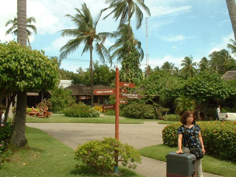
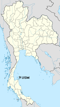
Samui Airport (IATA: USM, ICAO: VTSM), also known as Ko Samui Airport or Koh Samui Airport, is a privately owned airport on the island of Ko Samui (Koh Samui) in Thailand. The airport is located roughly 2 km north of the main village Chaweng.
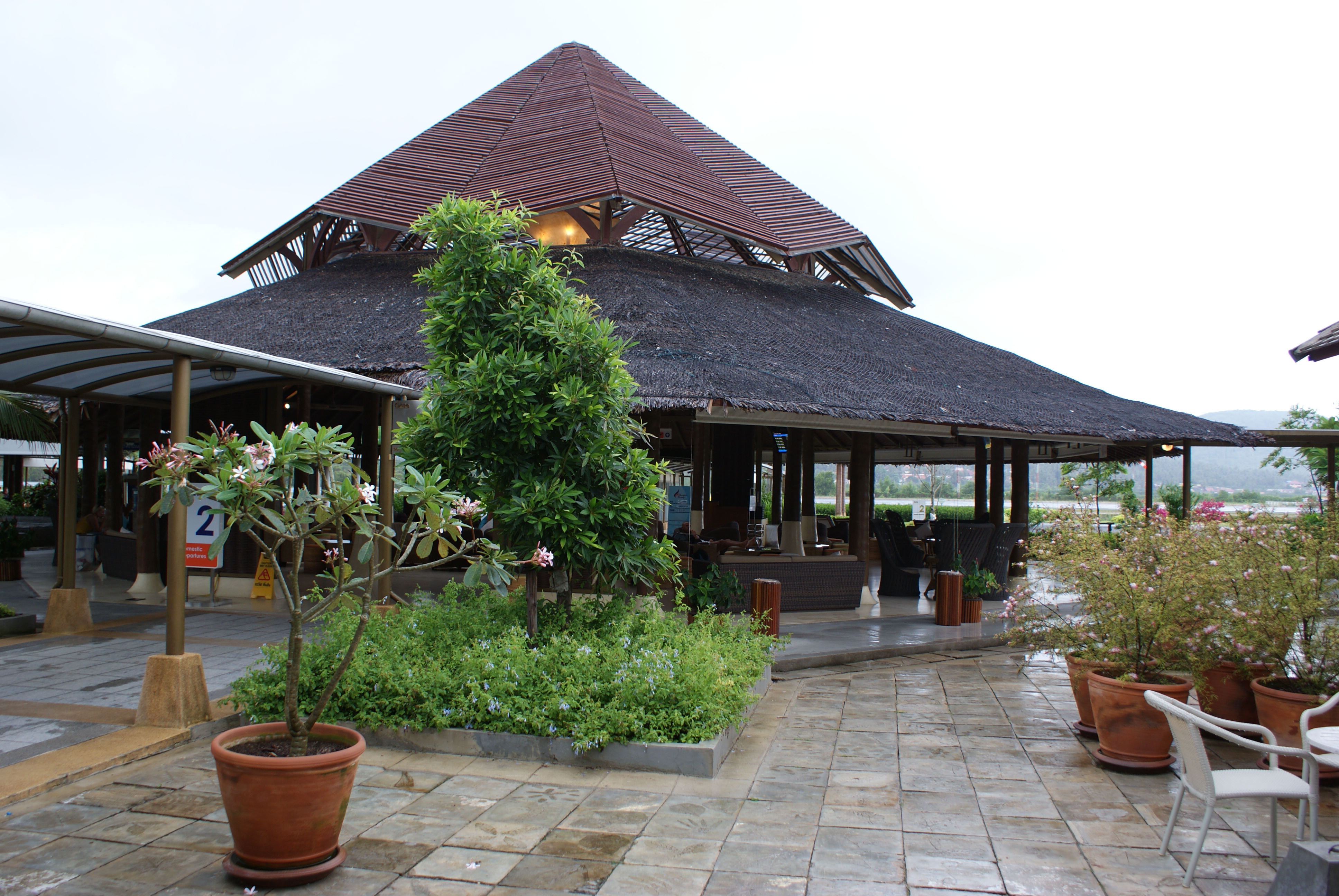
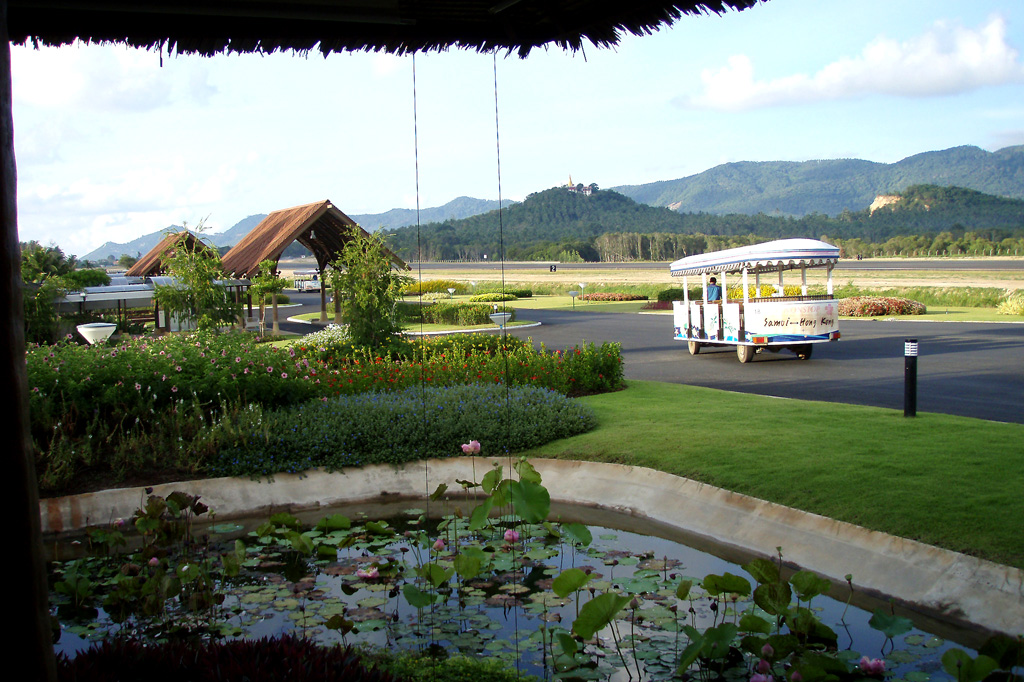
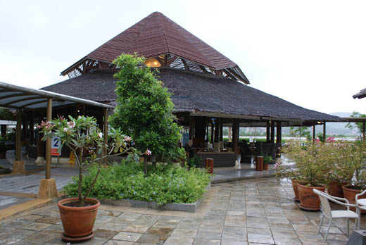
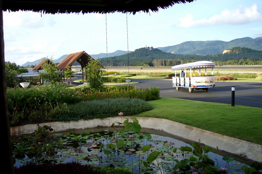
Samui Airport is an unusual airport because there is no indoor area, except the gift shop. The airport has 2 terminals (Domestic & International). The International terminal is located about 50 metres north of the domestic. The airport is located near the Big Buddha Pier where ferries to Ko Pha Ngan depart from. High speed ferries to Koh Tao and Chumphon depart from the Maenam beach pier, located approx 6 km North west of the airport. It was built by Bangkok Airways. Construction began in 1982 and was officially opened in April 1989.
Samui International Airport
Click to enlarge

Samui International Airport
Click to enlarge
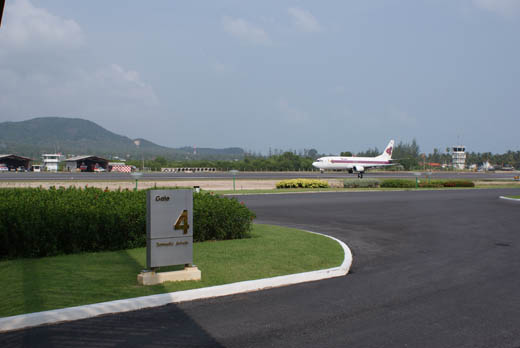 | |
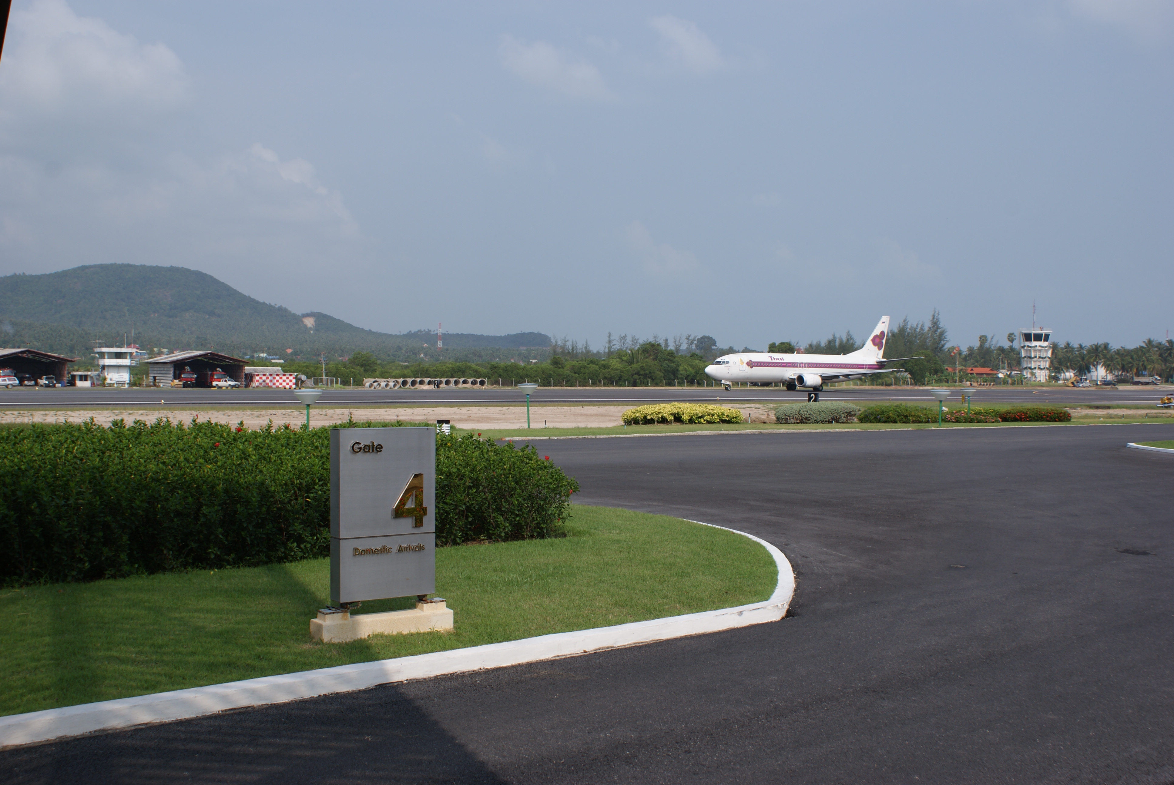
Samui airport runway |
 | |
Samui International Airport |
Airlines and destinations
Domestic
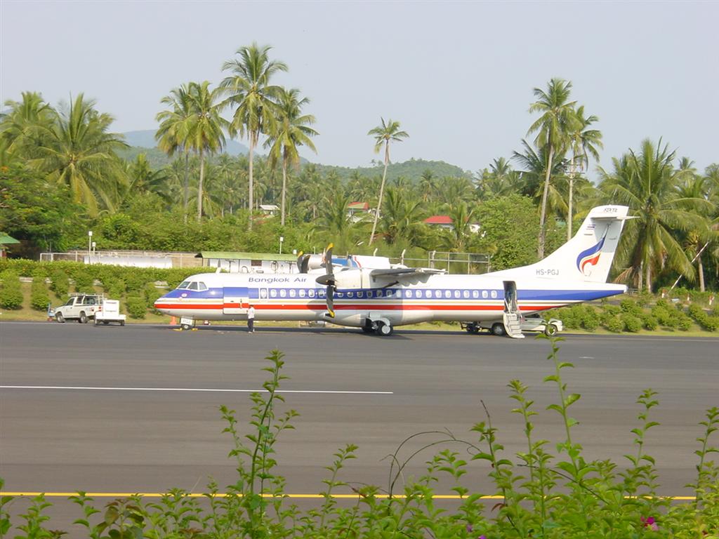
- Bangkok Airways (Bangkok-Suvarnabhumi, Chiang Mai, Krabi, Phuket, Trat [begins 2 December], U-Tapao)
- Thai Airways International (Bangkok-Suvarnabhumi)
International
- Bangkok Airways (Hong Kong, Singapore)
- Berjaya Air (Subang)
- Firefly (Subang)
Weather and climate
| Climate data for Ko Samui, Thailand |
| Month |
Jan |
Feb |
Mar |
Apr |
May |
Jun |
| Average high °C (°F) |
29.0
(84.2) |
29.5
(85.1) |
30.7
(87.3) |
32.1
(89.8) |
32.6
(90.7) |
32.2
(90) |
| Average low °C (°F) |
24.1
(75.4) |
25.0
(77) |
25.6
(78.1) |
26.1
(79) |
25.8
(78.4) |
25.5
(77.9) |
| Precipitation mm (inches) |
137.8
(5.425) |
57.8
(2.276) |
77.8
(3.063) |
76.6
(3.016) |
146.5
(5.768) |
112.7
(4.437) |
| Source: World Weather Information Service: Ko Samui, Thailand |
| Climate data for Ko Samui, Thailand |
| Month |
Jul |
Aug |
Sep |
Oct |
Nov |
Dec |
Year |
| Average high °C (°F) |
32.0
(89.6) |
31.9
(89.4) |
31.6
(88.9) |
30.5
(86.9) |
29.5
(85.1) |
29.1
(84.4) |
32.6
(90.7) |
| Average low °C (°F) |
25.1
(77.2) |
25.1
(77.2) |
24.8
(76.6) |
24.4
(75.9) |
24.1
(75.4) |
23.9
(75) |
23.9
(75) |
| Precipitation mm (inches) |
122.8
(4.835) |
118.7
(4.673) |
116.8
(4.598) |
290.2
(11.425) |
489.6
(19.276) |
209.1
(8.232) |
1,956.4
(77.024) |
| Source: World Weather Information Service: Ko Samui, Thailand |
Statistics
| Year |
Flights |
Arriving Passengers |
Departing Passengers |
Total Passengers |
| 2005 |
15,818 |
584,023 |
621,313 |
1,205,336 |
| 2006 |
18,762 |
689,063 |
711,196 |
1,400,259 |
| 2007 |
15,783 |
577,600 |
611,554 |
1,189,154 |
| 2008 |
17,707 |
673,851 |
691,283 |
1,365,439 |
| Source: Thailand's Department of Civil Aviation |
Accidents and incidents
- On 21 November 1990, a Bangkok Airways de Havilland Canada DHC-8-103 crashed while attempting to land in heavy rain and high winds. All 38 people on board were killed.
- On 4 August 2009, Bangkok Airways Flight 266, operated by an ATR-72 between Krabi and Koh Samui skidded off the runway, killing one of the pilots.
The above content comes from Wikipedia and is published under free licenses – click here to read more.
| General Info
|
| Country |
Thailand
|
| ICAO ID |
VTSM
|
| Time |
UTC+7
|
| Latitude |
9.547794
09° 32' 52.06" N
|
| Longitude |
100.062272
100° 03' 44.18" E
|
| Elevation |
64 feet
20 meters
|
| Type |
Civil
|
| Magnetic Variation |
000° W (01/06)
|
| Beacon |
Yes
|
| Operating Agency |
CIVIL GOVERNMENT, (LANDING FEES AND DIPLOMATIC CLEARANCE MAY BE REQUIRED)
|
| Near City |
Surat Thani
|
| Island Group |
Samui I
|
| Operating Hours |
SEE REMARKS FOR OPERATING HOURS OR COMMUNICATIONS FOR POSSIBLE HOURS
|
| Communications
|
TWR
Opr 2300-1500Z.
|
118.9
|
ATIS
Opr 2300-1500Z.
|
128.6
|
APP
Opr 2300-1500Z
|
129.6
305.4
|
| Runways
|
| ID |
Dimensions |
Surface |
PCN |
ILS
|
| 17/35 |
6759 x 148 feet
2060 x 45 meters |
ASPHALT |
038FBWT |
NO
|
| Navaids
|
| Type |
ID |
Name |
Channel |
Freq |
Distance From Field |
Bearing From Navaid
|
| VOR-DME |
SMU |
SAMUI |
123X |
117.6 |
At Field |
-
|
| NDB |
SM |
SAMUI |
- |
316 |
At Field |
-
|
| Supplies/Equipment
|
| Fuel |
Jet A1, without icing nhibitor.
|
| Remarks
|
| CAUTION |
65' trees on apch end Rwy 17.
|
| CSTMS/IMG |
Avbl O/R.
|
| FUEL |
(NC-A1)
|
| OPR HOURS |
Opr 2300-1400Z, OT 1 hr PN.
|
The content above was published at Airports-Worldwide.com in 2010.
We don't guarantee the information is fresh and accurate. The data may be wrong or outdated.
For more up-to-date information please refer to other sources.
|
|