 |
|
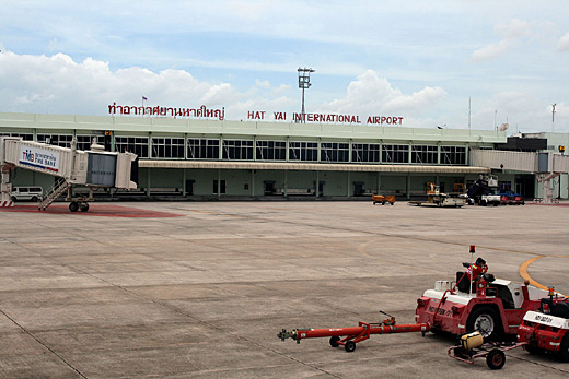
Hat Yai International Airport
ท่าอากาศยานนานาชาติหาดใหญ่ |
 |
IATA: HDY – ICAO: VTSS |
| Summary |
| Airport type |
Public |
| Operator |
Airports of Thailand |
| Location |
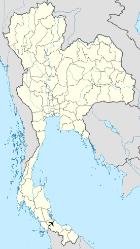
Hat Yai, Thailand |
| Elevation AMSL |
90 ft / 27 m |
| Coordinates |
06°55′59″N 100°23′34″E / 6.93306°N 100.39278°E / 6.93306; 100.39278 |
| Runways |
| Direction |
Length |
Surface |
| ft |
m |
| 08/26 |
10,007 |
3,050 |
Asphalt |
Hat Yai International Airport (IATA: HDY, ICAO: VTSS) is the major southern hub airport in Hat Yai, Thailand. It is under management of Airports of Thailand, PCL. It is also an important gateway for Muslims on their annual pilgrimage to Mecca. Nowadays, more than 800,000 passengers, 9,500 flights and 12,000 tons of cargo are handled at this airport. Located at longitude 100° 23' 55" E and latitude 06° 55' 46" N, 92 feet (28 m) above sea level, the airport is 9 km from downtown Hat Yai, Highway No. 4135 (Sanambin Panij road) links to the airport. Service time of airport: 06.00 a.m. to 24.00 p.m.
During the 2005 Songkhla bombings, a bomb planted at the departure lounge by Pattani separatists exploded on April 3, 2005, killing one passenger and injuring 10.
The runway can handle 30 flights per hour and its durability is rated at PCN 60/F/C/X/T.
There are 7 taxiways, and an apron area of 56,461 m². Airlines and destinations
Domestic
- Happy Airways (Phuket)
- Nok Air (Bangkok-Don Mueang)
- One-Two-GO Airlines (Bangkok-Don Mueang)
- Thai AirAsia (Bangkok-Suvarnabhumi)
- Thai Airways International (Bangkok-Suvarnabhumi)
International
- Tiger Airways (Singapore)
- Happy Airways (Subang)
- Air Asia (Kuala Lumpur)
- Thai Airways International ( Medina [Hajj Season])
The above content comes from Wikipedia and is published under free licenses – click here to read more.
| General Info
|
| Country |
Thailand
|
| ICAO ID |
VTSS
|
| Time |
UTC+7
|
| Latitude |
6.933206
06° 55' 59.54" N
|
| Longitude |
100.392975
100° 23' 34.71" E
|
| Elevation |
90 feet
27 meters
|
| Type |
Civil
|
| Magnetic Variation |
000° W (01/06)
|
| Beacon |
Yes
|
| Operating Agency |
CIVIL GOVERNMENT, (LANDING FEES AND DIPLOMATIC CLEARANCE MAY BE REQUIRED)
|
| Near City |
Songkhla
|
| Operating Hours |
SEE REMARKS FOR OPERATING HOURS OR COMMUNICATIONS FOR POSSIBLE HOURS
|
| International Clearance Status |
Airport of Entry
|
| Communications
|
| TWR |
118.1
275.8
|
| GND |
121.9
257.8
|
| ATIS |
128.8
|
| APP |
126.7
301.5
|
| Runways
|
| ID |
Dimensions |
Surface |
PCN |
ILS
|
| 08/26 |
10007 x 148 feet
3050 x 45 meters |
ASPHALT |
060FCXT |
YES
|
| Navaids
|
| Type |
ID |
Name |
Channel |
Freq |
Distance From Field |
Bearing From Navaid
|
| TACAN |
HTY |
HAT YAI |
104X |
- |
At Field |
-
|
| VOR-DME |
HTY |
HAT YAI |
100X |
115.3 |
At Field |
-
|
| NDB |
HY |
HAT YAI |
- |
328 |
At Field |
-
|
| Supplies/Equipment
|
| Fuel |
Jet A1, without icing nhibitor.
100/130 MIL Spec, low lead, aviation gasoline (BLUE)
|
| Remarks
|
| FUEL |
(NC-100LL, A1). Avbl 2300-1500Z.
|
| LGT |
PAPI MEHT Rwy 08 - 63', Rwy 26 - 68'.
|
| OPR HOURS |
Opr 2300-1700Z.
|
The content above was published at Airports-Worldwide.com in 2010.
We don't guarantee the information is fresh and accurate. The data may be wrong or outdated.
For more up-to-date information please refer to other sources.
|
|


