 |
|
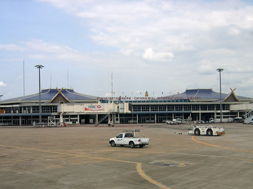
Chiang Mai International Airport
ท่าอากาศยานเชียงใหม่ |
 |
| IATA: CNX – ICAO: VTCC |
| Summary |
| Airport type |
Military/Public |
| Operator |
Military/Airports of Thailand |
| Serves |
Chiang Mai |
| Elevation AMSL |
1,036 ft / 316 m |
| Coordinates |
18°46′00″N 98°57′45″E / 18.7666667°N 98.9625°E / 18.7666667; 98.9625 |
| Runways |
| Direction |
Length |
Surface |
| ft |
m |
| 18/36 |
10,171 |
3,100 |
Asphalt |
Chiang Mai International Airport (IATA: CNX, ICAO: VTCC) is located in Chiang Mai, Thailand.
Chiang Mai International Airport is the major gateway to the north of Thailand. As of 2005, 10 airlines operate services and more than 2,000,000 passengers, 15,000 flights and 16,000 metric tons of cargo are handled. Now Chiang Mai International Airport is open until 01:00 AM until last the flight has departed.
As a result of the temporary closure of Suvarnabhumi Airport in 2008 due to the protests, Chiang Mai became the alternative stop-over for China Airlines' Taipei-Europe flights and for Swiss International Airlines' Singapore-Zurich flights in the interim. Airlines and destinations
There are two terminals, one for domestic passengers and the other for international flights.
| Airlines |
Destinations |
Terminal |
| AirAsia |
Kuala Lumpur |
International |
| Air Bagan |
Yangon |
International |
| Air Mandalay |
Yangon |
International |
| Bangkok Airways |
Bangkok-Suvarnabhumi, Koh Samui |
Domestic |
| China Airlines |
Kaohsiung [seasonal], Taipei-Taoyuan |
International |
| China Eastern Airlines |
Kunming |
International |
| Korean Air |
Seoul-Incheon |
International |
| Lao Airlines |
Luang Prabang |
International |
| Nok Air |
Bangkok-Don Mueang, Mae Hong Son,Udon Thani |
Domestic |
| One-Two-Go Airlines |
Bangkok-Don Mueang |
Domestic |
| SilkAir |
Singapore |
International |
| SGA Airlines |
Nan, Pai |
Domestic |
| Thai AirAsia |
Bangkok-Suvarnabhumi, Phuket |
Domestic |
| Thai Airways International |
Bangkok-Suvarnabhumi, Phuket |
Domestic |
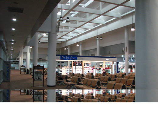 | |
Chiang Mai Airport international departure hall |
The above content comes from Wikipedia and is published under free licenses – click here to read more.
| General Info
|
| Country |
Thailand
|
| ICAO ID |
VTCC
|
| Time |
UTC+7
|
| Latitude |
18.766847
18° 46' 00.65" N
|
| Longitude |
98.962644
098° 57' 45.52" E
|
| Elevation |
1036 feet
316 meters
|
| Type |
Joint (Civil and Military)
|
| Magnetic Variation |
000° W (01/06)
|
| Beacon |
Yes
|
| Operating Agency |
MILITARY - CIVIL JOINT USE AIRPORT
|
| Operating Hours |
SEE REMARKS FOR OPERATING HOURS OR COMMUNICATIONS FOR POSSIBLE HOURS
|
| International Clearance Status |
Airport of Entry
|
| Communications
|
| TWR |
118.1
236.6
|
| GND |
121.9
275.8
|
| ATIS |
127.2
301.5
|
| APP |
129.6
305.4
|
| Runways
|
| ID |
Dimensions |
Surface |
PCN |
ILS
|
| 18/36 |
10171 x 148 feet
3100 x 45 meters |
ASPHALT |
059FAXT |
YES
|
| Navaids
|
| Type |
ID |
Name |
Channel |
Freq |
Distance From Field |
Bearing From Navaid
|
| TACAN |
CHM |
CHIANG MAI |
109X |
- |
At Field |
-
|
| VOR-DME |
CMA |
CHIANG MAI |
116X |
116.9 |
At Field |
-
|
| NDB |
CGM |
CHIANG MAI |
- |
255 |
At Field |
-
|
| Supplies/Equipment
|
| Fuel |
Jet A, without icing inhibitor.
JP-4, Wide cut turbine fuel MIL Spec T-5624
Jet A1, without icing nhibitor.
115/145 octane gasoline, leaded, MIL-L-5572F (PURPLE)
100/130 octane gasoline, leaded, MIL-L-5572F (GREEN)
100/130 MIL Spec, low lead, aviation gasoline (BLUE)
|
| Remarks
|
| CAUTION |
WIP on Rwy 18/36
|
| FUEL |
A1 (Petroleum Auth of TH fone C66-53-281-600/01, Avbl 0700-2200). (NC-100LL).
|
| JASU |
2(A1) 1(C26)
|
| LGT |
Rwy 18 has 2 bcn, 984' and 1968' fr thld. PAPI MEHT Rwy 18-36 60'.
|
| MISC |
Sec Opr Agcy - RTAF
|
| OPR HOURS |
Opr 2300-1630Z, OT 1 hr PN to ATC.
|
The content above was published at Airports-Worldwide.com in 2010.
We don't guarantee the information is fresh and accurate. The data may be wrong or outdated.
For more up-to-date information please refer to other sources.
|
|


