 |
|
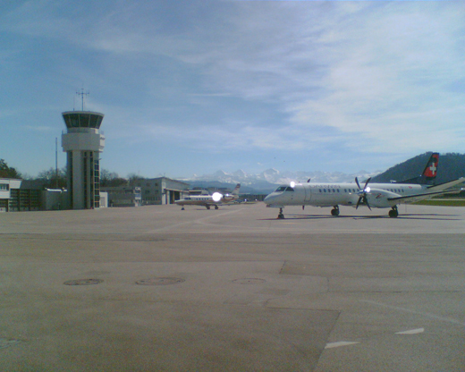
Bern Airport
Regionalflugplatz Bern-Belp
Bern Belp air field |
 |
| IATA: BRN – ICAO: LSZB |
| Summary |
| Airport type |
Public |
| Operator |
ALPAR Flug- und Flugplatz- gesellschaft AG |
| Serves |
Bern, Switzerland |
| Location |
Belp |
| Elevation AMSL |
1,673 ft / 510 m |
| Coordinates |
46°54′44″N 007°29′57″E / 46.91222°N 7.49917°E / 46.91222; 7.49917Coordinates: 46°54′44″N 007°29′57″E / 46.91222°N 7.49917°E / 46.91222; 7.49917 |
| Website |
www.flughafenbern.ch |
| Runways |
| Direction |
Length |
Surface |
| m |
ft |
| 14/32 |
1,730 |
5,676 |
Asphalt |
| 14 Grass/32 Grass |
650 |
2,133 |
Grass |
| Source: Swiss AIP at EUROCONTROL |
Bern Regional Airport (IATA: BRN, ICAO: LSZB) is an airport serving Bern in Switzerland. The airport is actually closer to the town of Belp and it is often known Bern Belp Airport.
The airport has multiple touchdown areas, a paved runway (14/32 of 1,730 meters (5,676 ft)), a grass runway (32L/12R of 650 meters (2,133 ft)), a heli-square, and a glider area. Runway 14 has an ILS approach and a NDB approach.
Two bus lines serve the airport: the AirportBus Bern (line 334) connects the terminal with Bern Rail Station, and the Tangento bus (line 160) connects the airport with Belp, Konolfingen and Münsingen .
The Biderhangar, one of the airport's hangars built by Swiss aviation pioneer Oskar Bider, is listed as a heritage site of national significance in the November 2008 review draft of the Swiss Inventory of Cultural Property of National and Regional Significance.
Airlines and destinations
| Airlines |
Destinations |
| Air France operated by Airlinair |
Paris-Orly |
| Cirrus Airlines |
Munich, Erfurt |
| Darwin Airline |
Palma de Mallorca |
| Flybe |
Southampton [seasonal] |
| Hamburg International |
London-Gatwick [seasonal] |
| Sky Work Airlines |
Angers [begins February 14, 2011], Barcelona, Berlin-Schönefeld [begins 6 December], Brussels [begins February 14, 2011], Djerba, Elba, Hamburg [begins 8 December], Hammamet, Ibiza, Olbia, Preveza, Pristina, Rotterdam, Tabarka, Tortoli, Vienna, Zakynthos |
The above content comes from Wikipedia and is published under free licenses – click here to read more.
| General Info
|
| Country |
Switzerland
|
| ICAO ID |
LSZB
|
| Time |
UTC+1(+2DT)
|
| Latitude |
46.914100
46° 54' 50.76" N
|
| Longitude |
7.497153
007° 29' 49.75" E
|
| Elevation |
1674 feet
510 meters
|
| Type |
Civil
|
| Magnetic Variation |
000° E (01/06)
|
| Beacon |
Yes
|
| Operating Agency |
CIVIL GOVERNMENT, (LANDING FEES AND DIPLOMATIC CLEARANCE MAY BE REQUIRED)
|
| Operating Hours |
SEE REMARKS FOR OPERATING HOURS OR COMMUNICATIONS FOR POSSIBLE HOURS
|
| International Clearance Status |
Airport of Entry
|
| Daylight Saving Time |
Last Sunday in March to last Sunday in October
|
| Communications
|
| TWR |
121.025
119.7
|
ALPAR
(Handling and fuel)
|
135.75
|
| GLIDER |
123.4
|
ATIS
Opr 0550-1920Z++.
|
125.125
|
| APP/DEP |
127.325
|
| Runways
|
| ID |
Dimensions |
Surface |
PCN |
ILS
|
| 14/32 |
4954 x 98 feet
1510 x 30 meters |
ASPHALT |
046FCXT |
YES
|
| 14R/32L |
2125 x 98 feet
648 x 30 meters |
GRASS OR EARTH NOT GRADED OR ROLLED. |
- |
NO
|
| 14L/32R |
2133 x 98 feet
650 x 30 meters |
GRASS OR EARTH NOT GRADED OR ROLLED. |
- |
NO
|
| Navaids
|
| Type |
ID |
Name |
Channel |
Freq |
Distance From Field |
Bearing From Navaid
|
| NDB |
SHU |
SCHUPBERG |
- |
356.5 |
7.8 NM |
145.9
|
| Supplies/Equipment
|
| Fuel |
Jet A1, without icing nhibitor.
100/130 MIL Spec, low lead, aviation gasoline (BLUE)
|
| Oil |
O-123, 1065,(Dispersant)Reciprocating Engine Oil(MIL L 22851 Type III)
|
| Remarks
|
| FUEL |
(NC-100LL, A1)
|
| LGT |
PAPI Rwy 14 GS 4 MEHT 26'. PAPI Rwy 32 GS 3 MEHT 13'.
|
| MISC |
ATIS mnt rqr opr in CTLZ
|
| OIL |
0-123-125.
|
| OPR HOURS |
Opr 0600-2100Z++ Mon-Fri, 0600-2000Z++ Sat, 0700-2100Z++ Sun.
|
| RSTD |
Aft 1900Z++, afld for ldg only.
|
The content above was published at Airports-Worldwide.com in 2010.
We don't guarantee the information is fresh and accurate. The data may be wrong or outdated.
For more up-to-date information please refer to other sources.
|
|


