|
|
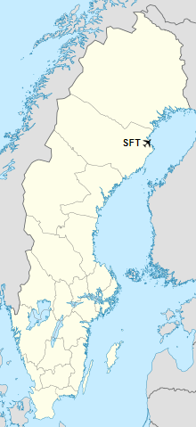
Skellefteå Airport (IATA: SFT, ICAO: ESNS), is located about 17 km from Skellefteå, Västerbotten, Sweden.
Skellefteå Airport is ranked as one of 10 largest airports in Sweden in terms of domestic flights.
Skellefteå Airport
Skellefteå flygplats |
|
|
|
| Summary |
| Airport type |
Public |
| Operator |
Skellefteå Municipality |
| Serves |
Skellefteå, Sweden |
| Elevation AMSL |
157 ft / 48 m |
| Coordinates |
64°37′29″N
21°04′37″E |
| Website |
skellefteaairport.se |
| Map |
|
|
| Runways |
| Direction |
Length |
Surface |
| ft |
m |
| 10/28 |
6,890 |
2,100 |
Asphalt |
|
| Statistics (2016) |
| Passengers total |
280,926 |
| International passengers |
15,592 |
| Domestic passengers |
265,334 |
|
Airlines and destinations
| Destinations |
| Aegean Airlines |
Seasonal charter: Rhodes |
| Croatia Airlines |
Seasonal charter: Split |
| Jet Time |
Seasonal charter: Gran Canaria |
| Norwegian Air Shuttle |
Stockholm-Arlanda |
| Scandinavian Airlines |
Stockholm-Arlanda
Seasonal: Málaga (begins 16 June 2018) |
Witch prank
Just before the Easter in March 2016, the airport gained notability for issuing a warning to witches flying south to Blockuladuring the holiday, not to enter the airport’s airspace since they risked colliding with aircraft. Instructions for witches on how to submit proper flight plans were included in the warning. According to old Swedish folklore, witches (påskkärringar) fly on their broomstick to Blockula during Easter, accompanied by their familiars, usually cats. Metrologist Åsa Rasmussen added a recommendation to let the cat stay at home, since the weather forecast predicted heavy snowfall.
The above content comes from Wikipedia and is published under free licenses – click here to read more.
| General Info
|
| Country |
Sweden
|
| ICAO ID |
ESNS
|
| Time |
UTC+1(+2DT)
|
| Latitude |
64.624772
64° 37' 29.18" N
|
| Longitude |
21.076892
021° 04' 36.81" E
|
| Elevation |
157 feet
48 meters
|
| Type |
Civil
|
| Magnetic Variation |
006° E (01/06)
|
| Operating Agency |
CIVIL GOVERNMENT, (LANDING FEES AND DIPLOMATIC CLEARANCE MAY BE REQUIRED)
|
| Operating Hours |
24 HOUR OPERATIONS
|
| Daylight Saving Time |
Last Sunday in March to last Sunday in October
|
| Communications
|
| TWR |
122.05
|
| Communications Remarks |
|
| TWR |
Opr 0500-2300Z++ Mon-Fri, 0715-2130Z++ Sat, 1015-2300Z++ Sun. Opr hr may be reduced around hol by NOTAM.
|
| Runways
|
| ID |
Dimensions |
Surface |
PCN |
ILS
|
| 10/28 |
6890 x 148 feet
2100 x 45 meters |
ASPHALT |
044FBXT |
YES
|
| Navaids
|
| Type |
ID |
Name |
Channel |
Freq |
Distance From Field |
Bearing From Navaid
|
| VOR-DME |
SKA |
SKELLEFTEA |
081X |
113.4 |
At Field |
-
|
| Supplies/Equipment
|
| Fuel |
Jet A1, without icing nhibitor.
100/130 MIL Spec, low lead, aviation gasoline (BLUE)
|
| Remarks
|
| CSTMS/IMG |
CSTMS avail O/R fone C+46 (0)8456 66 20.
|
| FLUID |
De-Ice.
|
| FUEL |
Avbl dur Twr hr. (NC-100LL, A1)
|
| LGT |
PAPI Rwy 10 MEHT 55.8', Rwy 28 MEHT 56.4'.
|
| MISC |
Ldg fees. Increased charges outside Twr opr hr. Arpt admin fone C+46 (0)910 576 00.
|
| RSTD |
PPR for ops outside Twr opr hr.
|
The content above was published at Airports-Worldwide.com in 2018.
We don't guarantee the information is fresh and accurate. The data may be wrong or outdated.
For more up-to-date information please refer to other sources.
|
|