|
|
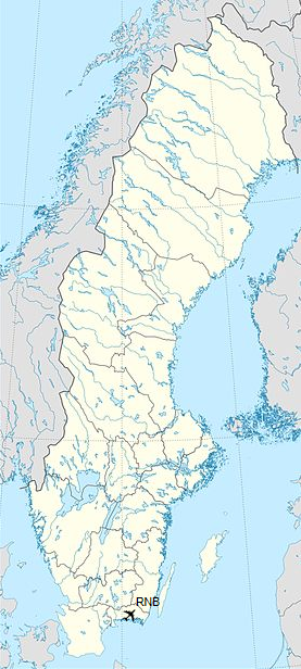
Ronneby Airport (Kallinge) (IATA: RNB, ICAO: ESDF) is located about 4 km (2.5 mi) from Ronneby, Sweden and 30 km (17 mi) from Karlshamn and 30 km (17 mi) from Karlskrona.
Ronneby airport is south Sweden’s (Götaland) 6th biggest airport and the 15th biggest airport in Sweden. The airport had 226,995 passengers in 2011.
| Ronneby Airport |
|
|
| Summary |
| Airport type |
Military/Public (Luftfartsverket) |
| Operator |
Swedavia |
| Location |
Ronneby, Sweden |
| Elevation AMSL |
191 ft / 58 m |
| Coordinates |
56°16′00″N
15°15′54″E |
| Website |
www.swedavia.com/ronneby/ |
| Map |
|
|
| Runways |
| Direction |
Length |
Surface |
| ft |
m |
| 01/19 |
7,648 |
2,331 |
Asphalt |
|
| Statistics (2016) |
| Passengers total |
231,562 |
| International passengers |
105 |
| Domestic passengers |
231,457 |
| Landings total (2011) |
2,009 |
|
Airlines and destinations
| Destinations |
| BRA Braathens Regional Airlines |
Stockholm-Bromma
Seasonal: Visby |
| Corendon Airlines |
Seasonal charter: Antalya |
| Scandinavian Airlines |
Stockholm-Arlanda |
The above content comes from Wikipedia and is published under free licenses – click here to read more.
| General Info
|
| Country |
Sweden
|
| ICAO ID |
ESDF
|
| Time |
UTC+1(+2DT)
|
| Latitude |
56.266667
56° 16' 00.00" N
|
| Longitude |
15.265000
015° 15' 54.00" E
|
| Elevation |
191 feet
58 meters
|
| Type |
Joint (Civil and Military)
|
| Magnetic Variation |
003° E (01/06)
|
| Operating Agency |
MILITARY - CIVIL JOINT USE AIRPORT
|
| Alternate Name |
F 17
|
| Operating Hours |
SEE REMARKS FOR OPERATING HOURS OR COMMUNICATIONS FOR POSSIBLE HOURS
|
| Daylight Saving Time |
Last Sunday in March to last Sunday in October
|
| Communications
|
| TWR |
119.2
257.8
3023
|
| CON |
128.45
129.9
257.8
|
| GND |
121.7
|
| Communications Remarks |
|
| TWR |
Opr 0500-2130Z++ Mon-Thu; 0500-2000Z++ Fri; 1215-1345Z++ Sat; 1300-1715Z++, 1730-2045Z++ Sun. Opr hr may be reduced around hol by NOTAM.
|
| Runways
|
| ID |
Dimensions |
Surface |
PCN |
ILS
|
| 01/19 |
7648 x 148 feet
2331 x 45 meters |
ASPHALT |
050FBXT |
YES
|
| Navaids
|
| Type |
ID |
Name |
Channel |
Freq |
Distance From Field |
Bearing From Navaid
|
| NDB |
LP |
RONNEBY |
- |
318 |
4.4 NM |
187.2
|
| Supplies/Equipment
|
| Fuel |
Jet A1, without icing nhibitor.
100/130 MIL Spec, low lead, aviation gasoline (BLUE)
|
| Remarks
|
| A-GEAR |
When TWR clsd, may be in upright posn and lgtd.
|
| CSTMS/IMG |
CSTMS avail O/R fone C+46 (0)8456 66 20.
|
| FUEL |
Avbl HS. (NC-100LL, A1)
|
| LGT |
Both rwy ends have 2 sets of PAPI; fst set for SW mil use only. PAPI Rwy 01 GS 3.25 and PAR GS not coincidental.
|
| MISC |
Ldg fees, INCR charges outside TWR opr hr.
|
| OPR HOURS |
Opr 0500-1830Z++ Mon-Fri, OT O/R fone C+46 (0)457 255 90 or C+46 (0)708 24 47 02.
|
| RSTD |
PPR for ops outside TWR opr hr.
|
The content above was published at Airports-Worldwide.com in 2018.
We don't guarantee the information is fresh and accurate. The data may be wrong or outdated.
For more up-to-date information please refer to other sources.
|
|