|
|
Gällivare Lapland Airport |
Gällivare Lapland Airport (IATA: GEV, ICAO: ESNG) is an airport located in Gällivare Municipality, Sweden, about 7 kilometres (4 mi) east from Gällivare and about 10 kilometres (6 mi) from Malmberget. The airport has since 2009 been expanded in a project co-financed by the county council and the EU, the airport was also re-branded.
| Gällivare Airport |
|
|
|
| Summary |
| Airport type |
Public |
| Operator |
Gällivare Municipality |
| Serves |
Gällivare and Malmberget |
| Location |
Gällivare Municipality, Norrbotten, Sweden |
| Elevation AMSL |
1,027 ft / 312 m |
| Coordinates |
67°07′59″N
020°48′44″E |
| Website |
www.gellivare.se/Projekt/Lapland-Airport |
| Map |
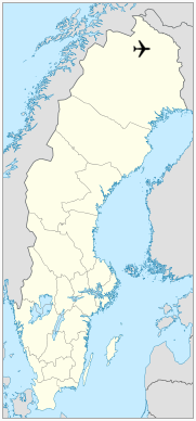
Location within Norrbotten
|
| Runways |
| Direction |
Length |
Surface |
| ft |
m |
| 12/30 |
5,610 |
1,714 |
Asphalt |
|
| Statistics (2009) |
| Passengers total |
36,836 |
| Domestic passengers |
36,836 |
| Landings total |
1,613 |
|
Facilities
The airport was originally a military facility with an 800-metre (2,625 ft) airstrip. The airstrip was extended to 1,350 metres (4,429 ft) before being opened to regular civilian flights on April 19, 1971. During the years 1984 and 1984 the airstrip was gradually extended to its current length. In 1989 the airstrip was broadened to 45 metres (148 ft).
Airlines and destinations
Passenger
| Destinations |
| NextJet |
Arvidsjaur, Stockholm–Arlanda, Kramfors (ended 16 May 2018) |
Cargo
| Destinations |
| Amapola Flyg |
Kiruna, Umeå |
Ground transportation
There are a taxi stand, short-term and long-term parking lots at the airport.
|
Gällivare Lapland Airport. |
The above content comes from Wikipedia and is published under free licenses – click here to read more.
| General Info
|
| Country |
Sweden
|
| ICAO ID |
ESNG
|
| Time |
UTC+1(+2DT)
|
| Latitude |
67.132408
67° 07' 56.67" N
|
| Longitude |
20.814636
020° 48' 52.69" E
|
| Elevation |
1027 feet
313 meters
|
| Magnetic Variation |
006° E (01/06)
|
| Operating Agency |
CIVIL GOVERNMENT, (LANDING FEES AND DIPLOMATIC CLEARANCE MAY BE REQUIRED)
|
| Operating Hours |
SEE REMARKS FOR OPERATING HOURS OR COMMUNICATIONS FOR POSSIBLE HOURS
|
| Daylight Saving Time |
Last Sunday in March to last Sunday in October
|
| Communications
|
| AFIS |
122.1
|
| Runways
|
| ID |
Dimensions |
Surface |
PCN |
ILS
|
| 12/30 |
5623 x 148 feet
1714 x 45 meters |
ASPHALT |
022FBXT |
YES
|
| Navaids
|
| Type |
ID |
Name |
Channel |
Freq |
Distance From Field |
Bearing From Navaid
|
| NDB |
OG |
GALLIVARE |
- |
325 |
3.6 NM |
291.9
|
| Supplies/Equipment
|
| Fuel |
Jet A1, without icing nhibitor.
100/130 MIL Spec, low lead, aviation gasoline (BLUE)
|
| Remarks
|
| FUEL |
(NC-100LL, A1)
|
| LGT |
PAPI Rwy 12 GS 4.0 .
|
| MISC |
Ldg fees.
|
| OPR HOURS |
Opr 0400-1940Z++ Mon-Fri, 0700-1140Z++ Sat, 1000-1940Z++ Sun.
|
| RSTD |
PPR outside opr hr.
|
The content above was published at Airports-Worldwide.com in 2018.
We don't guarantee the information is fresh and accurate. The data may be wrong or outdated.
For more up-to-date information please refer to other sources.
|
|