 |
|
Eskilstuna Airport is an airport in Eskilstuna, Sweden. It is located 13 km east of Eskilstuna and 97 km away from Stockholm.
Eskilstuna Airport
Eskilstuna-Kjula flygplats |
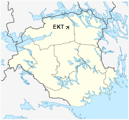
Map |
|
|
| Summary |
| Location |
Eskilstuna, Sweden |
| Elevation AMSL |
139 ft / 42 m |
| Coordinates |
59°21′0″N
16°42′30″E |
| Runways |
| Direction |
Length |
Surface |
| ft |
m |
| 18/36 |
7,218 |
2,200 |
asphalt |
|
The above content comes from Wikipedia and is published under free licenses – click here to read more.
| General Info
|
| Country |
Sweden
|
| ICAO ID |
ESSU
|
| Time |
UTC+1(+2DT)
|
| Latitude |
59.351078
59° 21' 03.88" N
|
| Longitude |
16.708400
016° 42' 30.24" E
|
| Elevation |
139 feet
42 meters
|
| Type |
Civil
|
| Magnetic Variation |
003° E (01/06)
|
| Operating Agency |
CIVIL GOVERNMENT, (LANDING FEES AND DIPLOMATIC CLEARANCE MAY BE REQUIRED)
|
| Operating Hours |
24 HOUR OPERATIONS
|
| Daylight Saving Time |
Last Sunday in March to last Sunday in October
|
| Communications
|
AFIS
Opr 0700-1100Z++, 1200-1600Z++ Mon-Fri.
|
126.85
|
| Runways
|
| ID |
Dimensions |
Surface |
PCN |
ILS
|
| 18/36 |
6187 x 115 feet
1886 x 35 meters |
PART CONCRETE, PART ASPHALT, OR PART BITUMEN-BOUND MACADAM. |
- |
YES
|
| Supplies/Equipment
|
| Fuel |
Jet A1, without icing nhibitor.
100/130 MIL Spec, low lead, aviation gasoline (BLUE)
|
| Remarks
|
| A-GEAR |
Barrier raised outside AFIS hr.
|
| CAUTION |
Exp turb on short final in hi W winds. Roads cros rwy 1200' fr S end and 400' frN end, FOD haz. Gldr act.
|
| FUEL |
Avbl 0700-1600Z++ Mon-Fri. (NC-100LL, A1)
|
| LGT |
Mil PAPI Rwy 18 GS 2.86 , Civ APAPI Rwy 36 MEHT 49.9'.
|
| MISC |
Civ opr Eskilstuna Flygplats, fone C+46 (0)16 940 15, mil opr fone C+46 (0)16 940 74.
|
| RSTD |
PPR. Mil PPR thru Satenas (F7) C+46 (0)510 870 00.
|
The content above was published at Airports-Worldwide.com in 2018.
We don't guarantee the information is fresh and accurate. The data may be wrong or outdated.
For more up-to-date information please refer to other sources.
|
|


