|
 |
|
||||
|
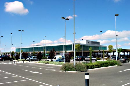
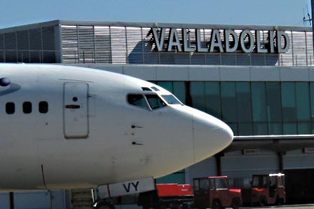
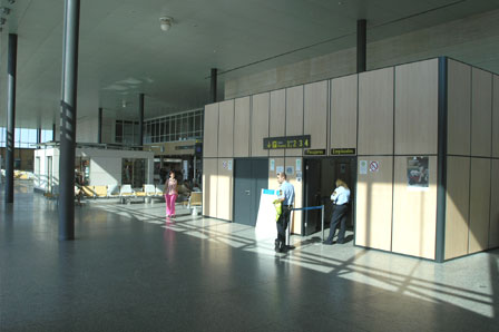
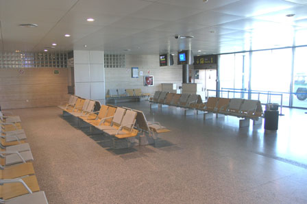
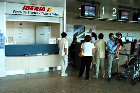
Valladolid is the capital city of the Castile - Leon area and the airport is around 10 kms outside of the City centre. The Valladolid arrivals hall is fairly small with only two carousels. The departures area at Valladolid airport includes 8 check in desks and it is here that you will also find a cafe, restaurant and small shop selling cigarettes, newspapers etc. Parking at Valladolid is quite reasonable and there are 246 spaces plus about another 80 spaces reserved for hire cars. The costs of parking are €0.40 for the 1st 30 mins, €0.50 for the 2nd 30 mins up to a maximum of €7.50 for a day. Lost tickets are charged at €37.50. There are three bus routes from the airport: Buses from Valladolid to Madrid and Valladolid to Leon must be booked in advance through www.alsa.es, this link takes you through to the English version of their website for timetables and fares. The journey to Madrid takes just over 2 hours. and cost just over €11 each way. The other buses at Valladolid Airport run between the City and the Airport. There are three buses per day. During the week these buses leave the airport at 1515, 1615 and 1920. The times at weekends and holidays vary. For more information call: 0034 983 230 033 Valladolid Airport Taxis can be found outside of the main terminal building and cost between €16-20 for a trip into the City. In 1936, the local inhabitants of Villanubla offered 700,000 metres squared for the construction of the airport. In 1938, Valladolid Airport was opened. The first commercial flight was carried out by a three-engined Junkers 52 of Iberia-Lufthansa which landed on the 28th March from Vitoria on route to Seville. The Salamanca-Valladolid-Burgos-Vitoria route opened this same year. In 1939, the First Air Brigade was installed in Villanubla. The 16th Regiment was created in 1940 and the 33rd Regiment in 1941. In 1946, the airport was opened to civilian traffic and the Valladolid Flying Club was founded in 1949. Between 1951 and 1952 the runway was improved with the installation of a hard surface and was equipped with the conditions needed for landing without visibility. Between 1955 and 1964, the airport was closed to civilian traffic. In 1970, the airline Aviaco started to operate scheduled flights. Between 1972 and 1973, the works on the terminal building were started as well as those for a tread road, parking platform and urbanisation. In 1982, the passenger arrivals area was revamped and an ILS category I system was installed on runway 23. In 1990, the runway was extended. On the 19th June 1991, the airport was opened to international traffic. The new terminal area was opened in the year 2000. Valladolid Airport - AENA airport Address: Carretera N-601 KM 203 47620 - Villanubla Valladolid Airport Code: VLL Telephone: 0034 983 415 500 Fax: 983 415 513 URL: http://www.aena.es/valladolid AENA accepts no responsibility for the information posted at this site neither for the possible damages caused for the use of this information. Images and information placed above are from http://www.aena.es/valladolid Valladolid Airport We thank them for the data!
Runway 05/239843 x 197 feet
|
|||||||||||||||||||||||||||||||||||||||||||||||||||||||||||||||||||||||||||||||||||||||||||||||||||||||||||||||||||||||||||||||||||||||||||||||||||||||||||||||||||||||||||||||||||||||||||||||||||||||||||||||||||||||||||||||||||||||||||||||||||||||||||||||||||
| Runway 05 | |
|---|---|
| Surface | ASPHALT |
| True Heading | 045.0 |
| Latitude | 41.697000 41° 41' 49.20" N |
| Longitude | -4.864750 004° 51' 53.10" W |
| Elevation | 2768.0
feet 844 meters |
| Slope | 0.1° |
| Landing Distance | 9843
feet 3000 meters |
| Takeoff Distance | 9843
feet 3000 meters |
| Lighting System | LIRL
PAPI |
| Runway 23 | |
|---|---|
| Surface | ASPHALT |
| True Heading | 225.0 |
| Latitude | 41.716056 41° 42' 57.80" N |
| Longitude | -4.839139 004° 50' 20.90" W |
| Elevation | 2775.0
feet 846 meters |
| Slope | -0.1° |
| Landing Distance | 9843
feet 3000 meters |
| Takeoff Distance | 9843
feet 3000 meters |
| Lighting System | LIRL
REIL PAPI |
| Runway 15 | |
|---|---|
| Surface | GRADED OR ROLLED EARTH, GRASS ON GRADED EARTH. |
| True Heading | 144.0 |
| Latitude | 41.713317 41° 42' 47.94" N |
| Longitude | -4.861808 004° 51' 42.51" W |
| Landing Distance | 2976
feet 907 meters |
| Takeoff Distance | 3632
feet 1107 meters |
| Overrun Length | 656
feet 200 meters |
| Overrun Surface | GRADED OR ROLLED EARTH, GRASS ON GRADED EARTH. |
| Runway 33 | |
|---|---|
| Surface | GRADED OR ROLLED EARTH, GRASS ON GRADED EARTH. |
| True Heading | 324.0 |
| Latitude | 41.706706 41° 42' 24.14" N |
| Longitude | -4.855417 004° 51' 19.50" W |
| Landing Distance | 2976
feet 907 meters |
| Takeoff Distance | 3189
feet 972 meters |
| Overrun Length | 213
feet 65 meters |
| Overrun Surface | GRADED OR ROLLED EARTH, GRASS ON GRADED EARTH. |
| VALLADOLID | |||||
|---|---|---|---|---|---|
| Type | ID | Channel | Freq | Country | State |
| TACAN | TVD | 019X | - | Spain | - |
| Latitude | Longitude | Airport |
| 41.704111 41° 42' 14.80" N |
-4.849806 004° 50' 59.30" W |
LEVD |
| VALLADOLID | |||||
|---|---|---|---|---|---|
| Type | ID | Channel | Freq | Country | State |
| NDB | VLD | - | 342 | Spain | - |
| Latitude | Longitude | Airport |
| 41.789492 41° 47' 22.17" N |
-4.739081 004° 44' 20.69" W |
LEVD |
Valladolid Airport - AENA airport
The content above was published at Airports-Worldwide.com in 2006.
We don't guarantee the information is fresh and accurate. The data may be wrong or outdated.
For more up-to-date information please refer to other sources.

 |
|
Copyright 2004-2026 © by Airports-Worldwide.com, Vyshenskoho st. 36, Lviv 79010, Ukraine Legal Disclaimer |