 |
 |
|
||||
|
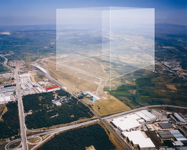
This airport does not yet operate commercial aircraft traffic, and Aena is thererfore currently conducting a series of actions, including the construction of a new terminal, a new runway and an apron, which will make it possible to meet the future air traffic demand with high levels of safety and quality until at least 2015. History On 8 August 1941, Burgos City Hall agreed to purchase a country estate of almost 300 thousand square metres that formed part of the old monte de Gamonal. On 10th November, the mayor offered this land to the Air Ministry.On 6 December, a decree granted the urgent installation of services and work to be carried out on the fields that it was trying to definitively link. In fact, the Air Ministry was founded in Burgos after the civil war, when the Military Aeronautical Service forces created by King Alfonso XII in 1910 were modernized. These in turn were inherited from the Military Service Air Station, that belonged at the time to the Military Engineering Corp, established by the same monarch. On 21 July 1949, the University Air Militia began its activities, after which 22 classes would form in its facilities, the offices of the latter being handed over in 1971. Villafría airdrome was opened to civil traffic in the autumn of that year. In 1973, what is now the Burgos Royal Flying Club was set up. Since then, and during the summer, the airport has hosted different teaching and training activities. In August 1995, the Ministry of Defence signed an agreement
with Burgos City Hall, via which it ceded the Villafría airdrome's
facility exclusively for civil use. Thus, institutions in the city and
province, as well as the most relevant companies present in the same geographical
area created GABSA (Gestión del Aeropuerto de Burgos, S.A.), which
is responsible for running the airport. In February 1999, the airport
was officially opened, and in June that year, the Ministry of Public Works
inaugurated the present hangars. Lastly, Burgos airport was declared to
be of general interest by means of the Order of 20 October 2000, and the
State manages it directly. Burgos Airport - AENA airport Address: Telephone: 947 478 570 URL: http://www.aena.es/burgos
AENA accepts no responsibility for the information posted at this site neither for the possible damages caused for the use of this information. Images and information placed above are from http://www.aena.es/burgos http://www.aeroclubburgos.org/foto.php?foto=imagenes/Caja.jpg We thank them for the data!
Runway 06/244393 x 98 feet
|
|||||||||||||||||||||||||||||||||||||||||||||||||||||||||||||||||||||||||||||||||||||||||||||||||||||||||||||||||||||||||||||||||||||||||||||||||||||||||||||||||||||||||||||||||||||||||||||
| Runway 06 | |
|---|---|
| Surface | ASPHALT |
| True Heading | 056.0 |
| Latitude | 42.354247 42° 21' 15.29" N |
| Longitude | -3.627494 003° 37' 38.98" W |
| Elevation | 2907.0
feet 886 meters |
| Slope | 0.9° |
| Landing Distance | 4393
feet 1339 meters |
| Takeoff Distance | 4393
feet 1339 meters |
| Lighting System | LIRL
REIL PAPI |
| Runway 24 | |
|---|---|
| Surface | ASPHALT |
| True Heading | 236.0 |
| Latitude | 42.361011 42° 21' 39.64" N |
| Longitude | -3.614033 003° 36' 50.52" W |
| Elevation | 2945.0
feet 898 meters |
| Slope | -0.9° |
| Landing Distance | 4393
feet 1339 meters |
| Takeoff Distance | 4393
feet 1339 meters |
| Lighting System | LIRL
REIL PAPI |
| BURGOS | |||||
|---|---|---|---|---|---|
| Type | ID | Channel | Freq | Country | State |
| VOR-DME | VIA | 051X | 111.4 | Spain | - |
| Latitude | Longitude | Airport |
| 42.354969 42° 21' 17.89" N |
-3.613583 003° 36' 48.90" W |
LEBG |
| BURGOS | |||||
|---|---|---|---|---|---|
| Type | ID | Channel | Freq | Country | State |
| NDB | BGS | - | 357 | Spain | - |
| Latitude | Longitude | Airport |
| 42.358131 42° 21' 29.27" N |
-3.635383 003° 38' 07.38" W |
LEBG |
Burgos Airport - AENA airport
The content above was published at Airports-Worldwide.com in 2006.
We don't guarantee the information is fresh and accurate. The data may be wrong or outdated.
For more up-to-date information please refer to other sources.
 Introduction
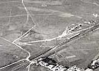 The origins of Villafría airdrome date back to the 1920's, when
a small aeronautical detachment was established in Gamonal, which served
its purpose until aeronautical advances showed it to be too small. After
this, the government of King Alfonso XII created the national Villafría
Burgos airport by Royal Decree on 19th July 1927. On 3 January 1928, the
Cabinet approved the construction of Burgos airport and, on the 15th of
the same month, Villafría Town Hall agreed to cede the field called
Gorreñal to the Superior Council of Military Aeronautics for the
airport to be built there. As from 1936, the fields of Gamonal and Villafría
joined their facilities, which went on to form a single aeronautical infrastructure.
The origins of Villafría airdrome date back to the 1920's, when
a small aeronautical detachment was established in Gamonal, which served
its purpose until aeronautical advances showed it to be too small. After
this, the government of King Alfonso XII created the national Villafría
Burgos airport by Royal Decree on 19th July 1927. On 3 January 1928, the
Cabinet approved the construction of Burgos airport and, on the 15th of
the same month, Villafría Town Hall agreed to cede the field called
Gorreñal to the Superior Council of Military Aeronautics for the
airport to be built there. As from 1936, the fields of Gamonal and Villafría
joined their facilities, which went on to form a single aeronautical infrastructure.